
Three Ps: Pouring rain, pea-soup fog and Polo
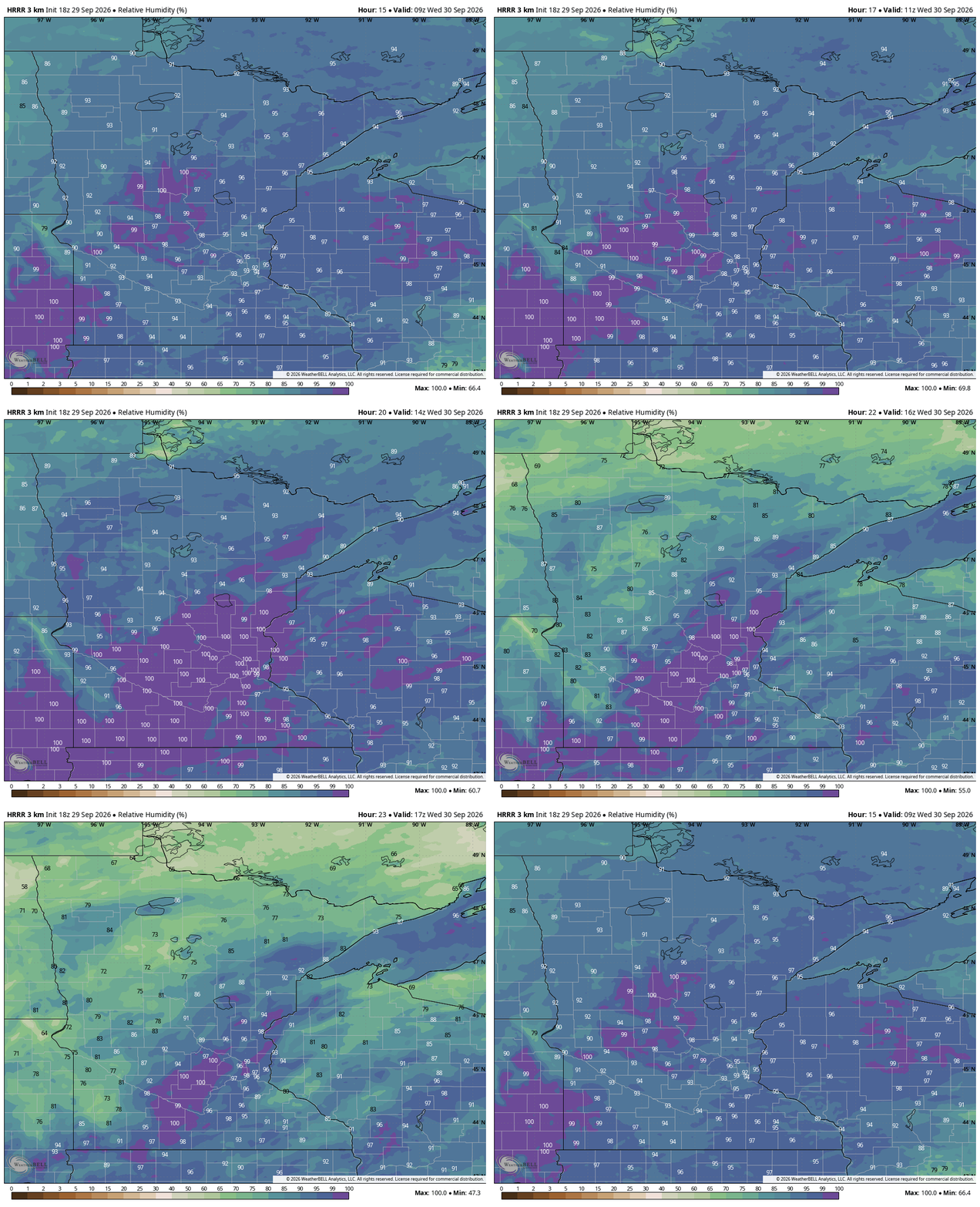
Expect some very thick fog on Wednesday morning along with a little cooler trend
Go Deeper.
Create an account or log in to save stories.
Like this?
Thanks for liking this story! We have added it to a list of your favorite stories.


After the current round of rain exits Tuesday evening, there will be a glancing blow from Tropical Storm Polo in the Driftless Area on Wednesday. The weather is then pretty tranquil until Saturday. While we have remained largely warmer than normal, but that’s about to change.

Latest on the rain
We’d predicted the rain would reach the Twin Cities around 1 pm. It began raining here at MPR headquarters at 12:46 pm. I’ll take that timing from 36 hours beforehand! Some of the rain was much heavier in northwest Minnesota, also as anticipated. We are expecting some traffic issues, though, given the timing around the evening rush. With leaves also coming down early from the drought, storm drains will clog up much faster.
Rain should begin to exit the Twin Cities — we are not just focusing on the Minneapolis and St. Paul metros here, this is just the last real part of Minnesota to get rain today — by about 9 p.m. Things go from rainy to misty to foggy in a hurry, so it’s not like we will just clear out like when we have a summer thunderstorm.
Fog is likely to be really heavy at times in central and east-central Minnesota on Wednesday morning. I made the fog timelapse the main image on this Updraft because it shows signs of lingering quite a bit later than normal. I’d be fairly surprised if we don’t get at least a couple of dense fog advisories. The kids might want something reflective at the bus stop on Wednesday, so that drivers can see them amid the fog.

That said, we have seen big improvements from all the recent rain. Check out the above mapping which has much higher soil moisture numbers around the western Twin Cities suburbs.
There could be a bit of rain from the remnant low of Tropical Storm Polo on Wednesday, but much of the state is dry and actually (eventually) sunny. The next slug of rain is not here until later in the day Saturday, even though we will steadily cool heading towards the weekend.

Turn Up Your Support
MPR News helps you turn down the noise and build shared understanding. Turn up your support for this public resource and keep trusted journalism accessible to all.

