
Beautiful fall weekend ahead
Temperatures trend upward next week

Go Deeper.
Create an account or log in to save stories.
Like this?
Thanks for liking this story! We have added it to a list of your favorite stories.


More seasonable air and dew points have settled back in across the region. Friday will be a good 10 to 15 degrees cooler. We’ll also see a nice dose of sunshine ahead over the next several days.
Beautiful fall weekend ahead before temps warm next week
It’s a chilly start early Friday morning and the Twin Cities has finally officially dropped below 50 degrees. This first morning in the 40s comes almost a month later than normal.
Many areas dipped into the 30s with the coolest readings in northwestern Minnesota. Hallock dipped to 28 degrees along with Big Fork.

We’ll see afternoon highs on the cool and crisp side, in the low 60s in southern Minnesota and 50s north. We’ll have lots of sunshine through the day.
Turn Up Your Support
MPR News helps you turn down the noise and build shared understanding. Turn up your support for this public resource and keep trusted journalism accessible to all.

We’ll start with sunshine Saturday but clouds will increase a bit in the afternoon ahead of another cool front that will mostly just reinforce the seasonably cool air mass. It could touch off a few spotty, late-day showers, however.
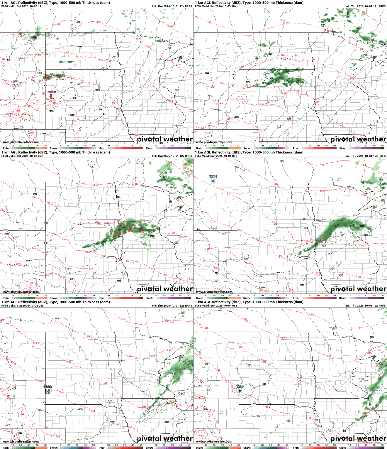
The weekend will otherwise yield similar temperatures with highs in the 60s and 50s and overnight lows in the 40s and 30s north.
The cool air will be reinforced for Sunday and Monday but warmer air already begins to move in mid to late week and especially into next weekend as anomalous warmth really builds in.
Conditions also look pretty dry over the next week other than that light rain chance late Saturday.
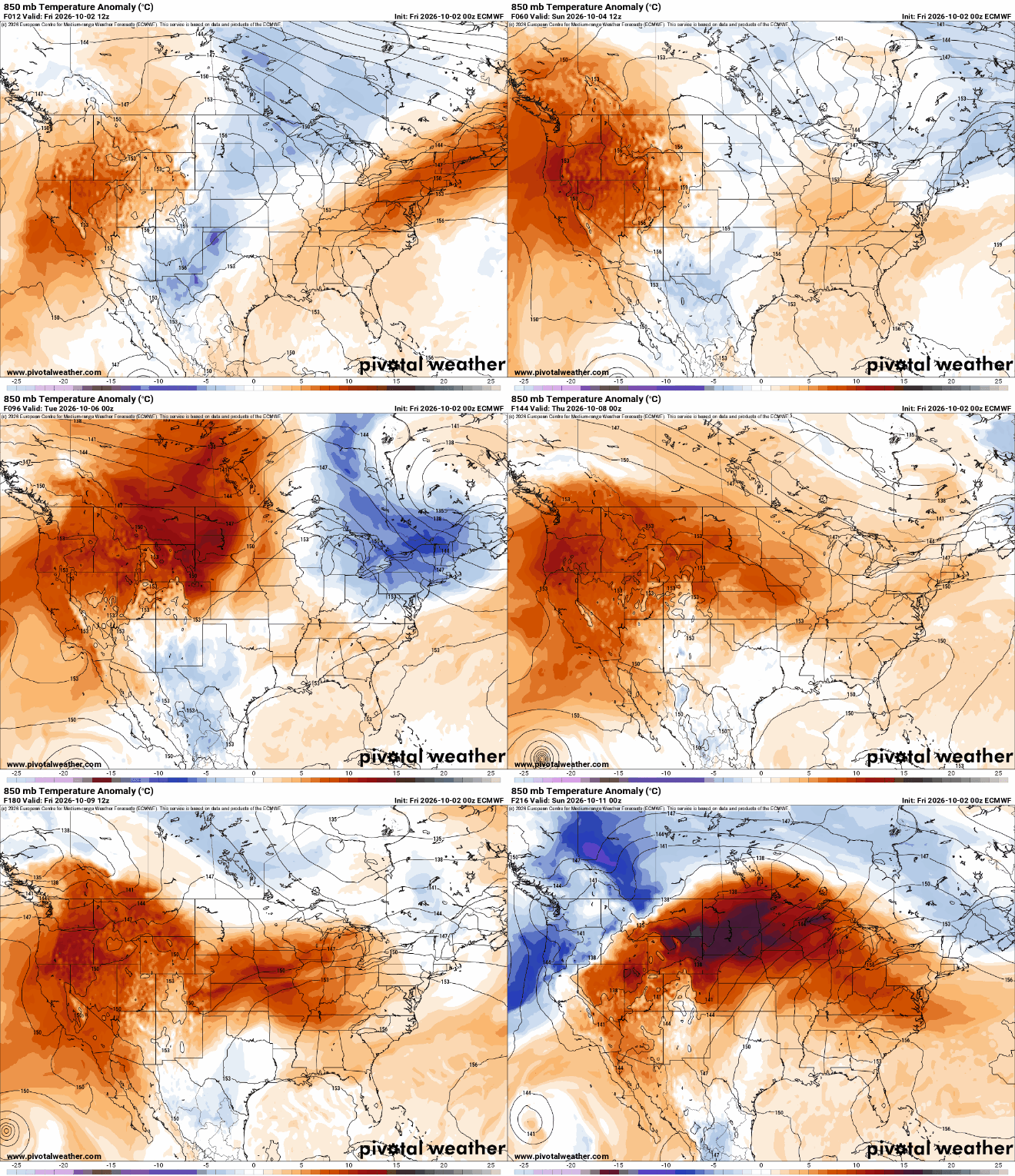
Most forecast models have temperatures reaching at least into the 70s next week into next weekend for central and southern Minnesota. Some forecast models push highs to near 80 degrees in the Twin Cities by next weekend.


