
Gusty winds arrive ahead of Saturday's showers
Wind gusts between 25-35 mph, closer to 50 mph in southwestern Minnesota

Go Deeper.
Create an account or log in to save stories.
Like this?
Thanks for liking this story! We have added it to a list of your favorite stories.


A blustery Saturday is ahead, with gusty winds and a few isolated showers possible as a cold front pushes across the region.
Windy with isolated showers possible
Saturday will start off mild, but the wind will quickly pick up after sunrise as a cold front approaches. Most locations across the state will see gusts in the 25 to 35 mph range.
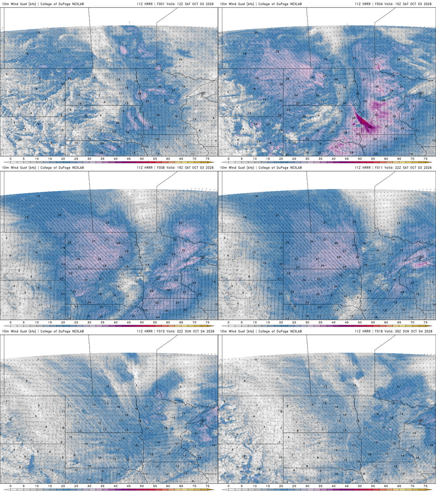
The strongest winds will be across southwestern Minnesota, where gusts could exceed 40 to 45 mph. A wind advisory is in effect from 7 a.m. to 1 p.m for portions of that area.

Those strong southerly winds could actually help boost temperatures ahead of the front. Southwest Minnesota could climb into the lower 70s, while the Twin Cities and much of the surrounding area warm into the lower to middle 60s. Temperatures will be cooler in the Arrowhead, with highs in the upper 50s.
Turn Up Your Support
MPR News helps you turn down the noise and build shared understanding. Turn up your support for this public resource and keep trusted journalism accessible to all.

A few isolated showers could pop up early Saturday, but the main area of rain is expected to develop across western Minnesota during the early to mid-afternoon before spreading eastward into eastern Minnesota and western Wisconsin.
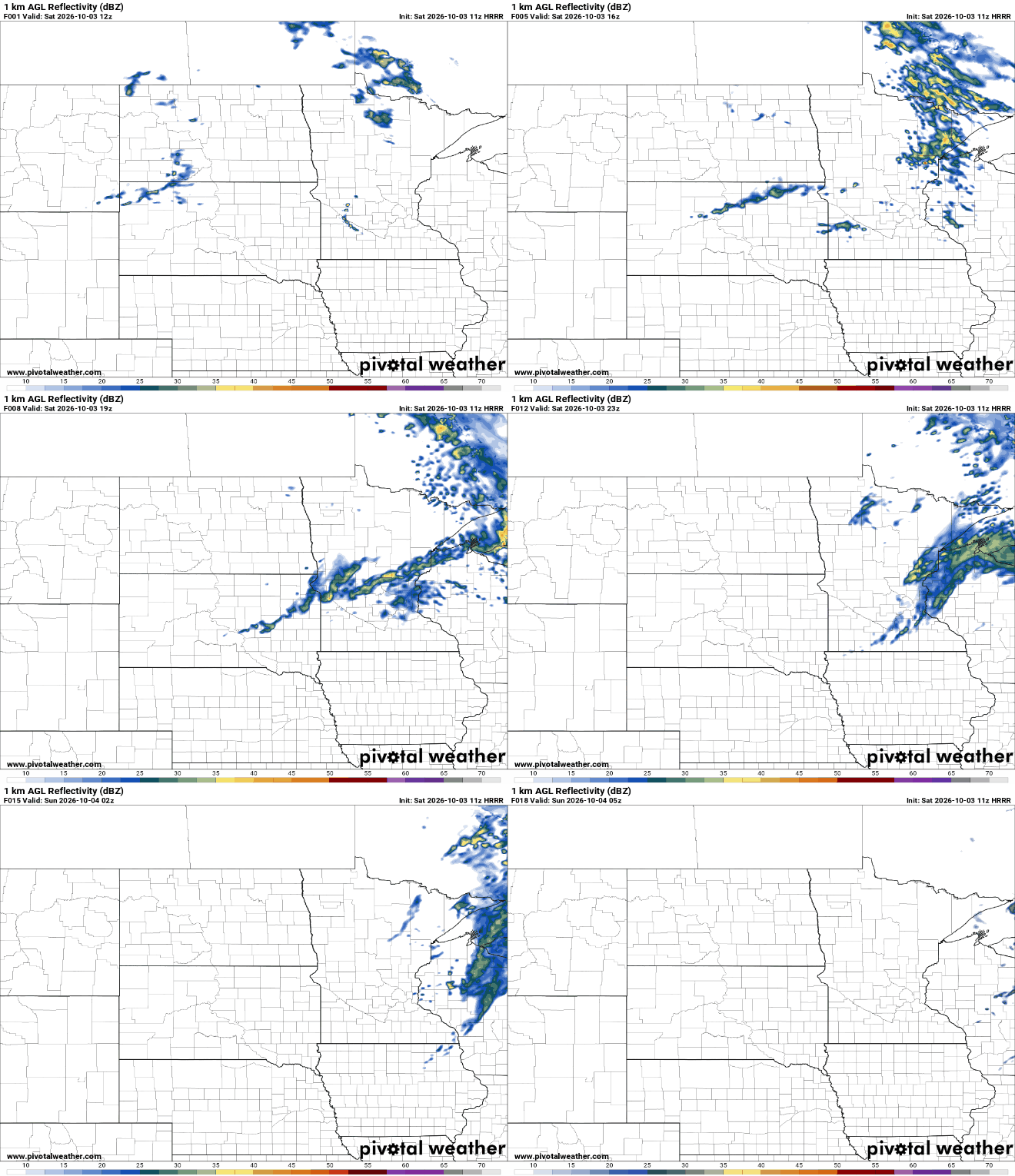
Rainfall will generally be light, with most locations picking up around a tenth to less than a quarter of an inch. There may also be a few rumbles of thunder Saturday afternoon and evening, but widespread thunderstorms are not expected. The showers will gradually exit from west to east, with most areas dry before midnight Saturday.
Sunday looks great for the Twin Cities Marathon
Once the cold front moves through, the weather settles down quickly. Sunday looks cooler, but dry and generally pleasant, with afternoon highs in the lower to middle 60s.
That sets up a much more comfortable day for the Twin Cities Marathon, especially compared with Saturday's gusty winds. Dew points will also be noticeably lower in the 40s, making for a much more refreshing feel during the race.

The cooler air will really settle in Sunday night, with temperatures falling into the 30s, which could lead to frost headlines.

