
Isais set to become the Atlantic's first hurricane in a remarkably late start
A strong El Niño is putting a damper on hurricane season

Go Deeper.
Create an account or log in to save stories.
Like this?
Thanks for liking this story! We have added it to a list of your favorite stories.


The Atlantic hurricane season has been unusually quiet in 2026, but that long stretch of silence is about to come to an end.
First 2026 Atlantic hurricane about to arrive
Tropical Storm Isais, which formed in the Gulf of Mexico, is forecast to strengthen into the first hurricane of the 2026 Atlantic hurricane season. If that happens as expected, it would mark an extraordinarily late arrival for the season’s first hurricane.
Hurricane season officially runs from June 1 through Nov 30. Typically, the first Atlantic hurricane forms around Aug. 11, so Isaias is showing up nearly two months late to the party.

Warm Gulf waters are providing plenty of fuel for strengthening while atmospheric conditions could allow Isaias to intensify rapidly. Forecast discussions indicate the storm could become a significant hurricane before reaching the northern Gulf Coast late this week.
Turn Up Your Support
MPR News helps you turn down the noise and build shared understanding. Turn up your support for this public resource and keep trusted journalism accessible to all.
Isaias could bring hurricane-force winds, storm surge, heavy rainfall and flooding to portions of the Gulf Coast and Southeast. Heavy rain could also spread well inland after landfall.
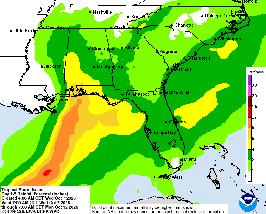
Hurricane watches have been issued up and down the Gulf Coast in anticipation of Isais arrival.

El Niño leads to suppressed hurricane season in Atlantic
There is a clear reason the season has struggled to produce stronger storms, and that would be the very strong El Niño that has developed.
During a typical El Niño, stronger wind shear develops across the Atlantic, which can tear apart developing thunderstorms before they have a chance to organize and intensify into a tropical system.

Hurricanes are vertically stacked storms, meaning their circulation needs to remain aligned from the surface all the way up through the atmosphere in order to strengthen efficiently.
When strong wind shear is introduced, it can tilt and disrupt that circulation, separating the storm’s surface center from its thunderstorms aloft. When that alignment is lost, the storm can struggle to organize and intensify, and in some cases, it can lead to weakening and eventual decay.
Despite the late start to the Atlantic hurricane season, we still have a little under two months left of the official hurricane season to see more tropical activity develop.

