
A blast of heat this weekend followed by seasonable temps
A couple of chances rain next week

Go Deeper.
Create an account or log in to save stories.
Like this?
Thanks for liking this story! We have added it to a list of your favorite stories.


Temperatures ramp up Friday with 70s across much of central and southern Minnesota by afternoon. Highs will be in the 80s Saturday and Sunday before cooling off.
Weekend heat, then seasonable temps return
Friday will be warm and sun-filled. Look for some occasional high clouds with afternoon highs in the 70s across central and southern Minnesota. It’ll be breezy from the southeast at 10 to 20 mph.

Saturday will be our warmest day in this stretch of above-normal temperatures. Highs Saturday will be 20 to 30 degrees above normal!

High temperatures on Saturday will be well into the 80s across central, southern and western Minnesota. A couple of places could even reach an incredible 90 degrees.
Turn Up Your Support
MPR News helps you turn down the noise and build shared understanding. Turn up your support for this public resource and keep trusted journalism accessible to all.
Saturday happens to be the latest we’ve ever reached 90 degrees in the Twin Cities.

Sunday also will likely be in the 80s for portions of southeastern Minnesota up to the Twin Cities, but cooler air will be moving into northwestern Minnesota.
Cooler and potentially wetter next week
Cooler air moves in starting in northwest Minnesota Sunday and spreading statewide Monday into Tuesday. While next week will be cooler, it will actually be closer to normal temperatures.
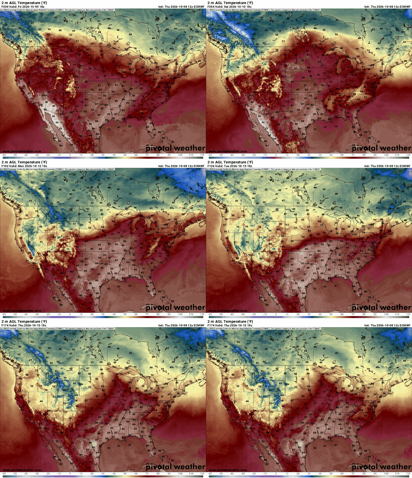
High temperatures by Tuesday will be right near normal, in the 50s and 60s, primarily. The normal high and low in the Twin Cities by Tuesday is 59 and 42 degrees while in International Falls the normal is 52 and 32 degrees.

The pattern also looks potentially more active next week and we could really use the moisture. That slow-moving cool front will touch off showers late Sunday in northern Minnesota and statewide on Monday. Another system could deliver rain late Wednesday into Thursday and Friday.
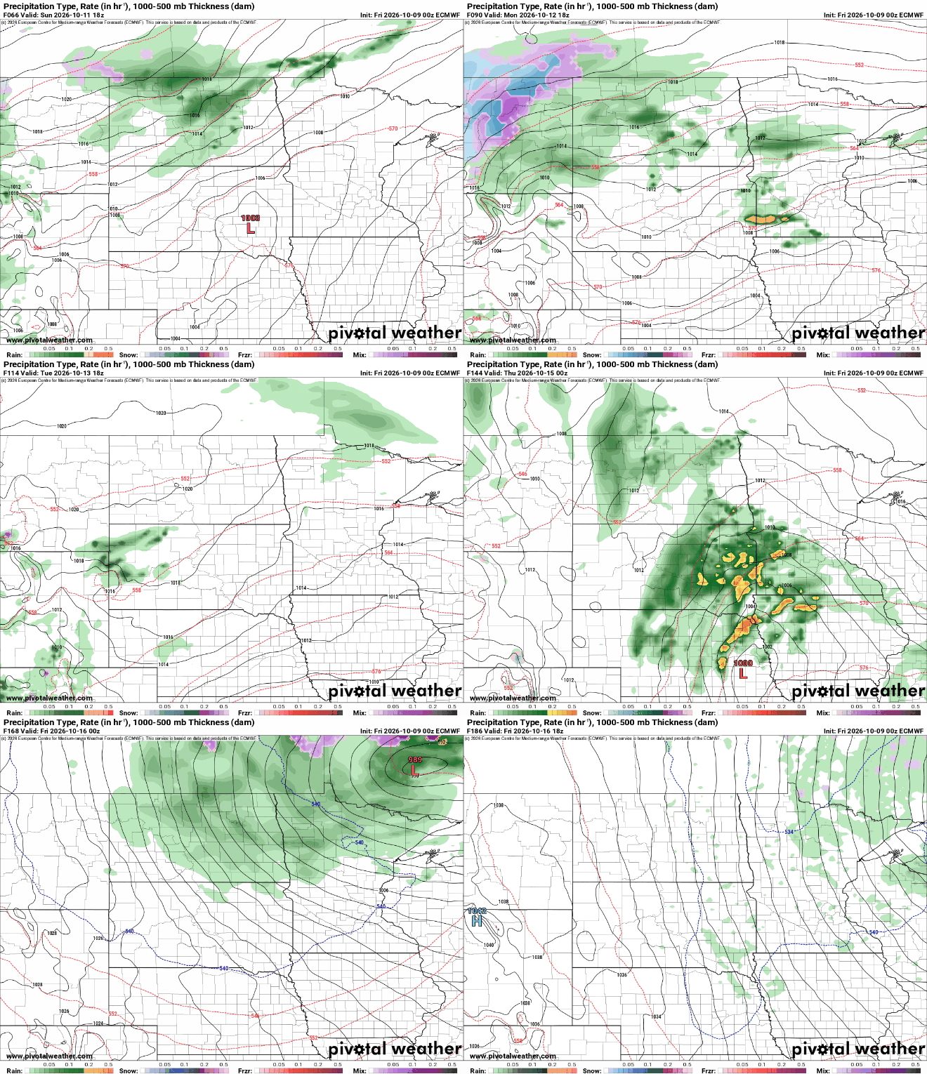
There’s a potential for a widespread 1 to 2 inches across much of Minnesota for total rainfall through next week between the two systems. In the Twin Cities, we’re still behind by 6.83 inches of year to date precipitation.


