Coldest weather in months headed our way soon
While not everyone will get rain on Thursday, we're set up for a more widespread frost on Saturday

Go Deeper.
Create an account or log in to save stories.
Like this?
Thanks for liking this story! We have added it to a list of your favorite stories.


Next week is likely to be windy and warmer, all followed by some solid continental lows. Those large storm systems often mean big swings in our temperatures and wind directions, plus they can rip down fall color from trees.
Big drop already underway
All of the cloud cover is a sign of colder air aloft, with really chilly temperatures up at the cloud level. While the frontal passage is already happening, there’s a very brief window for a couple of tiny showers Tuesday evening into the early overnight. New UIm, Redwood Falls, Mankato and the Twin Cities should see a couple of low-impact raindrops around 8-10 p.m. Tuesday.

We are looking a little cool into a more clear Wednesday. I keep having to remind myself that while the lower 60s sound pretty cold for highs, that’s exactly normal for mid-October. Wednesday should end up looking very pleasant and the sun will make it feel noticeably warmer than Tuesday ever could.
There’s some rain back on Thursday. We have the high-res data right below, followed by the wider view. Notice how large the storm is in scale, which also means it will pull in more cold air later Thursday into Friday.
Turn Up Your Support
MPR News helps you turn down the noise and build shared understanding. Turn up your support for this public resource and keep trusted journalism accessible to all.


A real chill
Actually behind schedule by quite a bit, the coldest air of the season will soon be here. There may even be a few melty snowflakes way up in northern Minnesota Thursday evening or into early Friday. That’s totally normal. The average first day of measurable snow (this is not likely to stick at a heavy enough pace to be measured) at International Falls is Oct. 22.
Oftentimes we get the biggest temperature impact about 36 hours behind a cold front. The front that arrives on Thursday will be most acutely felt on Saturday morning. Hello sweater weather? Too early to turn on the heat? Well, maybe, because we will warm right back up for parts of next week.

Swing and a miss
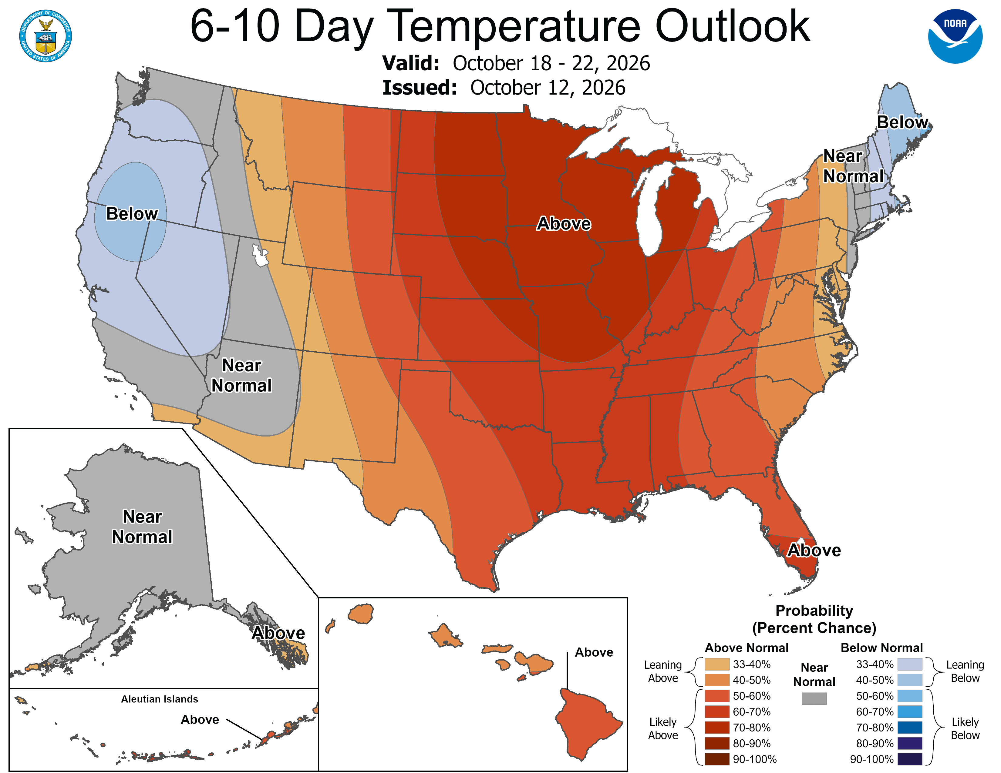
Just as soon as the first 30s arrive in the Twin Cities this season (that’s this Saturday, just to reiterate), we should warm back up early next week. Note the below image, which is the chances of warmer-than-normal temperatures. That is a very high probability, though we are not as apt to break record high temperatures.
We will be pretty windy, as the above image showcases. The CPC has much of Minnesota at a risk for high wind hazards. That happens when we get so warm, out of seasonal norms, as a front nears our region. That is also likely to bring rain through the middle of next week.