
A warmer-than-normal Minnesota winter is likely as El Niño looms
Go Deeper.
Create an account or log in to save stories.
Like this?
Thanks for liking this story! We have added it to a list of your favorite stories.


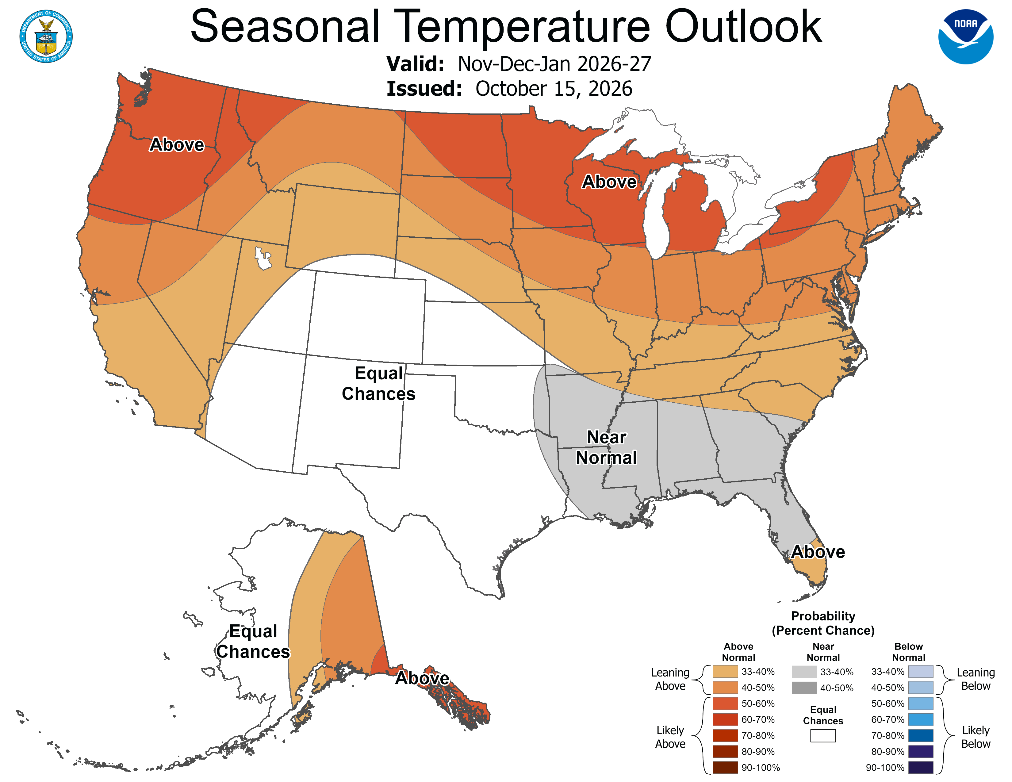
The El Niño global weather pattern is likely to keep temperatures warmer than normal this winter across most of Minnesota, according to the National Oceanic and Atmospheric Administration’s newly released three-month outlook.
Northern Minnesota may feel the biggest effects.
Minnesota’s fastest-warming season
NOAA forecasters left no doubt in their report on Thursday that a “very strong El Niño” will have a significant influence on the nation’s weather through February.
El Niño or not, winter is the fastest-warming season in Minnesota. Winter lows in northern Minnesota have climbed 7.8 degrees from 1895 to present. That stat absolutely shocks me, and the coming winter is likely to extend that big warming trend further.
Turn Up Your Support
MPR News helps you turn down the noise and build shared understanding. Turn up your support for this public resource and keep trusted journalism accessible to all.

This bump in temperatures is on top of what we’ve seen developing in past decades. We're also warmer than the 30-year average from 100 years ago. My takeaway: Winter 2026-27 is probably going to be warmer than the winters of your childhood, plus the winters your grandparents experienced in Minnesota.

Typical winter moisture but drought lingers
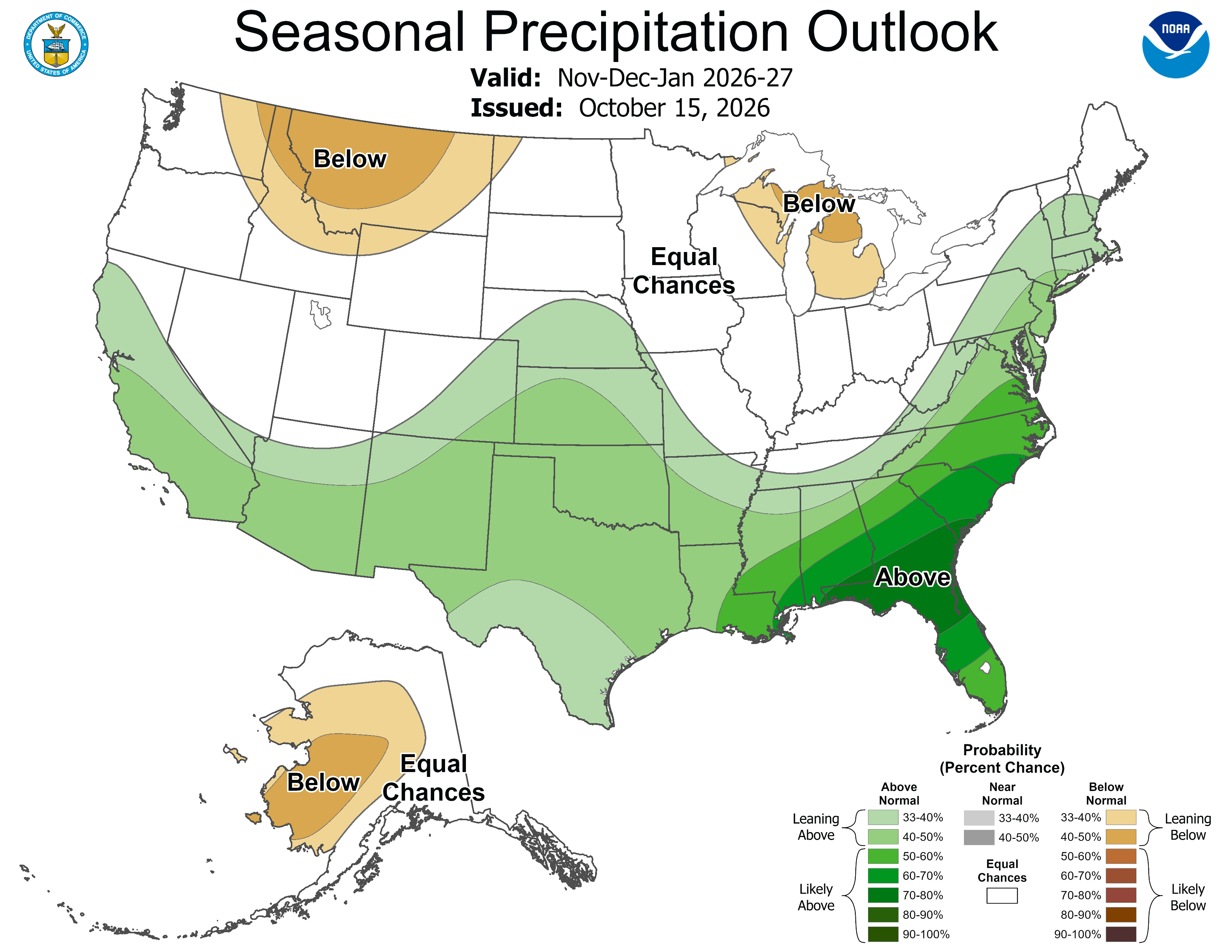
Warmer doesn’t mean drier and this doesn’t mean we are going to be snow free. NOAA also does not expect drought to wrap up this winter but we could have pretty typical moisture. That may come in the form of more cold rain.
The seasonal outlook shows equal chances of regular precipitation. It means that while snowfall could be less, we could still get rain, which will hopefully keep drought conditions from worsening.
On a media call, National Weather Service Director Ken Graham stressed that a single, big winter storm can make a huge difference.
This season, the National Weather Service will start using the term “particularly dangerous situation” in select blizzard and ice storm warnings. It will help forecasters alert the public about high-confidence blizzards or ice storms of historic severity.
A longer stretch of ice-free Lake Superior?
While typical moisture is likely overall this winter, NOAA indicated that it could be drier than average over Lake Superior. That surprised me, given the higher change of lake effect snow later into the winter with the El Niño setup.
When there’s a big low-pressure system to the south of Lake Superior, and there’s no big ice coverage, we can get an east-to-west wind field that drives lake effect snow onto the North Shore of Minnesota.
Since we are likely to be warmer, Superior could be ice free for longer into the winter.

