
Unseasonably warm, dry weather across Minnesota this week
Omega blocking pattern stalls weather systems

Go Deeper.
Create an account or log in to save stories.
Like this?
Thanks for liking this story! We have added it to a list of your favorite stories.


Get ready for a stretch of unusually warm and dry weather across Minnesota, with temperatures climbing well above normal for mid-October. Rain chances will remain limited, with the next opportunity not expected until next weekend.
Omega blocking pattern helps keep Minnesota warm and dry
We’re in for a quiet stretch of weather this week, with high temperatures well above average. A big reason behind Minnesota’s quiet weather is a pattern known as an omega block. Simply put, this pattern can cause weather systems to slow down, allowing the same type of weather to stick around for several days. It gets its name from the Greek letter omega (Ω), which the pattern resembles.

Think of it as the atmosphere getting stuck in a pattern. In this case, warmer air and high pressure are helping keep Minnesota dry, while stronger weather systems remain farther west and east.
Sunday, temperatures will climb into the mid to upper 60s across the state, with stronger south-southwesterly winds expected across southern Minnesota.
Turn Up Your Support
MPR News helps you turn down the noise and build shared understanding. Turn up your support for this public resource and keep trusted journalism accessible to all.

A weak front will approach from the northwest this afternoon, helping winds ease across northern and central Minnesota.
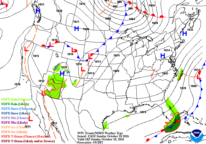
Monday will bring a brief cooldown, with highs in the upper 50s to low 60s, right around seasonal averages for this time of year.

From Tuesday onward, anomalous warmth will continue across the Upper Midwest, with temperatures running 15 to 25 degrees above normal. Widespread highs in the 60s and 70s are expected, with some readings near 80 degrees possible around the Buffalo Ridge area of western Minnesota.
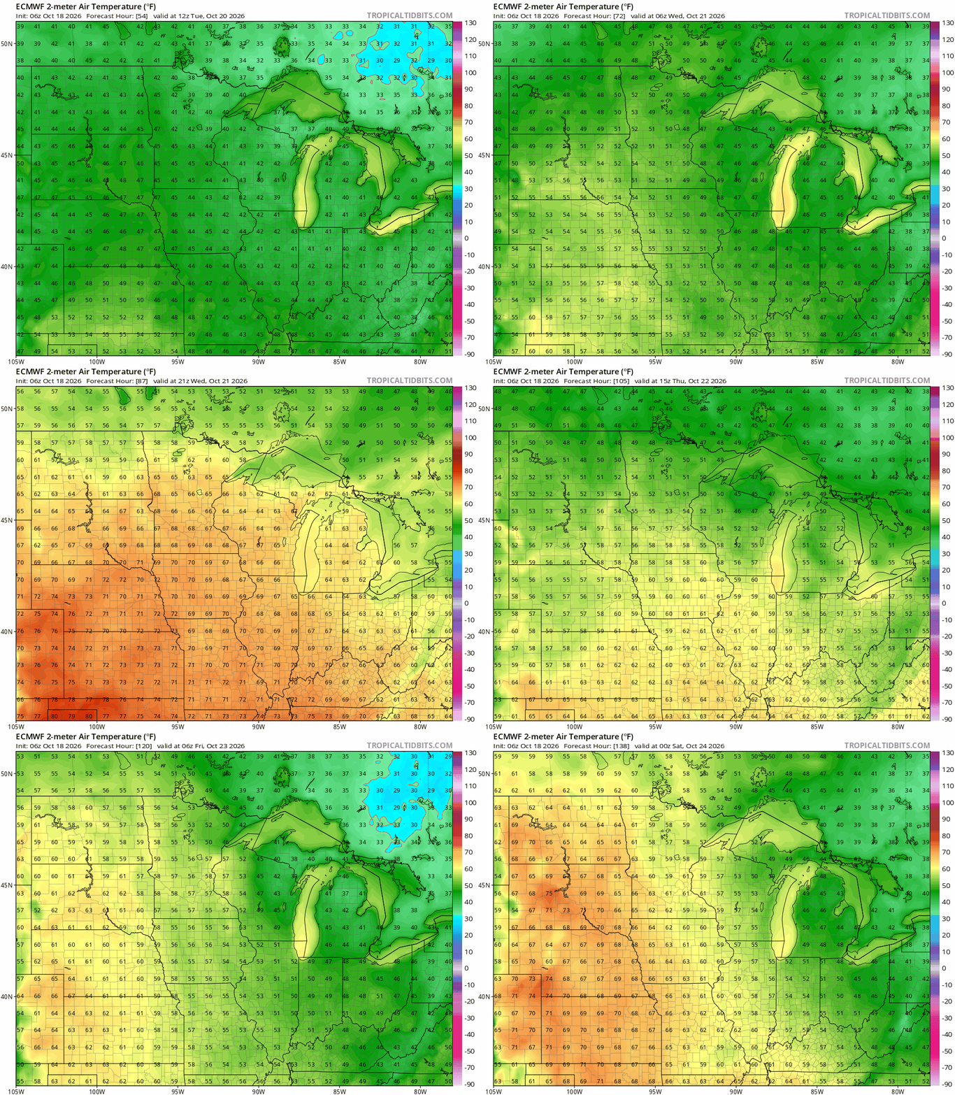
Rain chances will remain low for most of the week as the pattern holds. The next opportunity for rain comes next weekend as a weather system approaches from the west, although widespread rainfall is not looking especially likely right now.

