
Above normal temperatures and dry this week
Highs will surpass 70-degrees in southern Minnesota midweek

Go Deeper.
Create an account or log in to save stories.
Like this?
Thanks for liking this story! We have added it to a list of your favorite stories.


It’ll be a very mild, sun-filled week with little or no rainfall until perhaps the weekend. High temperatures could exceed 70-degrees mid to late week in southern Minnesota.
Above normal temperatures and dry this week
If you liked Sunday’s weather, you’ll love Monday and Tuesday too. We’ll see lots of continued sunshine and lighter winds today and tomorrow. Afternoon highs will be mostly in the 60s, which is above normal by at least 5 degrees.

It’ll be a milder than normal overnight too, under clear skies. Overnight lows will fall into the 30s and 40s mostly.

Tuesday will see another day in the 60s with more sunshine, again about 5 to 10 degrees above normal for the date. Normal highs range from 56 in southern Minnesota to 49 on the Iron Range.

We get an even bigger boost in temperatures from even warmer air moving mid to late week as an upper level ridge of high pressure builds across the central United States. That means more sunshine and dry weather too.
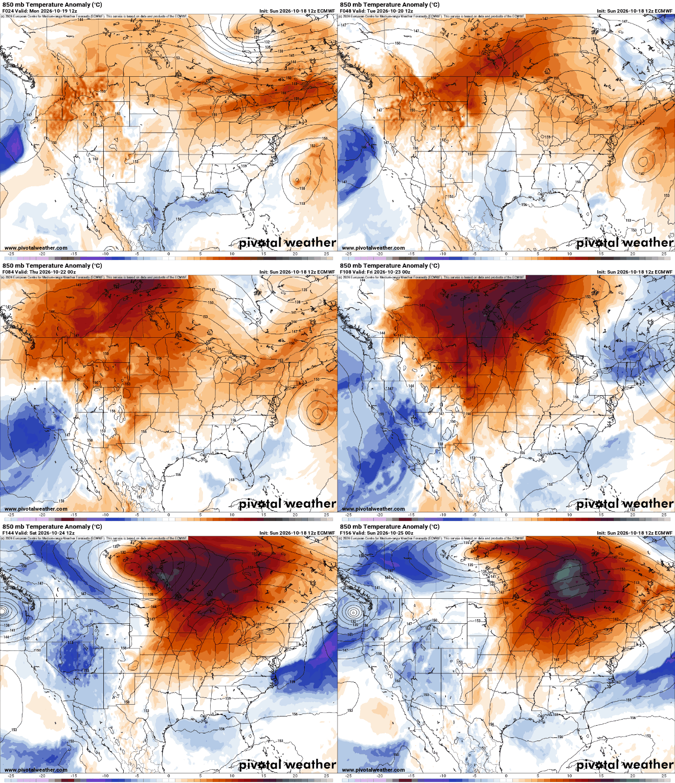
Afternoon highs Wednesday through Saturday will likely be in the 70s across much of southern Minnesota. In fact, some places in western Minnesota could take a run at 80-degrees Friday afternoon.

A cool front will move through Saturday night or Sunday and that will the next chance of any real rain for most of the state. Western Minnesota could see a few showers Friday.
Turn Up Your Support
MPR News helps you turn down the noise and build shared understanding. Turn up your support for this public resource and keep trusted journalism accessible to all.

