
Nearing records two different ways before weekend rain
The powerful weekend front is our next big weather-maker, setting up a cold blast before Halloween

Go Deeper.
Create an account or log in to save stories.
Like this?
Thanks for liking this story! We have added it to a list of your favorite stories.


We had our weather meet-up on Tuesday. Mandy and Sven made sure I know: late October is not always like this in Minnesota! Through the end of Saturday, we are very mild. Then things drop off quite a bit. That sets up a cooler period for Halloween week.
‘Weather is cancelled’
I saw this headline on a regional weather enthusiast page - somewhere in Indiana or Ohio - the other day. The Upper Midwest and Great Lakes forecast is ultra quiet for this week, which is not always the norm. Six years ago today, the Twin Cities were blanketed with about eight inches of snow!

There could be a little bit of patchy fog in south-central Minnesota, along both the Minnesota and Mississippi River Valleys (or some other small streams). The biggest impact is: you might need to budget two extra minutes for the morning drive to defrost the windows on your car from all the condensation and dew. Otherwise it’s just a generally chilly (though not cold!) morning across the Land of 10,000 Lakes.

How about the 70s in October? If you cannot make it outside on Wednesday afternoon, don’t fret! Thursday will be even warmer and just as quiet, weather-wise. We still expect loads of sunshine. Speaking of sunshine, the Twin Cities’ latitude is getting about 10:40 of daylight per day now, as we lose roughly three minutes of daylight per day. Soak up the Vitamin D while you can, friends!

Rain into a big front
There’s a limited chance for rain on Friday, mainly in the west-central sector of Minnesota. That is a slight change from earlier weather maps which only have rain on Saturday. We still think Saturday is the best chance for rain this week, by a mile. We’d say at this stage, to pack a rain jacket all across the state, though we will fine-tune details over the next few days. Saturday is likely to start exceptionally warm, given the pull of higher (and warmer) winds from the Southern Plains throughout the previous night.
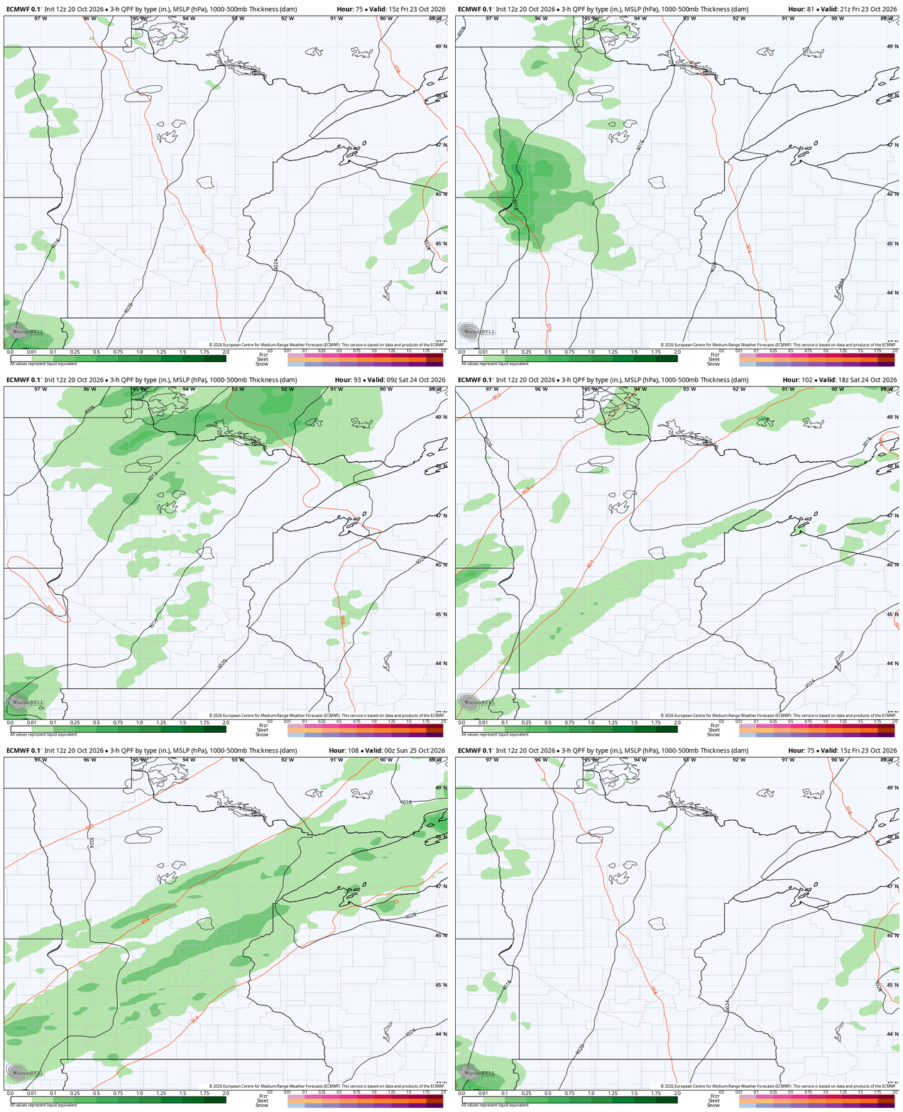
Some of these showers try to linger into Sunday, possibly even Monday morning! By Monday through much of next work-week, we could very easily be below average on temps. A few later week snowflakes are also possible in the Boundary Waters. It might actually be more surprising that we haven’t had many cracks at snow so far, compared to a scenario where we did have snow.
Halloween looks to have more moderate temps at this point.
Turn Up Your Support
MPR News helps you turn down the noise and build shared understanding. Turn up your support for this public resource and keep trusted journalism accessible to all.

