
Sweat(ing) weather through Saturday, then a monster drop
Go Deeper.
Create an account or log in to save stories.
Like this?
Thanks for liking this story! We have added it to a list of your favorite stories.


When the Minnesota Timberwolves took the floor against the Miami Heat Wednesday night, temperatures between parts of the Twin Cities were nearly as warm as in the Magic City. We will keep up our pursuits of record-high temperatures across Minnesota through Saturday — then it gets much colder.
You’ve heard of the dog days of summer? How about the dog days of October. I asked around Minnesota Public Radio for pictures of staffers’ pets soaking up all this sunshine. We hope you enjoy all the snapshots. It will make the upcoming colder weather easier to handle!


Shorts weather before Halloween
We are once again rivaling records all across Minnesota as the string of 70s continues. For reference, because this warmth is starting to feel normal, these temperatures are way above average. In the Twin Cities, the average high is 55 degrees. Up north, the average high is 48. We’ve only have a single below-average morning pretty much all fall. That was last Saturday morning.

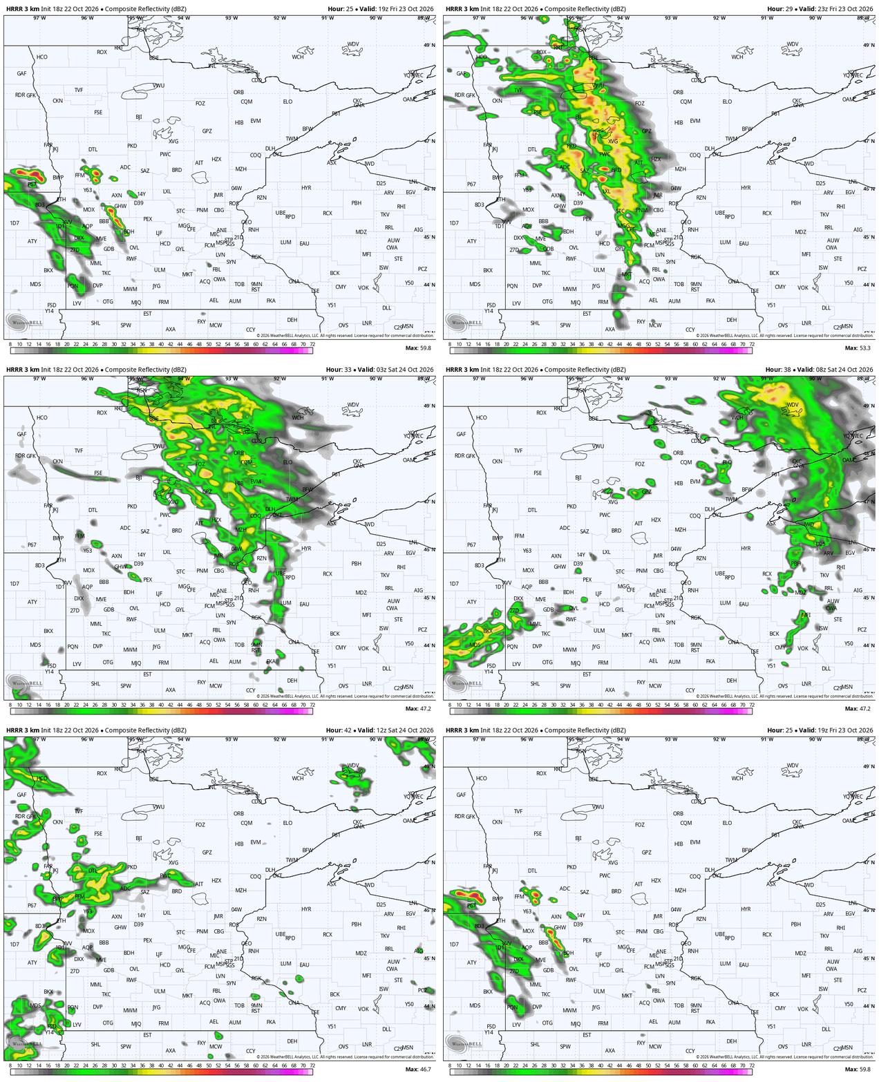
With the arrival of some higher clouds early Friday, we are even more mild. There is no rain yet, but it does arrive to the upper Minnesota River Valley by 3 p.m. Friday. That’s places like Wheaton, Ortonville, Redwood Falls, Morris, Madison and a lot more. This small band could clip the northernmost suburbs of the Twin Cities, but that is not too likely. The more probable setup is that these showers move northeast towards Brainerd, Duluth and Grand Rapids by Friday’s late evening.
Turn Up Your Support
MPR News helps you turn down the noise and build shared understanding. Turn up your support for this public resource and keep trusted journalism accessible to all.


The graphic above is the rain through later Saturday morning. Notice the first band favors our northern counties, with the far northwestern zones getting practically nothing. Saturday is also trending a lot drier now. There will be some rain Saturday, but likely under a tenth of an inch.
There will also be some rain overnight Saturday into the start of Sunday. Sunday will likely be colder, gray and a little drizzly. The maps are teetering back and forth on Sunday’s exact forecast, but this is our longtime experience coming in handy to predict the pattern itself, not the exact weather.
Not Elsa weather, not Tinkerbell weather
There’s a secondary storm complex rolling into the start of the week. Monday, Tuesday and even parts of Wednesday will see some cold rains developing. This rain looks heaviest in southern Minnesota, but we are all likely to deal with some frigid winds. That will also probably silence a lot of leaves falling because they’ll have moved down the street after falling off your trees in breezy weather. Enjoy the rest of the peak fall colors while you can before Sunday.
Halloween is next Saturday and it’s milder than past years. You won’t need to bundle the kids up like a Frozen character, and they probably won’t be wearing a fairy costume or shorts. This year, Halloween is somewhere in between hot and cold. Assuming we hold onto the middle 50s for southern Minnesota and a little cooler up north, that’s actually pretty average. So, no Halloween Blizzard of 1991 rerun this year, but also no record highs during Spooky Season.


