
A few very warm days before seasonably cooler temps return
Increasing chances for at least some rain this weekend

Go Deeper.
Create an account or log in to save stories.
Like this?
Thanks for liking this story! We have added it to a list of your favorite stories.


We have a few incredibly warm days ahead before more seasonable air arrives early next week. We’ll also see the chance of at least a little rain increase this weekend.
Very warm days, then seasonable temps return
Thursday could be one of the warmest days of this week so far. We’ll see more sunshine. Highs will be in the 70s for most, including all the way north to the international border. High temperatures in western Minnesota will be near 80 degrees and possibly higher for some.

Friday will be very warm too, back well into the 70s across most of the state, but we’ll start to see an increase in cloud cover.

It’ll also become fairly windy again Friday into Saturday. Winds will be up to 15-25 mph in western Minnesota.
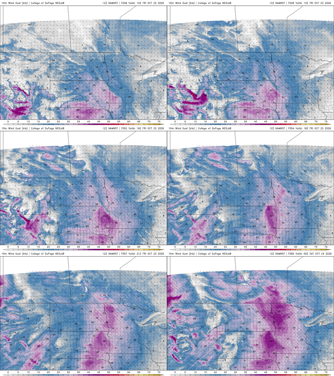
Shower chances into the weekend
Friday also brings the first minor disturbance that could touch off some showers in western and northern Minnesota later in the day. As a slowly moving cool front advances south and east, we’ll see statewide chances of at least some showers increase later Saturday into Sunday.
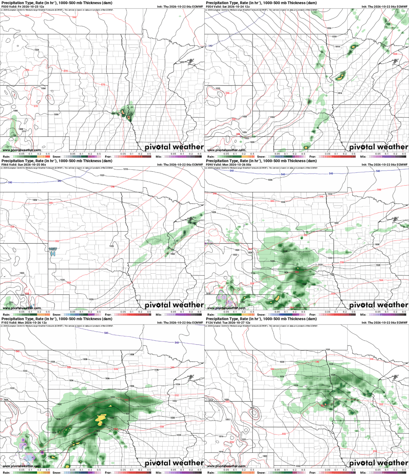
While we have the chance of some showers almost each day from Saturday through Tuesday or Wednesday, it won’t likely add up to a significant rainfall for most of us.

Next week brings a return to more normal temperatures with highs mainly in the 50s and 40s and overnights back in the 40s and 30s, with even some 20s north.

Turn Up Your Support
MPR News helps you turn down the noise and build shared understanding. Turn up your support for this public resource and keep trusted journalism accessible to all.

