
70s to showers: A cooler, wetter week ahead
Widespread rain expected on Monday

Go Deeper.
Create an account or log in to save stories.
Like this?
Thanks for liking this story! We have added it to a list of your favorite stories.


A cooler, cloudier and wetter stretch of weather has arrived, with multiple chances for rain through early next week. However, the cooldown won’t last long, as temperatures are expected to trend warmer again toward the end of the week, potentially bringing another taste of 70-degree weather to Minnesota.
A cool and cloudy end to the weekend
Temperatures early Sunday morning are running 10-30 degrees cooler than they were at this time Saturday following the passage of the cold front. Cloud cover and a few areas of light rain will keep things feeling chilly throughout the day.
Additional showers are expected to linger through Sunday morning before gradually diminishing. Another area of light rain may develop across southern Minnesota later in the morning and slowly spread northward through the afternoon and evening.
High temperatures will struggle to climb out of the 40s up north and mid-50s for southern locations, making for a cool and cloudy end to the weekend.
Turn Up Your Support
MPR News helps you turn down the noise and build shared understanding. Turn up your support for this public resource and keep trusted journalism accessible to all.

Monday is shaping up to be the wettest day of the upcoming forecast period as a storm system moves across the Upper Midwest. A broad area of rain is expected to develop ahead of the system, bringing several hours of potentially steady rainfall to much of Minnesota.
The heaviest rainfall is expected across eastern South Dakota and far western Minnesota, where totals of around 1-1.5 inches are possible. Rainfall amounts will generally decrease farther east, with approximately a quarter to a half inch possible around the Twin Cities.
Along with the rain, temperatures will remain chilly. Monday’s widespread rain will keep high temperatures in the 40s across much of the region. The rain is expected to gradually move north and out of the area by Tuesday morning, bringing a brief break in the wet weather.

However, that break may not last long, as another system approaches from the west and brings additional shower chances later Tuesday. Southerly winds will help temperatures rebound, with highs climbing into the mid-60s.
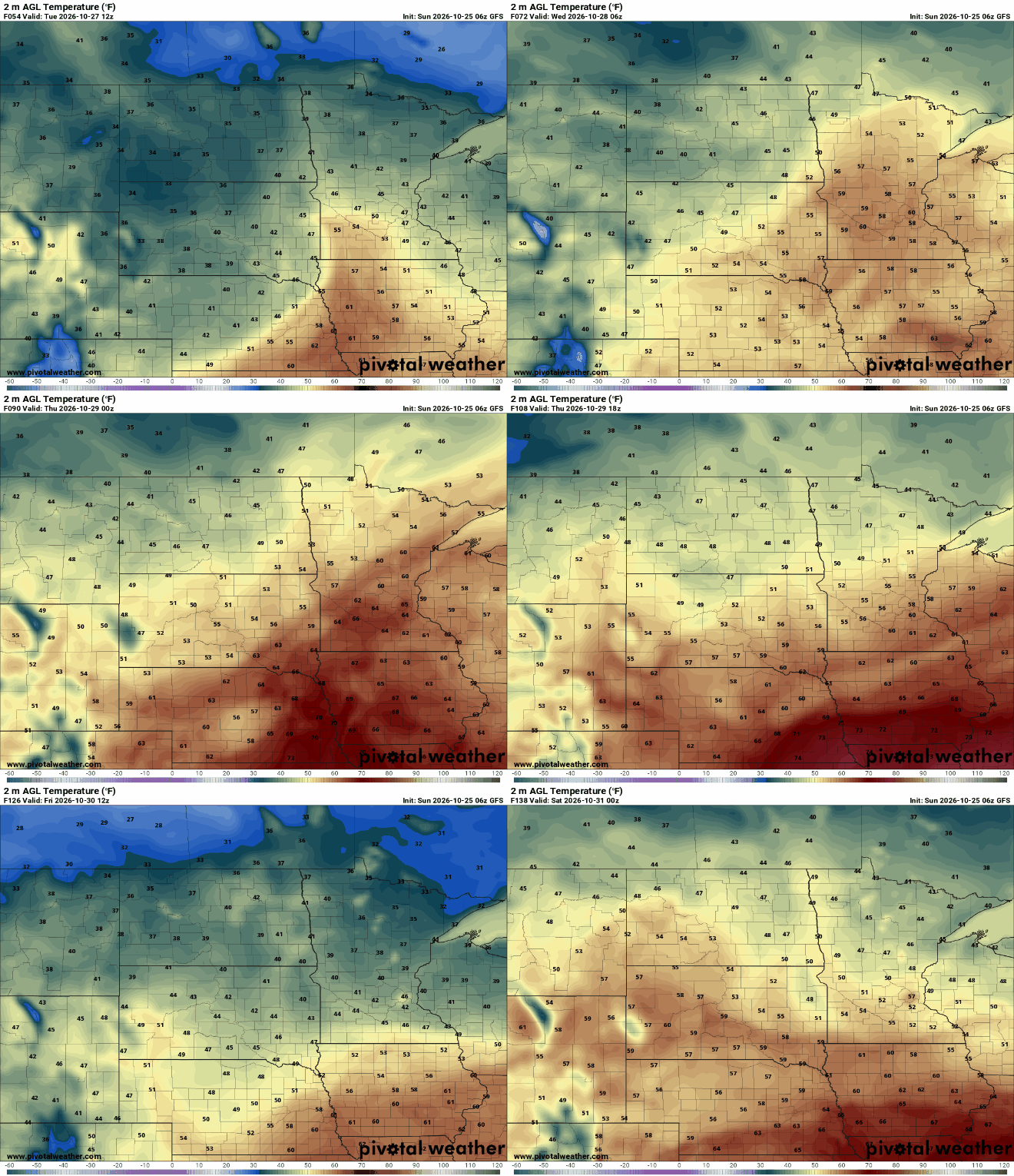
After the early-week cooldown, the forecast is trending warmer toward the end of the workweek. Increasing high pressure and a warming weather pattern could help temperatures climb well above seasonal averages once again.
There is even a chance the Twin Cities could record another 70-degree day before October comes to an end.

