
Warm and potentially stormy Wednesday
Sunshine returns Thursday; mild temps through Halloween

Go Deeper.
Create an account or log in to save stories.
Like this?
Thanks for liking this story! We have added it to a list of your favorite stories.


Wednesday will be warmer and even a bit muggy with late-day storms ahead of a cool front. It’ll be cooler Thursday behind the front but still mild and above normal through the weekend.
Warm and potentially stormy Wednesday followed by sunshine Thursday
In the continued bizarre tale of our very warm October, we’ll see a combination of three factors more typically seen in early September or August.
The first factor will be warmer-than-normal temperatures Wednesday afternoon. That’s been pretty common this month. Afternoon highs will be in the 60s and low 70s.

The second factor is even rarer for near-November: some muggy air from the Gulf moving in at least briefly.
Turn Up Your Support
MPR News helps you turn down the noise and build shared understanding. Turn up your support for this public resource and keep trusted journalism accessible to all.
Dew points could top 60 degrees Wednesday afternoon ahead of a cool front. We’ve only had 60-degree dew points twice this month, on Oct. 1 and Oct. 12. The average dew point for late October is in the 30s.
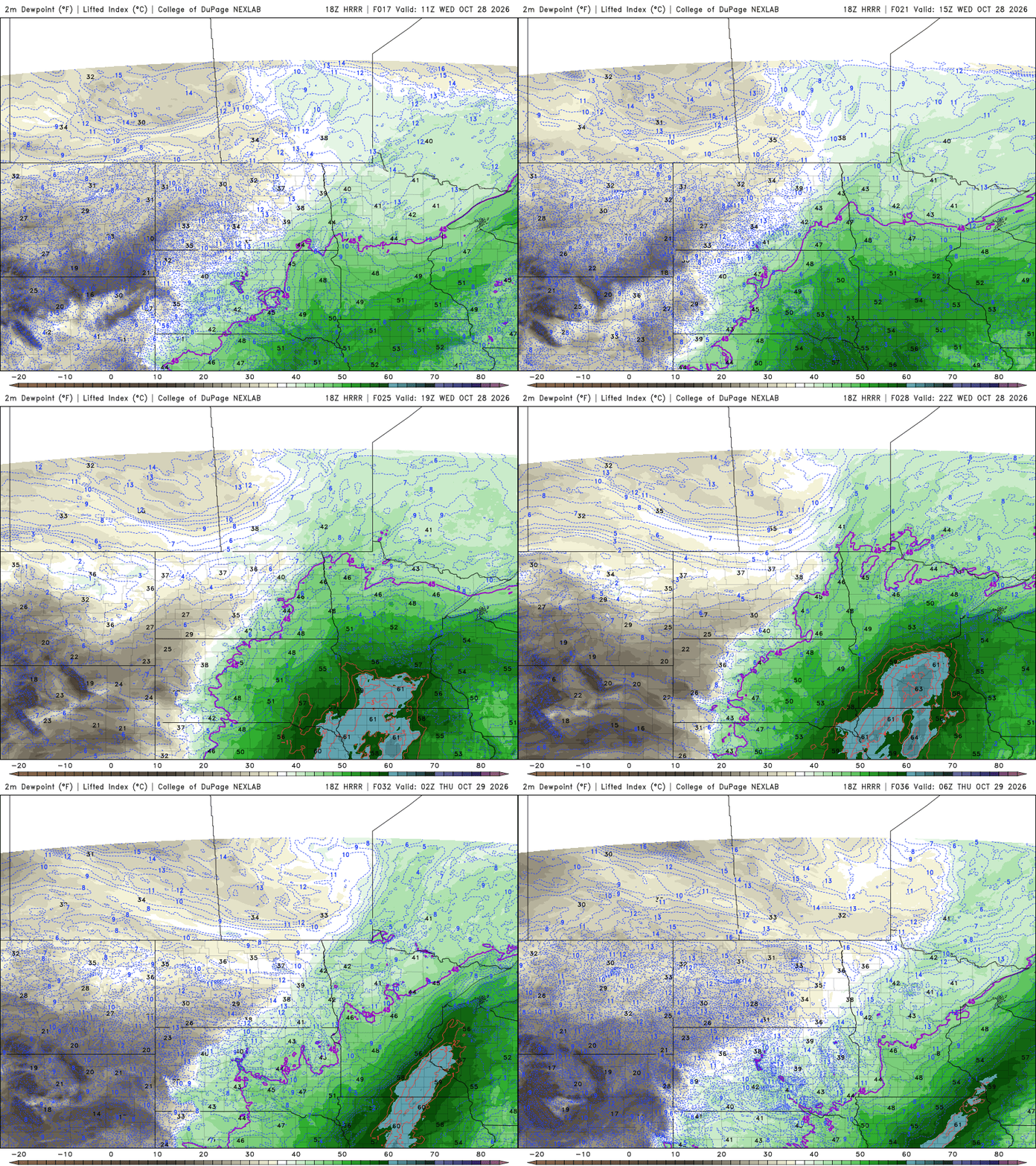
The third factor Wednesday that takes both these unusually mild temperatures and unusually high dew points into account are thunderstorms.
The mild and muggy air combined with an advancing cool front and upper-level disturbance will touch off scattered thunderstorms later Wednesday afternoon and evening.
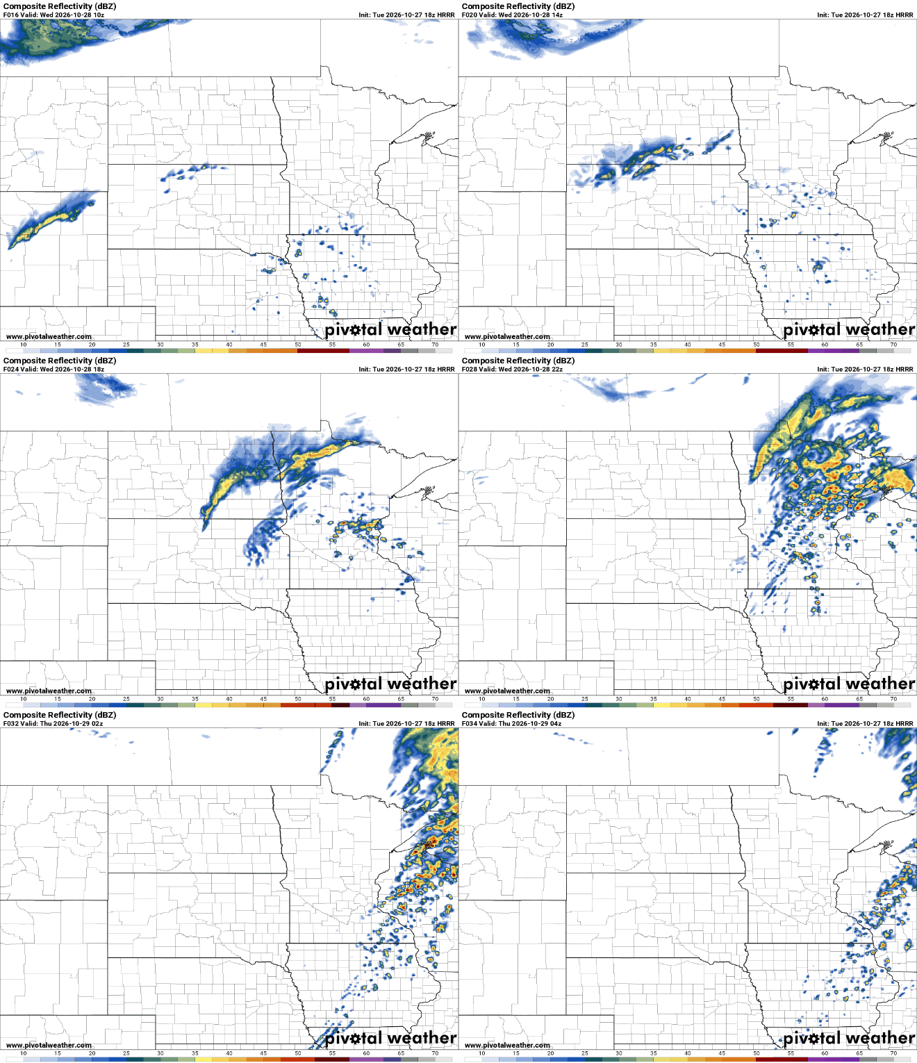
What’s even more rare than all those things above is that they’ll combine to form a slight (level 2 of 5) severe weather risk Wednesday afternoon and evening across east-central Minnesota into western Wisconsin with a broader marginal risk (level 1 of 5) for much of southern and central Minnesota.
A few storms could be severe:
All severe weather hazards are possible Wednesday afternoon but in particular we’ll be watching for isolated tornadoes.
The National Oceanic and Atmospheric Administration’s Storm Prediction Center gives the Twin Cities area a 5 percent probability of tornadoes.

There will be sufficient moisture and shear to organize storms into a few, discrete supercells that could produce tornadoes. One forecast parameter we watch is the “significant tornado parameter,” which for late Wednesday afternoon is elevated:

October tornadoes are rare but not unheard of
The last time Minnesota had October tornadoes was 2021. We had a whopping nine tornadoes that year, including one in the Boundary Waters Canoe Area Wilderness that did significant damage. That tornado on Oct. 10, 2021 was rated an EF-2 with maximum winds of 120 mph.

In the past 20 years, there have only been two Octobers with tornadoes: 2021 and 2013. Prior to that we had October tornadoes in 2004, 1997 and 1996. So, roughly 1 in 6 years we see tornadoes in October. The last time this year we had severe weather near the Twin Cities was Aug. 7.
Mild weather through Halloween
Behind Wednesday night’s cool front, temperatures will dip for Thursday some, but still be about 10 degrees above normal, near 60 degrees in the Twin Cities. We’ll also see sunshine return in abundance.

The mild weather persists through Halloween weekend and our transition into November. Highs will be near 60 degrees in southern Minnesota with above-freezing overnights.

