
A Halloween forecast that shouldn't scare you

Go Deeper.
Create an account or log in to save stories.
Like this?
Thanks for liking this story! We have added it to a list of your favorite stories.


Spotty Halloween showers will diminish across much of Minnesota Saturday afternoon. Following a pleasant day Sunday, a moisture-rich system will bring widespread soaking rain Monday into Tuesday.
A not-too-scary Halloween forecast
Don’t be scared of rain during the day Saturday, as the chances of precipitation are pretty low across the region and have actually decreased since a day or two ago. This is good news for trick-or-treaters, especially in central, southern and eastern parts of Minnesota.
We’ll see patching showers moving through mainly western and extreme southeastern parts of Minnesota and southwestern Wisconsin this morning and into northern Minnesota by this evening. For the most part, any rain will be diminishing from south to north across the state this afternoon, so umbrellas or rain jackets do not need become part of your Halloween costume, with the possible exception of parts of northern Minnesota, especially across the Iron Range and Arrowhead regions.

And even if it’s not raining, there could be areas of drizzle or fog, especially in northwestern and west-central Minnesota, so be careful, as sidewalks could be slippery and visibility reduced.
Turn Up Your Support
MPR News helps you turn down the noise and build shared understanding. Turn up your support for this public resource and keep trusted journalism accessible to all.
A pleasant Sunday
As we move into next week, we should see a fairly pleasant day on Sunday, with highs ranging from the upper 50s to the lower and middle 60s—roughly 10–15 degrees above normal.
Soaking rain moves in Monday
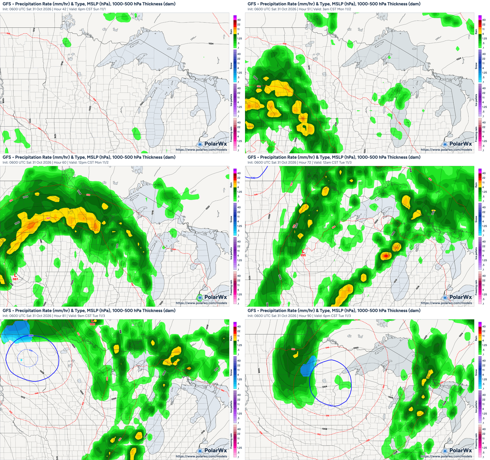
Things are shaping up for a wet start to the work week, however, a storm system currently developing over the Four Corners region will move into our area, bringing widespread soaking rain Monday into Tuesday, with 1–2 inches likely for many areas and localized totals exceeding 3 inches possible across western and central Minnesota.
The NWS Weather Prediction Center has much of Minnesota in a marginal risk area for excessive rainfall—that’s rainfall that’s forecast to exceed flash flood guidance levels—for Monday into Tuesday. It’s a very low probability, however, 5 percent, so any flash flooding should be isolated and mostly in vulnerable or flood-prone areas.

We do need the rain, however, as we’ve only received 1.4 inches throughout the month of October in the Twin Cities, which is just over an inch below normal for the month. We’re still more than 7 inches below normal for the year so far, however, so we need that moisture in the soil—especially before it starts freezing—in order to help mitigate drought conditions.
Extended forecast: drier and warmer
Drier and cooler weather should arrive later Wednesday into Thursday, though temperatures will remain generally above average for early November

