Soggy stretch ahead of minor cool trend
Bemidji, Red and Cass Lakes, Mahnomen could be the rain bullseye of America

Go Deeper.
Create an account or log in to save stories.
Like this?
Thanks for liking this story! We have added it to a list of your favorite stories.


We’re still warmer than average with the looming chance of the latest freeze in the Twin Cities’ history.
Washing Machine: Heavy Duty Cycle
The tumbling nature of this rain in a big loop is highly reminiscent of your at-home washing machine. So, it’s laundry day here in the MPR Weather Center and the spin cycle of rain is going. The upper-level low we have overhead through Wednesday morning has been in the forecast for more than a week; it’s a huge storm lumbering through the Plains and Upper Midwest. The center of the low is pinwheeling all around us, but northern Minnesota is very likely to have higher rain totals than southern communities.
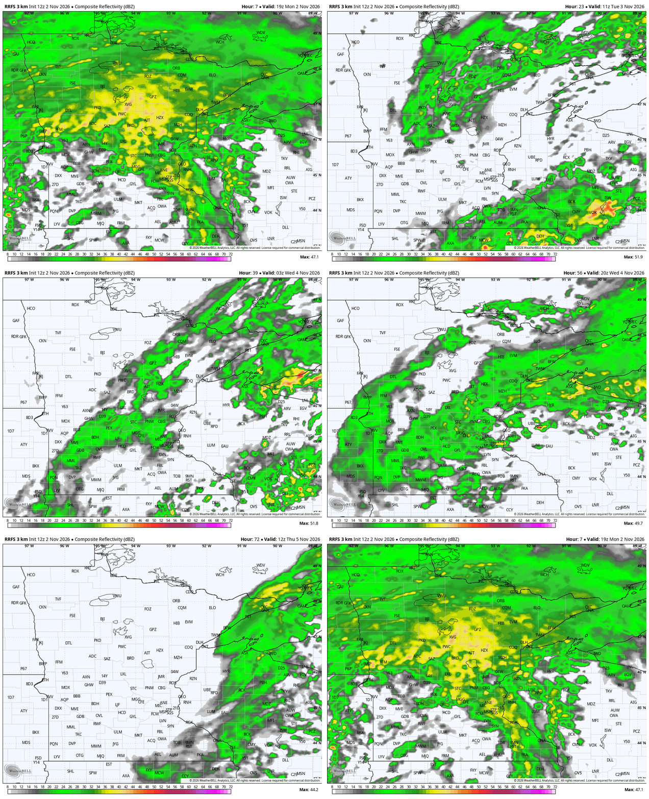
As Sven Sundgaard mentioned in a note (and on Morning Edition), the amount of moisture to tap into is really high right now. We have about four times the amount of cloud-level moisture than we typically would in November, which is remarkable if you stop to consider that. The broader storm goes from Mexico to Canada, the Rockies to almost the East Coast. It is huge! That means we are not getting rid of the complex quite yet. Rain will lighten in southern Minnesota later Monday, pushing into northeastern Minnesota and Wisconsin. The above graphic shows the storm spinning back around, which means that much of the North Star State will have rain on Election Day.
But then we’re clear, right? Two days of rain? Nope! Rain showers are curling around yet again on Wednesday. This time, however, it is starting to turn colder pretty fast. Thursday finally kicks the rain out of here except for far eastern Minnesota, the Driftless, and Arrowhead. Usually clouds are really stubborn in clearing the ULL pattern — that’s an upper-level low, sometimes always named a cutoff low.
Colder stretch but no freeze yet
Meteorologists are always geeking out over numbers, stats and records, so this week is no different. From 71 degrees to start November, to the third warmest October on record, now we’re pinging what could be the latest first freeze in Twin Cities’ history! We will certainly be chilly Thursday into the weekend. These highs and lows are going to be pretty shocking, I believe, and yet they are actually totally normal for the first full week of November.
Bear in mind that we are basically all losing at least a full hour (or more) of daylight in November; it is hard to maintain such elevated temperatures, but we’ve held on for now! I think Sunday into Monday morning is likely to be the coldest, though we still are not forecasting a 32-degree reading for the Twin Cities quite yet. Even snow is pretty unlikely except along the Gunflint Trail, maybe a couple of isolated snow showers near the Apostle Islands or north of Thief River Falls.
The brand new 30-day outlook from our friends at the Climate Prediction Center also has a higher likelihood of relatively warm conditions lasting through the end of November, thanks to a super El Niño.

Turn Up Your Support
MPR News helps you turn down the noise and build shared understanding. Turn up your support for this public resource and keep trusted journalism accessible to all.