When to stay dry on Election Day and the week ahead
Things dry out substantially starting midday Thursday, with cooler conditions following that
Go Deeper.
Create an account or log in to save stories.
Like this?
Thanks for liking this story! We have added it to a list of your favorite stories.


You know the expression “when it rains, it pours?” That is certainly true in a literal sense this week with four days in a row featuring rain. After that, many maps have a substantial drying period of cooler — but not cold — weather. We are still awaiting the first 32-degree temperature reading at Minneapolis-St. Paul International Airport, and already closing in on a top-five latest freeze with plenty more time ahead of us.
Get out the vote — and the umbrella
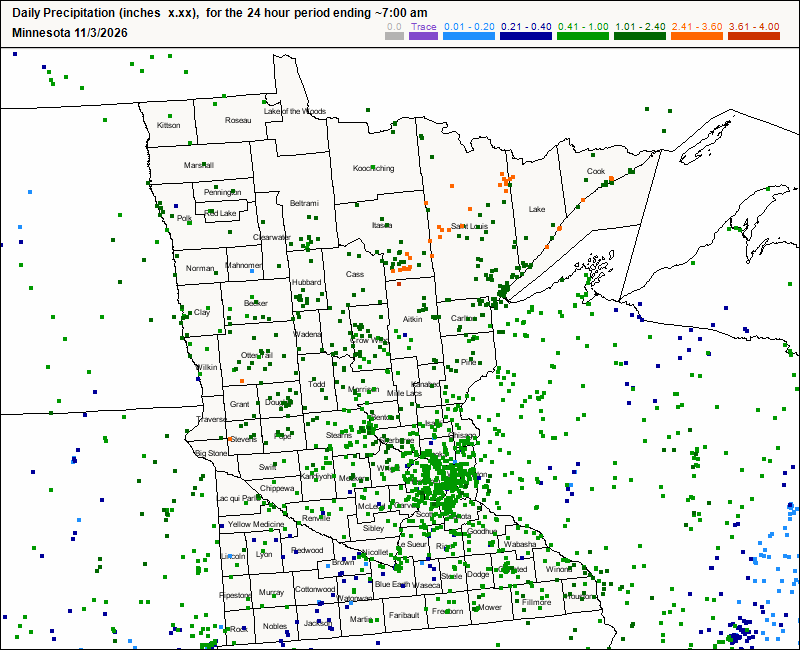
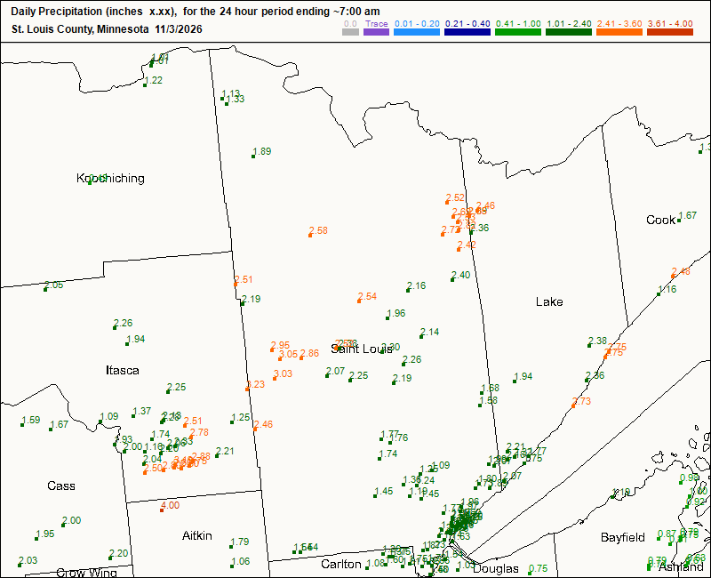
Goodness, we’ve had quite a bit of rain. If you thought it was heavy around the Twin Cities, Grand Rapids and Chisholm had nearly five times the official amount at MSP.
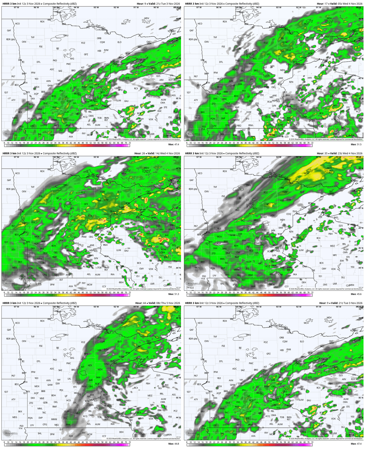
If you are wanting to vote on Election Day and stay dry, midafternoon looks best, followed closely by the last hour the polls are open on Tuesday, from 7 to 8 p.m. While I have not heard many reports of people being stuck outside in the rain, there is more rain moving in later in the afternoon and during the evening commute.
Note that dusk is now before 5 p.m. in most places following the end of daylight saving time on Sunday, so you might want something bright on if you are going to be standing in line later. Still, you should plan on some rain arriving later Tuesday and certainly into a colder Wednesday.
Turn Up Your Support
MPR News helps you turn down the noise and build shared understanding. Turn up your support for this public resource and keep trusted journalism accessible to all.
Unlike Monday and Tuesday, which had plenty of rain but also lots of warmth, Wednesday and Thursday will be the much colder back half of the cutoff-low pattern. The humongous system finally starts pulling east — a little — Tuesday night. That leaves it colder along the Minnesota border with the Dakotas. The rest of us are mild enough.
Wednesday afternoon is going to be pretty raw, with afternoon temperatures likely stuck in the 40s and 50s. You might want to layer up, because the biting north wind will also add a chill and drive the smaller raindrops sideways. Ick.


Both of the maps above look really similar. They are not identical at all, one is the morning lows, one is the afternoon highs. There just is not much chance to warm things up. The rain will also continue in earnest, though the amounts are dialed back from earlier in the week. The final showers exit Thursday morning in the Arrowhead and Driftless areas of Minnesota.
Late week chill ahead
Most of Thursday and Friday are substantially drier across the Land of 10,000 Lakes. We will have increasing sunshine but also decreasing temperatures. We should not expect to get much above 50 degrees on Thursday in southern Minnesota, and only into the 40s across more northern parts of the state. Several maps do not have places like Duluth ever getting to 40 on Friday, while the Twin Cities might struggle to hit the middle 40s.
Most of Minnesota is likely to have several lows close to freezing Friday and Saturday. Maps have been keying on that for nearly two weeks — that this cold pool will arrive around that period. Still, the chances of MSP getting to 32 degrees is really low. I know it seems like a weird stat to fixate on — and Sven, Mandy, Sean and I are probably geeking out on this — but it is actually important because the growing season still remains alive in the Twin Cities. Folks still have blooming flowers and tomato plants producing tomatoes.
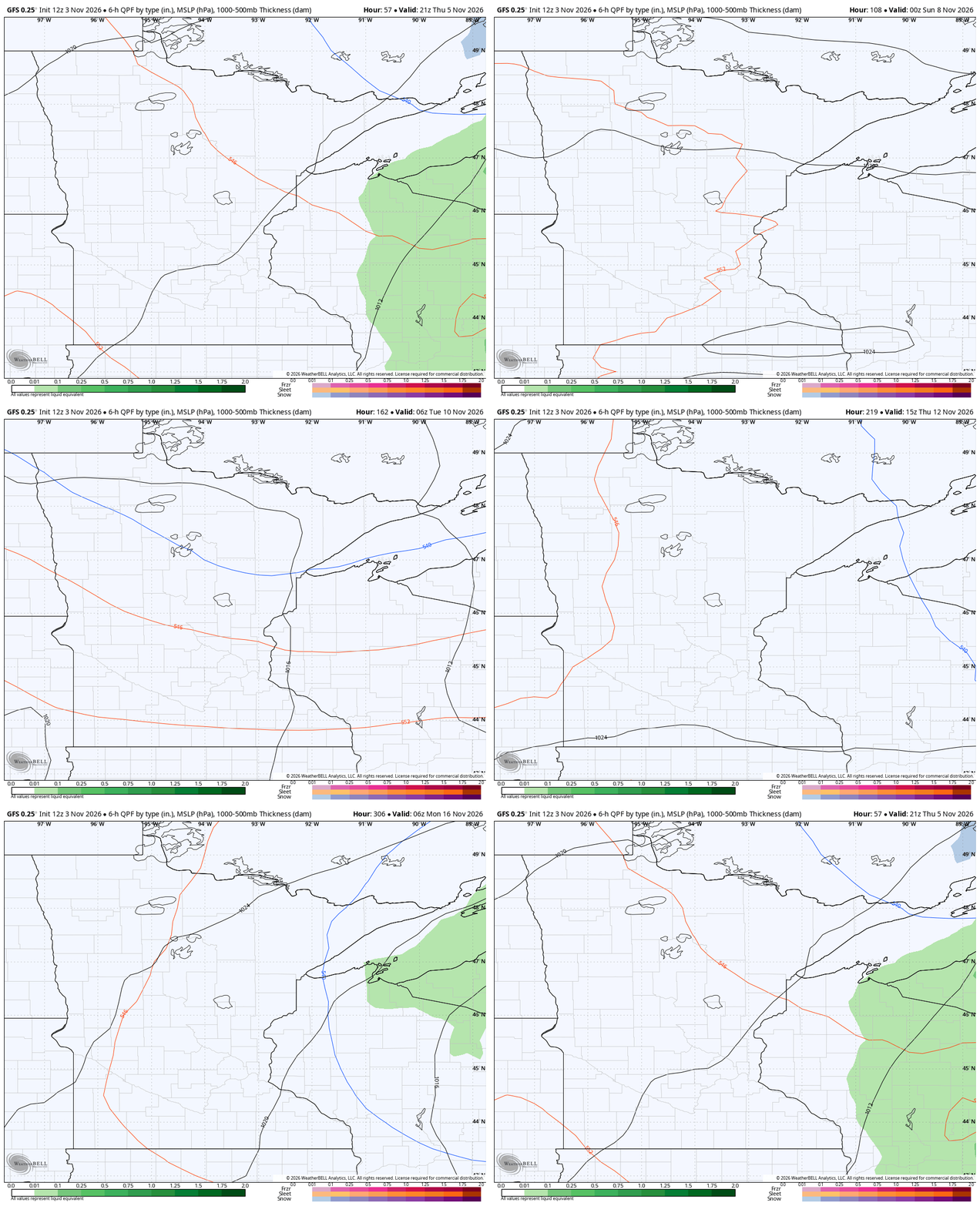
There could be a hint of snow on Saturday, but the weather maps are duking it out to see how much, if any, rain can materialize across the state that day. Right now, the dry weather is winning out big time. Following this, Sunday through at least next Thursday appears very tame. Not too warm, not terribly cold and totally dry.