Temperatures hit the 60s before a cooler turn
More seasonal highs by midweek with spotty shower chances

Go Deeper.
Create an account or log in to save stories.
Like this?
Thanks for liking this story! We have added it to a list of your favorite stories.


Warm temperatures once again pushed thermometer readings above 60 degrees Monday, with one more day of mild, above-normal temperatures expected Tuesday.
Enjoy the nice weather while it lasts, as a gradual cooldown will bring some chilly air back to the region by the end of the week. Precipitation chances look minimal for Veterans Day, with most areas expected to stay dry.
Late summerlike warmth in early November
What a warm day across Minnesota! After starting with a little bit of cloud cover, we saw plenty of sunshine, and temperatures climbed into the lower 60s Monday afternoon. Low 60s could be seen all the way to the Canadian border. That's quite a bit warmer than what we typically expect this time of year, when normal highs are generally in the upper 30s to mid-40s.
At times, there were some gusty winds as both a warm front and cold front moved through the region. Clear skies Monday night will allow temperatures to drop back into the 30s as cooler air settles in behind the cold front.
Turn Up Your Support
MPR News helps you turn down the noise and build shared understanding. Turn up your support for this public resource and keep trusted journalism accessible to all.

Gradual cooldown before temps drop Thursday and Friday
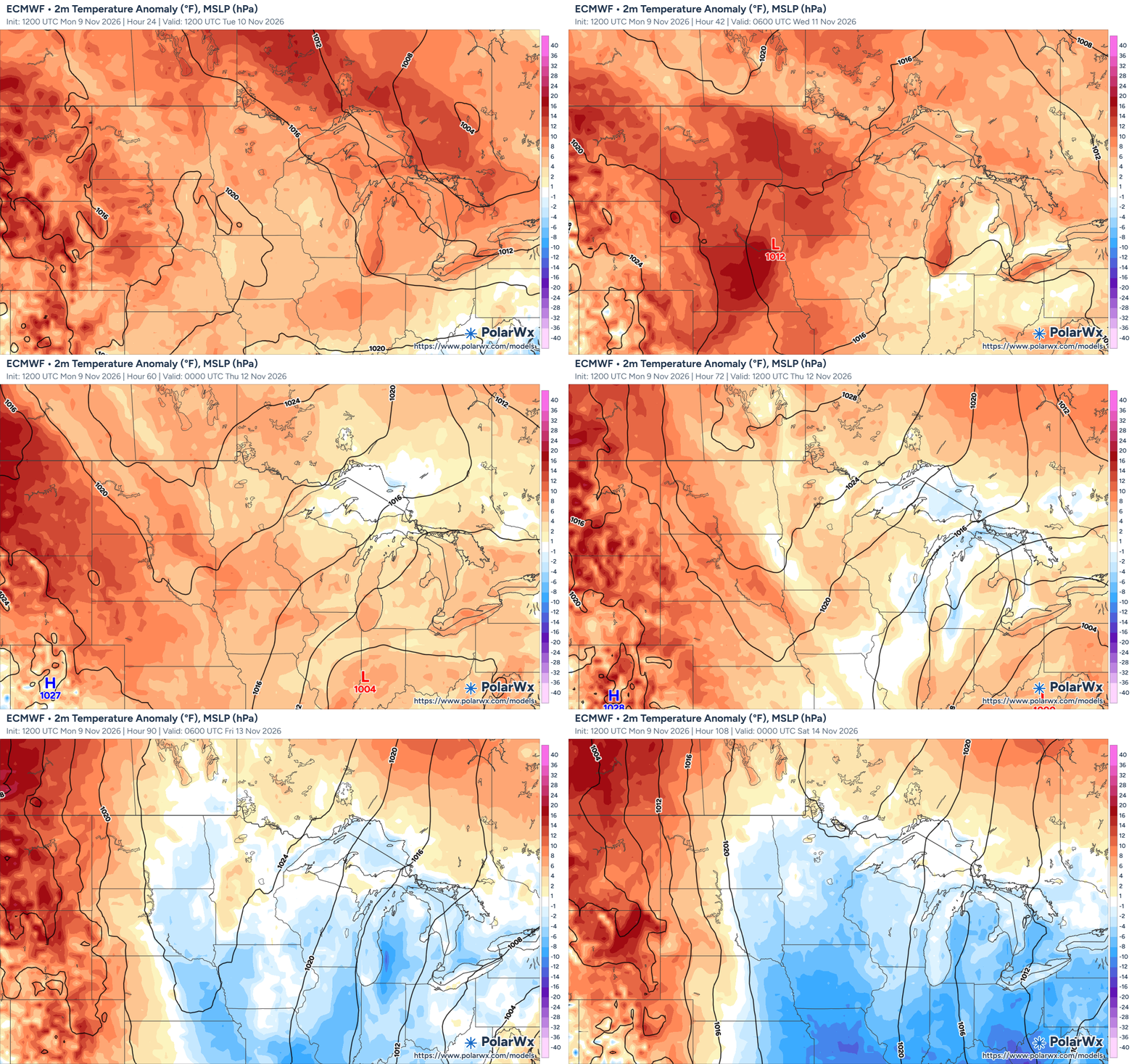
We'll start to notice a gradual cooling trend Tuesday, although temperatures will remain above normal for a couple more days. Highs will still reach the 40s and 50s on Tuesday before continuing to slide through midweek.
The bigger push of colder air arrives Thursday and Friday, bringing highs back into the 30s and 40s. High pressure will build into the region, allowing skies to clear, but it will also usher in a much colder air mass. Overnight lows could dip below freezing for several nights across the Twin Cities metro.
By Thursday and Friday, highs will struggle to reach the upper 30s to lower 40s, with overnight lows falling into the mid-20s to lower 30s. That's a noticeable change from our recent warmth and will put us below our typical mid-40s for daytime highs.
There is also a small chance for some light rain Tuesday night into Wednesday, mainly along and north of Interstate 94. A couple of weather disturbances will pass through the region, but moisture will be very limited.
The best chance for precipitation looks to be across northern Minnesota. For areas that do see rain, amounts should be very light, generally a few hundredths of an inch or less. Most locations may stay completely dry.