A beautiful fall day with warming on the way

Go Deeper.
Create an account or log in to save stories.
Like this?
Thanks for liking this story! We have added it to a list of your favorite stories.


Although it may feel like a chilly start to the weekend, temperatures are actually close to their seasonal averages across Minnesota, with lows this morning in the 20s across the state.
Daytime highs on Saturday should be close to normal for this time of year, with upper-30s to around 40 in the north (which will actually be a few degrees above normal for some spots, such as Hibbing and Roseau) to low-to-mid-40s across the rest of the state.
As the high pressure begins to move to the east, we’ll have more southerly flow—bringing with it warmer air—to Minnesota. As we make that transition, we can expect overnight lows tonight into Sunday a bit warmer across western Minnesota, but remaining just as cold as we were this morning across western Wisconsin.
Unseasonably warm by midweek
As that warmer pattern settles in overhead, we’ll see a gradual warming trend across our region each day as we move into the middle part of next week. It looks like temps will peak Wednesday with highs in the 50s across much of Minnesota—places like Hibbing and International Falls being the exception—which is 10 to 15 degrees above normal.
Turn Up Your Support
MPR News helps you turn down the noise and build shared understanding. Turn up your support for this public resource and keep trusted journalism accessible to all.

Things will start to cool down again beginning on Thursday as we return to more seasonable values in terms of our daytime highs.
Increasing winds early next week
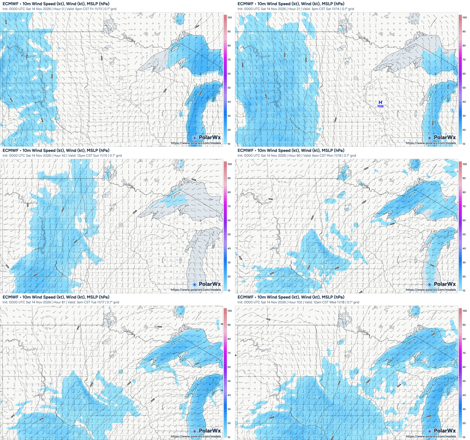
As we transition from high pressure overhead to a low-pressure system moving into our area, we’ll see a tightening pressure gradient early next week, which translates into increased wind speeds. Strongest winds are expected in western and southwestern Minnesota, with gusts potentially reaching 35 to 45 mph Tuesday in eastern South Dakota region and parts of western Minnesota.

Rain possible late next week
In terms of precipitation, we’re still expecting a system to develop just east of the Rockies early next week and possibly bring us some rain—most likely late Wednesday and into Thursday—though this appears to be a fairly weak system so don’t expect too much in terms of rain, if any.
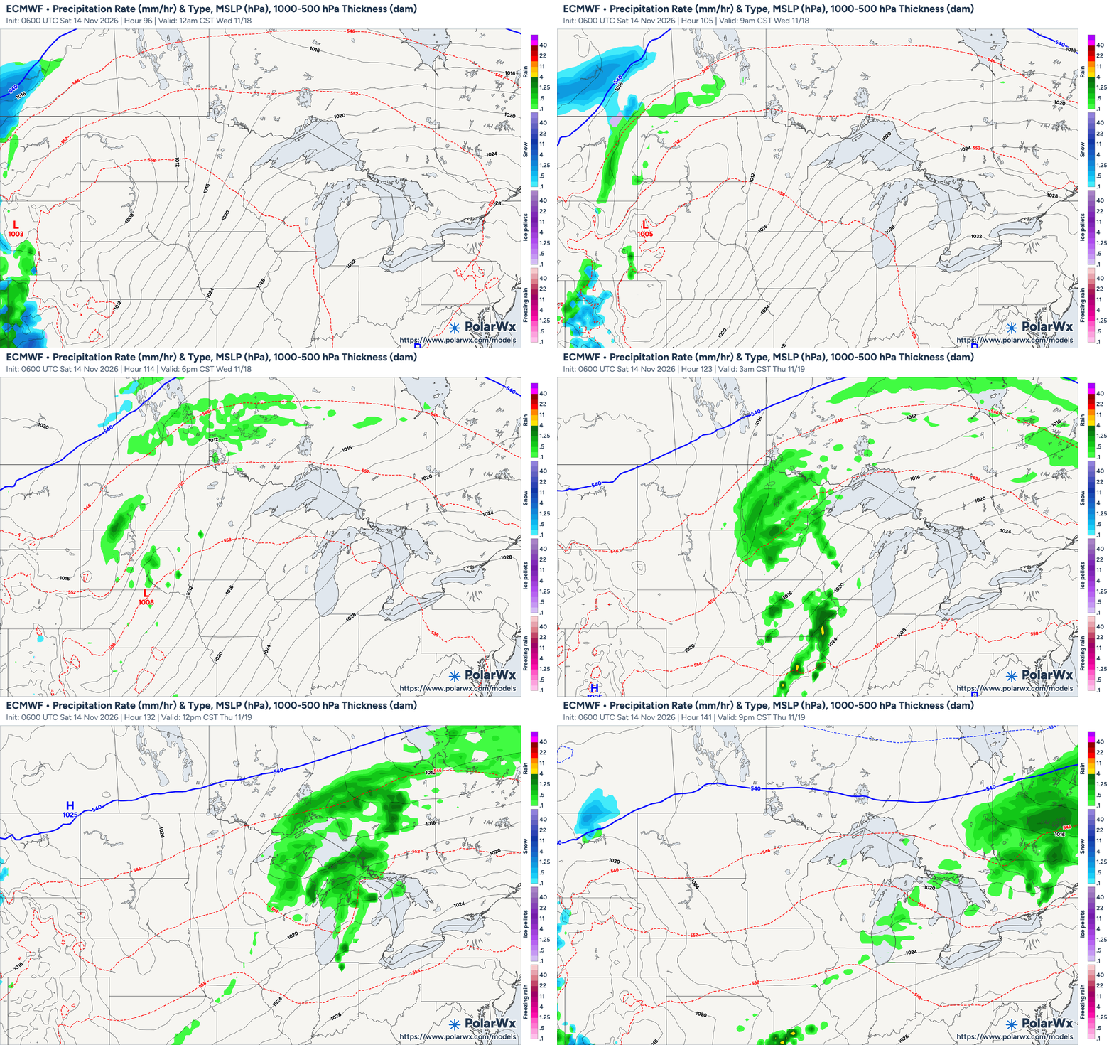
Looking further out, there is the potential for a stronger system to develop and move our way next weekend—mainly affecting southern Minnesota and the Twin Cities—but this, too, looks to be an all-rain system though it’s still a week out so we’ll have to keep an eye on it to see how things develop.