Big warmup underway with rain chances later in the week

Go Deeper.
Create an account or log in to save stories.
Like this?
Thanks for liking this story! We have added it to a list of your favorite stories.


It’s been another chilly morning across Minnesota, with temperatures mainly in the 20s across the state, which is right around average — if not a few degrees below average — for mid-November.
Some of the warmer spots Sunday morning are actually up in the Red River Valley, where places like Fosston and Mahnomen are checking in with temperatures of 36 degrees, which is about 15 degrees above normal in terms of overnight lows.

This is the last morning for a while that we’ll see widespread freezing conditions across Minnesota, as a transition in the overall weather pattern overhead will bring more southerly flow of air to our region over the next several days. This will result in daytime highs that will be increasingly above normal for mid-November. Here’s what we’re expecting across the state over the next several days:

A few spots in southern Minnesota could reach 60 degrees by Wednesday before temperatures begin moderating statewide during the second half of the week, though they will likely remain several degrees above average until next weekend.
Along with the warmer conditions, we’ll see increasing winds during the first half of the week, especially across western Minnesota, where gusts could reach 25 to 35 mph — and possibly as high as 45 mph for areas in the southwestern part of the state.

Precipitation chances later in the week
We’re still monitoring two back-to-back low-pressure systems in terms of the possibility of precipitation later in the week. The first system is forecast to hit us Wednesday into Thursday. Scattered rain showers are possible, with the highest chances in northern Minnesota, though widespread soaking rain is unlikely with this first system.
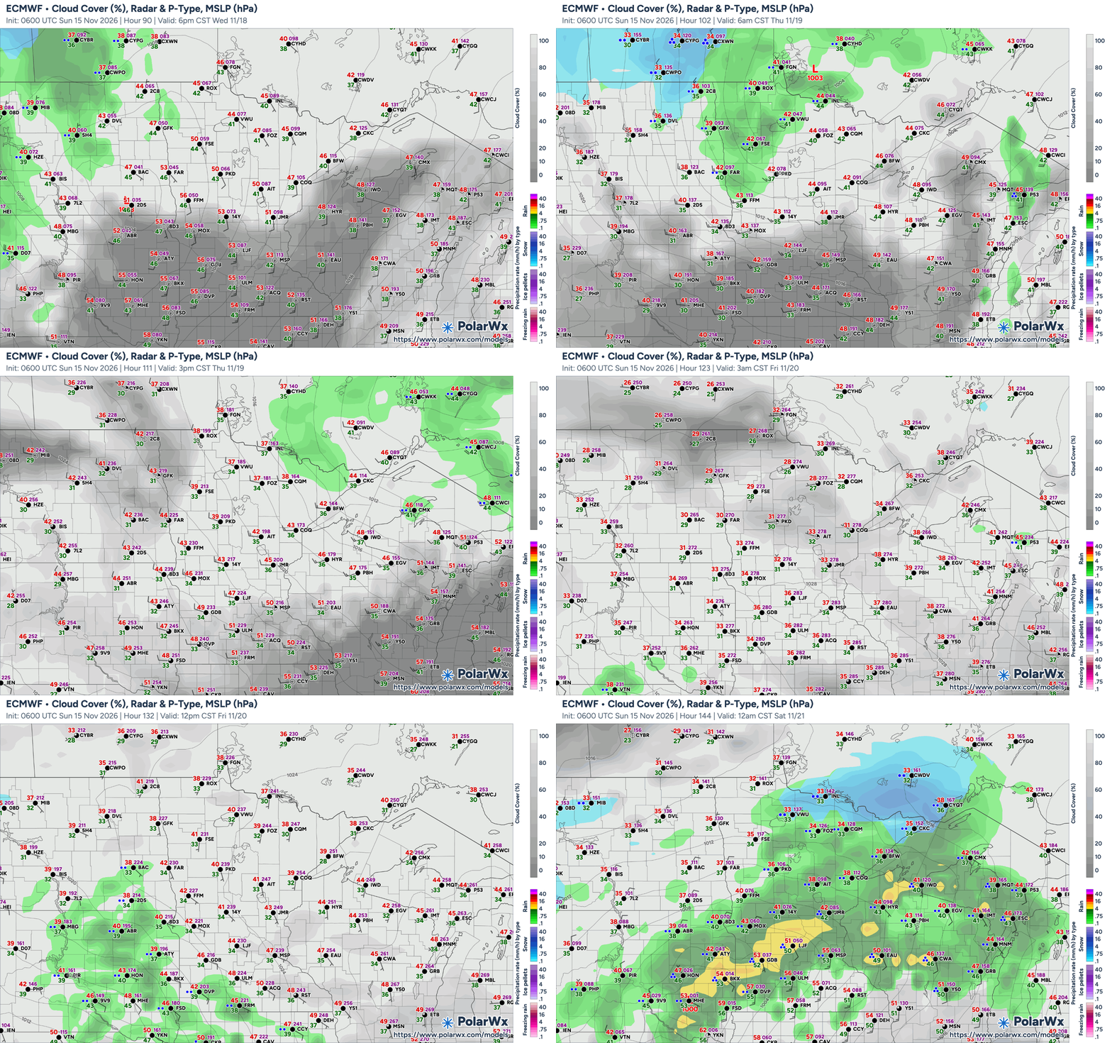
The more likely chances of precipitation will come with the second, potentially stronger, moisture-rich storm Friday night into Saturday. Rain is favored initially, although colder air wrapping around the departing system could introduce some snow, especially across northern and central Minnesota. Some areas could see in excess of half an inch of rain with this system.
Turn Up Your Support
MPR News helps you turn down the noise and build shared understanding. Turn up your support for this public resource and keep trusted journalism accessible to all.