Minnesota weather: Mild for now, wintry mix awaits
The weekend sees a huge drop in temperatures and possibly some snow
Go Deeper.
Create an account or log in to save stories.
Like this?
Thanks for liking this story! We have added it to a list of your favorite stories.


Sunny and relatively warm weather is here all the way through Thursday. Starting Friday, we’ll see a hint of rain and more clouds, but this weekend is the true test of whether much of Minnesota will see its first snow of the Super El Niño season.
Soaking up the sun
Highs in the mid-50s may not sound warm, but my goodness, we are so far above average once we’re in that territory. At least in the middle of November, our average high right now in the Twin Cities is actually only 42 degrees. Monday night, frost will be less common across Minnesota with a few more fair-weather clouds boosting temperatures just a bit. Lows south and west will be in the 40s while lows north and east will be in the 30s.

Tuesday is shaping up to be another pleasant day, from stem to stern. We will have above-normal temperatures all day long and all across the state of Minnesota. One weather map had an isolated sprinkle near Brainerd and Bemidji, but that seems rather unlikely.

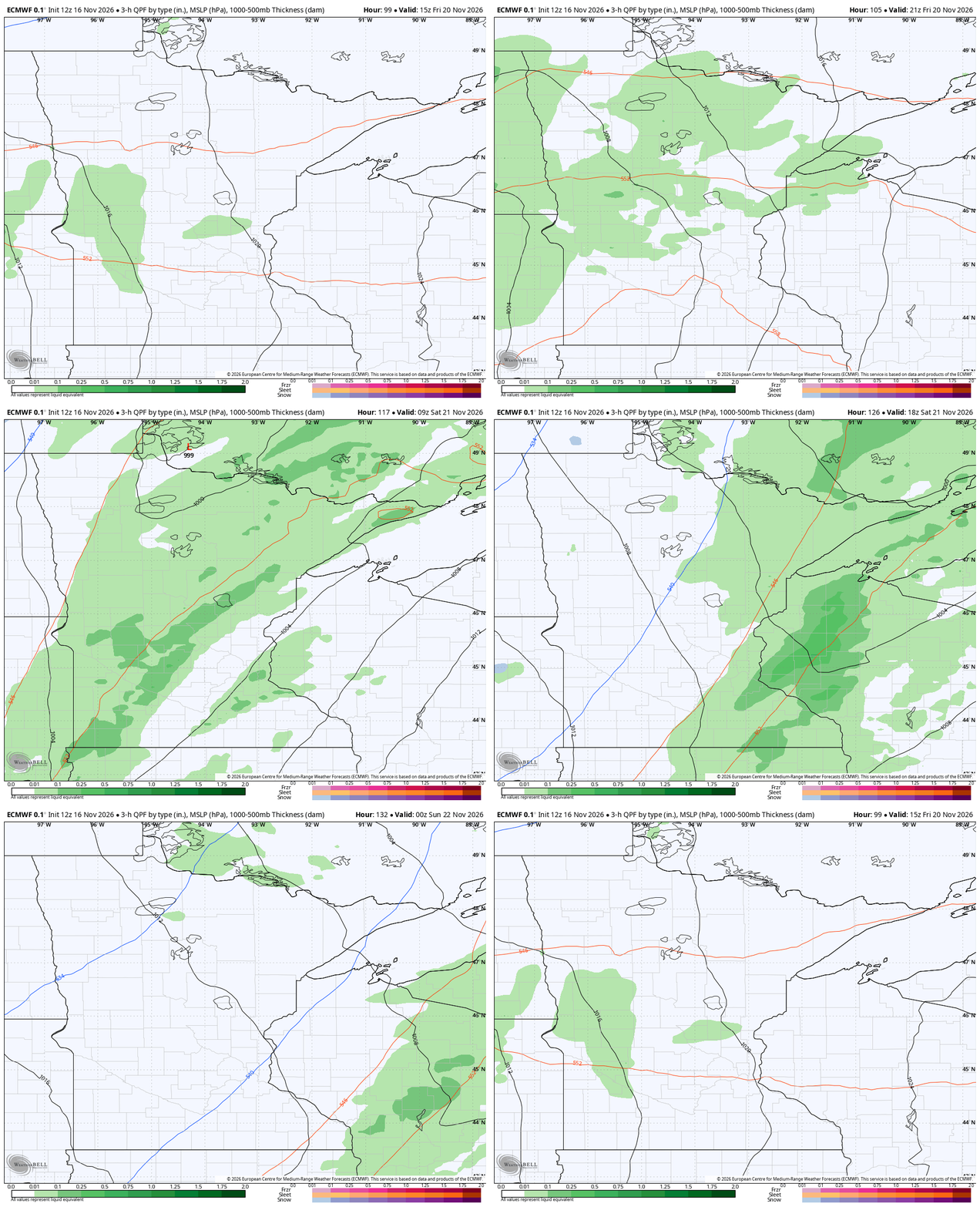
All the way through Thursday night, we really do not expect much in the way of active weather. This mild stretch (coupled with dry leaves and a few frosts) may create the optimal yardwork conditions. Starting on Friday morning in the northern part of Minnesota, then spreading south as the day progresses, rain will start to develop as a low pressure center deepens over our state.
Turn Up Your Support
MPR News helps you turn down the noise and build shared understanding. Turn up your support for this public resource and keep trusted journalism accessible to all.

This rain will strengthen through Friday evening and last well into Saturday. At its center, the low will start to pull down cold winds from Canada. Eventually, that’s likely to turn the rain on the northern flank into some snow. Some weather maps are showing pretty hefty snow throughout central Minnesota Saturday into Sunday, but certainly not every map. Right now, we’ll be conservative with the forecast and not call for a big blob of snow. There’s always time to increase the forecast if the trend holds. Meteorologists have long waited for more data to come out before really fine-tuning a snow forecast in the closest 36-48 hours before an event. At the very least, I’d prepare for frigid rain throughout much of the state this weekend.
Holiday travel: First look
We are soon to enter into one of the busiest travel weeks of the year for drivers. The American Automobile Association predicts about 6.5 million Minnesotans will hit the roads by car around Thanksgiving. AAA says that one of the busiest spots in America will be the Twin Cities-to-Eau Claire stretch of Interstate 94. Point is: We need the weather to cooperate since things will be busy regardless. Leading into Thanksgiving it will be much colder. Highs will go from the 50s to the 30s in many cases.

There could also be a rain-into-snow maker on the day before Thanksgiving, though the computers are almost evenly split on that chance. Thanksgiving itself looks to be more idyllic with weather, perhaps even a little above normal in the afternoon.

After Thanksgiving
One of the telltale signs of a powerful El Niño in Minnesota is a big splash of early-season cold. We can get that as early as October. While folks have been occasionally chilly, there haven’t been any big surges of prolonged cold air. That continues to be the trend through at least the first parts of December. The Climate Prediction Center has Minnesota and most of the surrounding region in a higher-than-normal sector for warm temperatures. That’s true not only for the moment, but into the holiday week and then well after. This extends all the way through the first half of December.
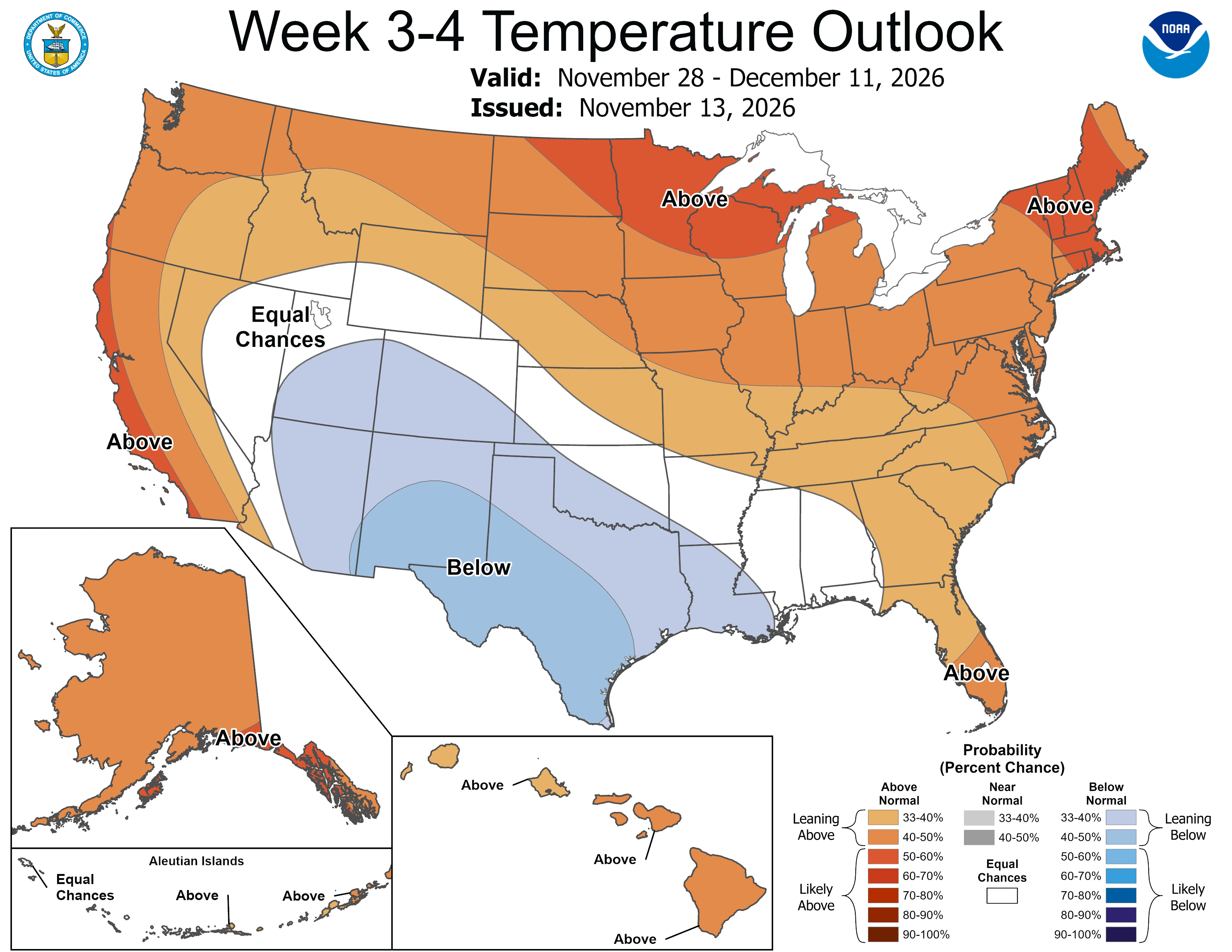
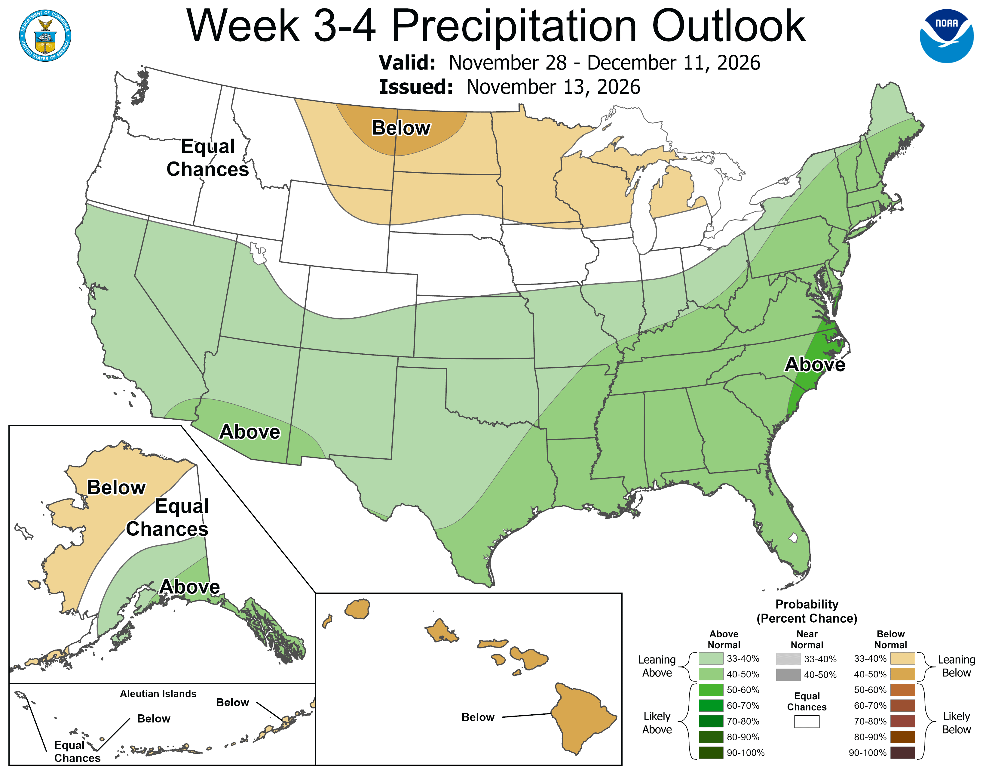
The temperature theme is warmer, warmer and warmer. For rain or other precipitation like snow or graupel, it’s kind of a mixed bag. We have a very slight drier-than-normal track for now, but that could easily shift given a single storm track.