Warm and windy Monday, rain chances later in the week
Rain chances return late week
Go Deeper.
Create an account or log in to save stories.
Like this?
Thanks for liking this story! We have added it to a list of your favorite stories.


Above-normal temperatures are expected through the middle of the week, with highs generally in the 50s, possibly some 60s on Wednesday.
Rain chances return later in the week.
Warm and windy start to the week
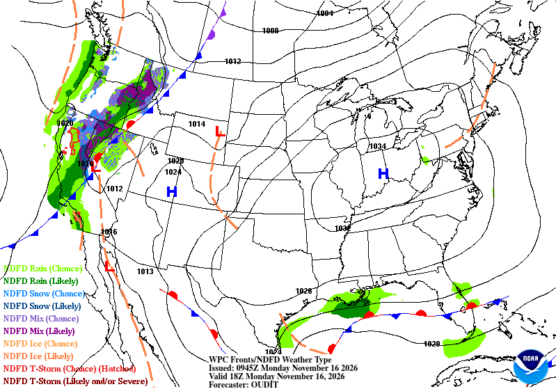
High pressure and upper-level ridging will help keep conditions mostly dry through Wednesday across the region.
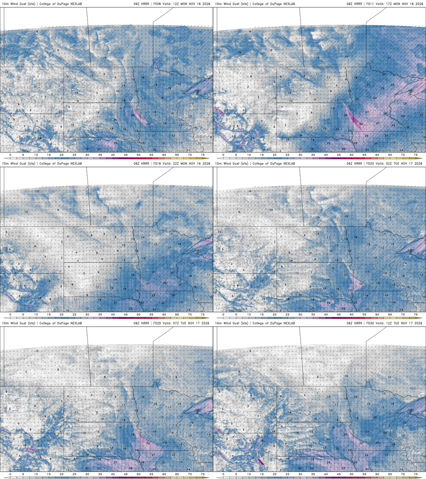
Breezy south winds of 12 to 25 mph will usher in warmer air, pushing temperatures well above normal for this time of year.
Turn Up Your Support
MPR News helps you turn down the noise and build shared understanding. Turn up your support for this public resource and keep trusted journalism accessible to all.
Monday afternoon highs will reach the 50s across southern areas with 40s to the north. Overnight lows will remain above freezing through the next several days.

The week will start off warm, breezy and dry before a change in the weather pattern brings cooler temperatures and rain chances later in the week.
Late-week rain chances; watching Saturday’s system
The jet stream becomes more active later this week, bringing a couple of storm systems our way. The first arrives late Wednesday into Thursday, but limited moisture should keep things mostly dry aside from a few sprinkles. A wind shift to the northwest is expected behind it.
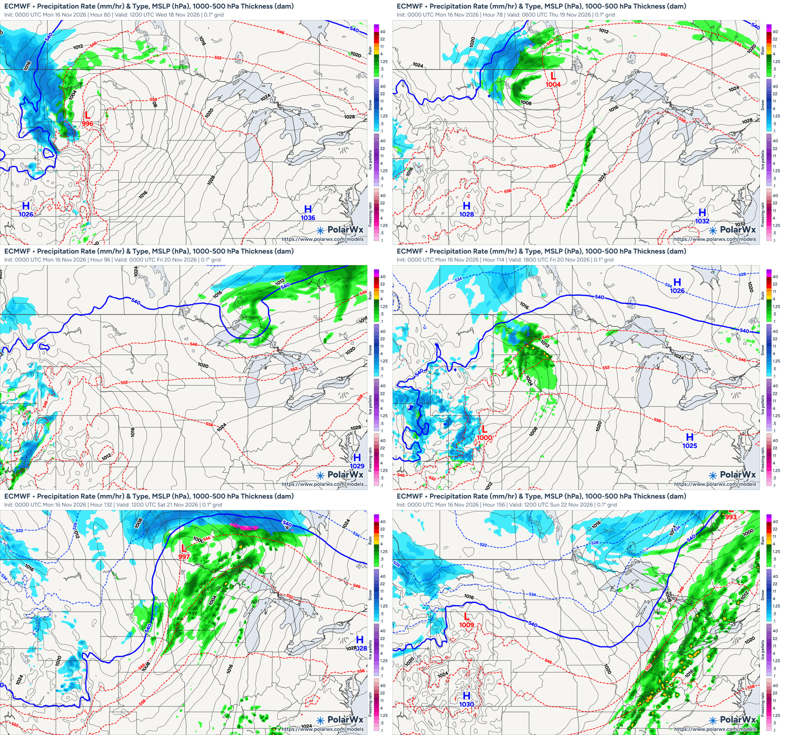
A stronger system moves in Saturday, bringing a better chance for rain as the low tracks north of the area.
Much colder air follows late Saturday into Sunday, dropping highs into the 30s. A few snowflakes are possible on the backside of the system, but it's too early to discuss. Colder-than-normal temperatures look to stick around through Thanksgiving.
Winter Hazard Awareness Week
This week is Winter Hazard Awareness Week in Minnesota and Wisconsin, making it a great time to start preparing for the months ahead.
While we're enjoying a stretch of mild November weather, winter can arrive quickly, and it's important to be ready for everything Minnesota winters can bring. Now is the time to review your winter safety plans.
Make sure your vehicle is stocked with a winter emergency kit, have your home heating systems checked, and take time to learn how to stay safe during winter storms.
Here's a look at this week's topics:
Monday — Winter weather overview: Understand winter storm watches and warnings, extreme cold and changing weather conditions.
Tuesday — Outdoor winter safety: Learn about frostbite, hypothermia, ice safety and staying safe during winter recreation.
Wednesday — Winter fire safety: Review safe heating practices, space heater safety and smoke alarm maintenance.
Thursday — Indoor winter safety: Be aware of carbon monoxide, radon and other potential indoor hazards.
Friday — Winter driving: Prepare your vehicle, check road conditions, slow down and give snowplows plenty of room.