Minnesota weather: A walk on the mild side
Temperatures are well above average with no immediate sign of widespread frosts or freezes

Go Deeper.
Create an account or log in to save stories.
Like this?
Thanks for liking this story! We have added it to a list of your favorite stories.


Our lows are above our normal highs right now — let that sink in as we continue a streak of very warm weather. That will come crashing down on Saturday afternoon as a powerful front brings really cold rain and frigid winds. The weather turns quieter again just in time for Thanksgiving.
Holding warm and steady
For almost all Minnesotans, we will remain dry and exceptionally warm for the season through dusk on Friday. There is a tiny wave of rain in the middle of the night Wednesday into Thursday but that will impact very few folks.
The frost that affected most counties over the weekend? It’s gone for now, replaced by lots of overnight cloud cover that stabilizes our low temperatures. We also have a fairly stout wind coming from the south, which helps to boost our daytime and nighttime temperatures all the way past the Canadian border. The clouds might make you believe rain is imminent, but there’s no rain in the local forecast for now.

For reference, our average high is 42 degrees and our average lows are in the upper 20s now. Most lows will be above average-high territory, and the actual high temperatures are 15-20 degrees above normal from now until Friday. Friday may even hit 60 degrees around the Twin Cities, upper Minnesota River Valley and the Interstate 90 corridor. I looked into the 30-year average for the typical last 60-degree day in Minneapolis and St. Paul. For simplified record keeping, that average goes from 1990-2020, not actually the last 30 years (it gets complicated!).
Turn Up Your Support
MPR News helps you turn down the noise and build shared understanding. Turn up your support for this public resource and keep trusted journalism accessible to all.
Historically, the Twin Cities are done with 60-degree highs by Nov. 6. So if we do hit 60 on Friday, that’d be nearly two weeks later than normal!
Gales of November
In the above section, we mentioned a tiny chance of rain Wednesday night into Thursday. That small low coming out of the Rockies (and southern California prior to that) will not materialize more than a few tenths of an inch of rain for northern Minnesota. That storm will bring big winds and waves to Lake Superior, however.

A Gale Watch is posted for much of the big lake, and the National Weather Service office up in Duluth has this as its details for the November gales:
* WHAT...Southwest winds 20 to 30 kt with gusts up to 40 kt and waves 4 to 7 ft possible.
* WHERE...Portions of Lake Superior. * WHEN...From late Wednesday night through Thursday afternoon.
* IMPACTS...Strong winds can cause hazardous waves which could capsize or damage vessels and reduce visibility.

Friday to Saturday storm
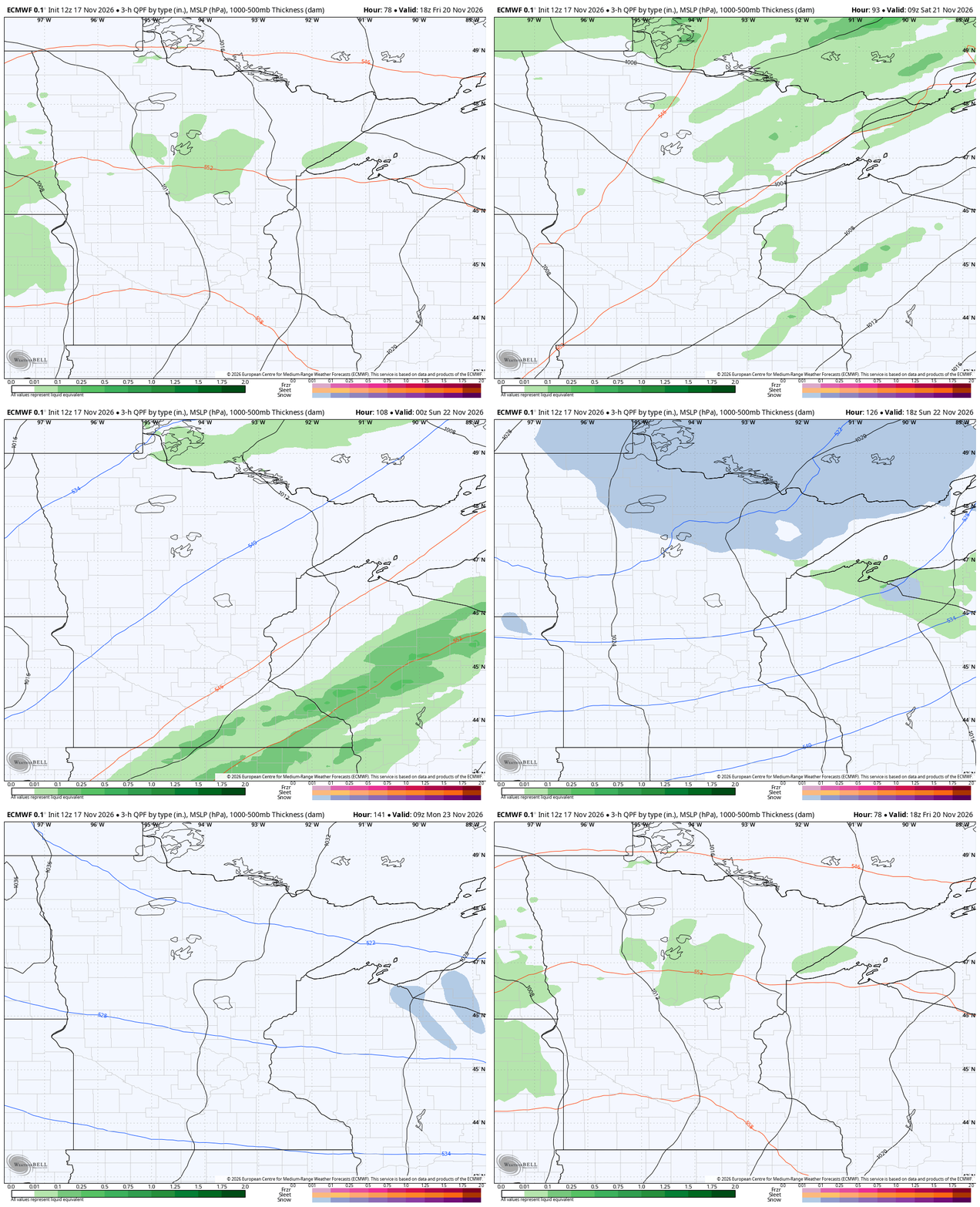
Rain returns to northern Minnesota starting later Friday morning. It actually takes quite a while for much to materialize farther south, possibly as late as Friday night. The center of the storm is actually in a good position for warmth lovers, but in a bad spot if you’re hoping for snow. By forming near the Mississippi River headwaters, that will not allow cold air to arrive in time to turn this into snow for most of Minnesota.
That said, there is likely to be some snow in spots along the Canadian border (obviously not just there, snow will probably fly later Saturday within 50 or so miles of the border at the current track).
Colder into the holidays
Bundle up Sunday and into early next week. We will start to rebound, back above average, before you know it. There is an Alberta Clipper trying to form in the wake of the big front. That could arrive with a fast wave of lighter snow late Tuesday into early next Wednesday. A ton could change before then, and it would need several other pieces to lock into place first, so it’s not worth diving too deeply now. By Wednesday of next week, continuing through Thanksgiving Day, the weather is quieter for regional travelers.