A couple more very mild days before big changes move in
Rain and snow possible up north over the weekend
Go Deeper.
Create an account or log in to save stories.
Like this?
Thanks for liking this story! We have added it to a list of your favorite stories.


We’ll see lots of sun Thursday in southern Minnesota. Rain showers develop late Friday into the weekend with some snow north. Colder, near-normal temperatures move in next week.
A couple more very mild days before big changes arrive
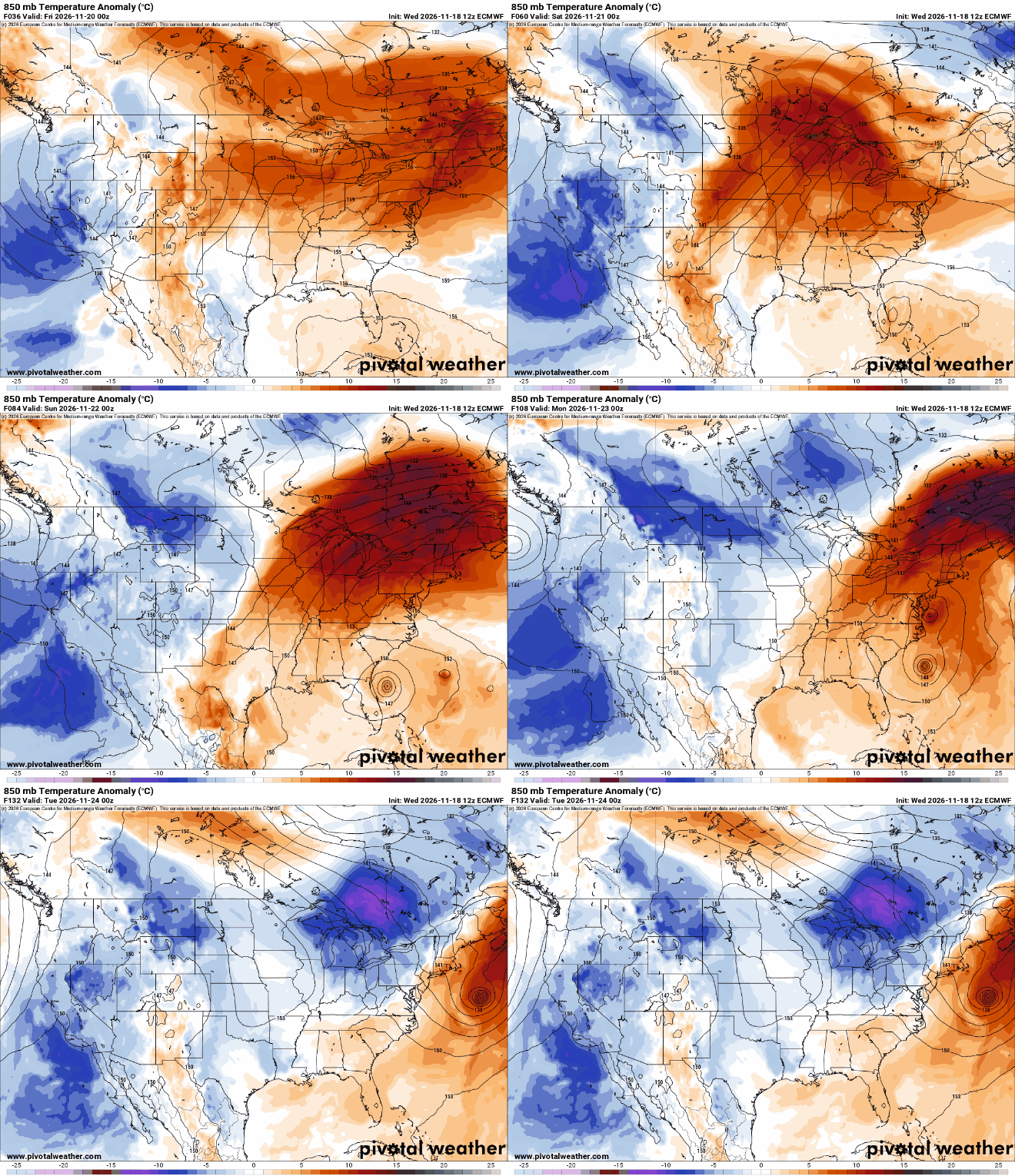
Look for lots of sunshine Thursday in southern Minnesota. Northern Minnesota will see considerably more clouds and cooler temps. There could also be a few light rain showers north. Highs will range from the mid-50s south to 40s north.

We’ll be looking at potential record high temperatures on Friday. The Twin Cities, Hibbing and International Falls could all break daily records. Afternoon highs will range from the mid-60s south to 50s north with some increase in cloud cover.

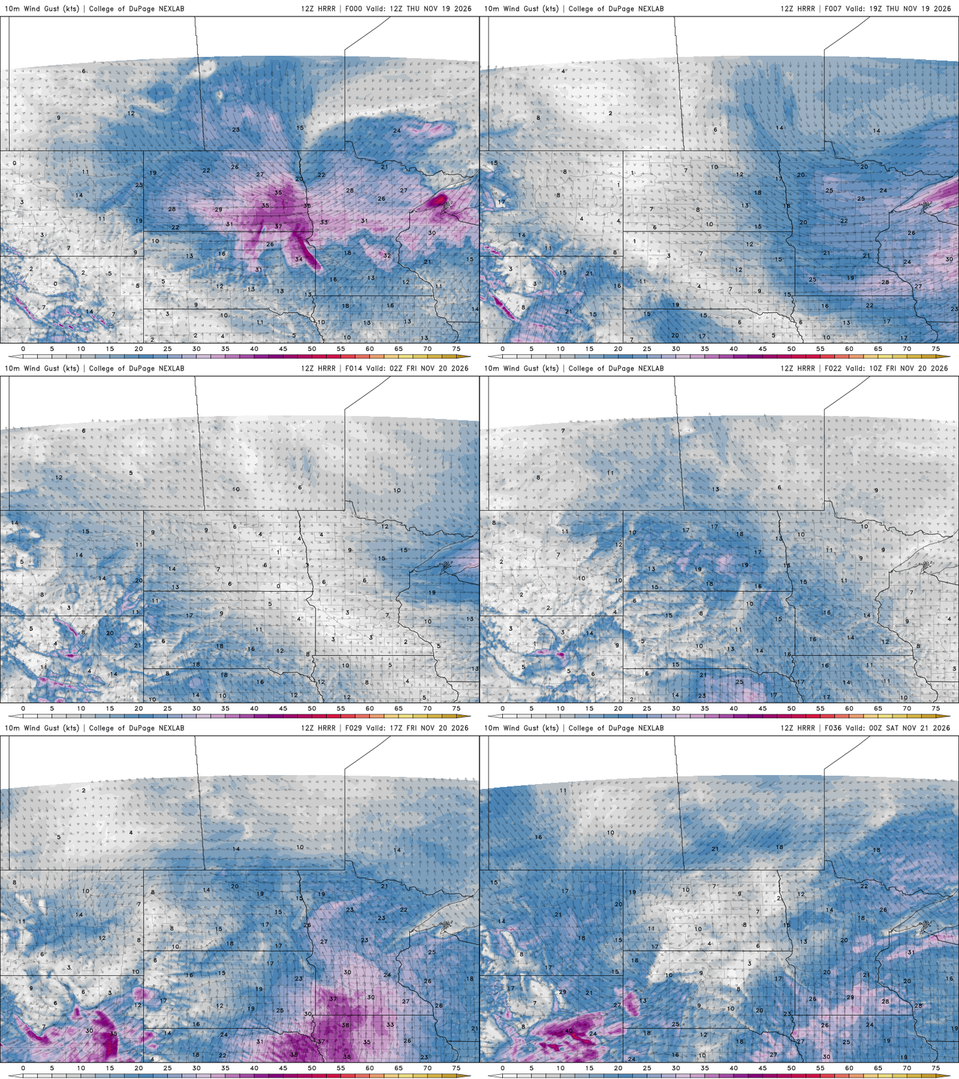
Winds will be blowing both Thursday and Friday. On Thursday, the winds will be from the west-southwest. On Friday, they’ll be roaring out of the south. Wind gusts could be as high as 40 to 45 mph in far southern Minnesota Friday.
Turn Up Your Support
MPR News helps you turn down the noise and build shared understanding. Turn up your support for this public resource and keep trusted journalism accessible to all.
We’ll also see increased chances for some precipitation late Friday in northern Minnesota and statewide Saturday into Sunday as the next system moves in. That system will pull in much colder air too, which means northern Minnesota could get a little snowfall Sunday.
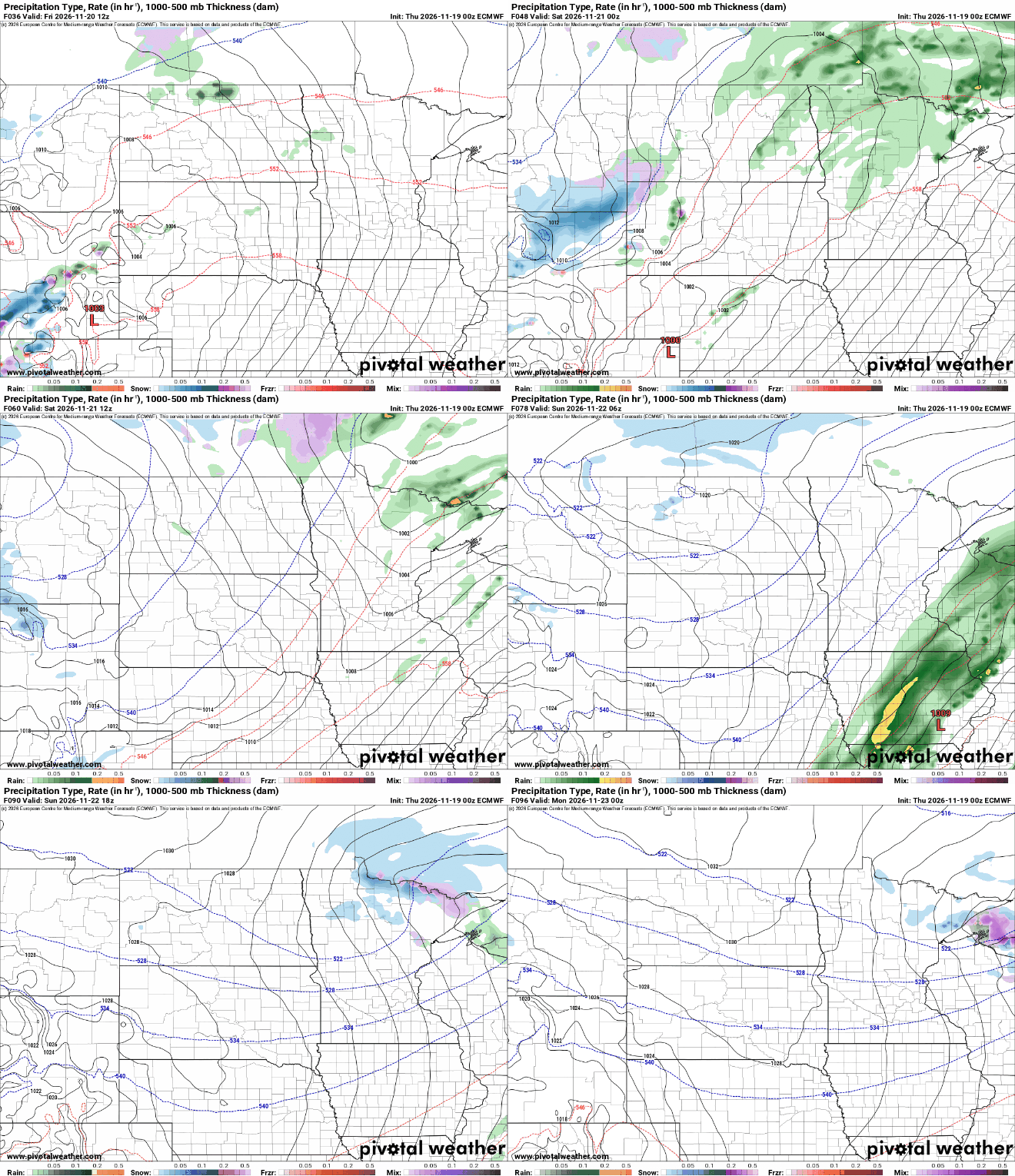
A coating of slushy accumulation is possible for places like the Arrowhead and along the international border and North Shore. Most snowfall will likely be under 1 inch.

Seasonably cold weather arrives
Here comes some chilly air, finally. That Friday-Saturday storm system will finally pull down more seasonable air. While it will be considerably colder next week, it will be near-normal.
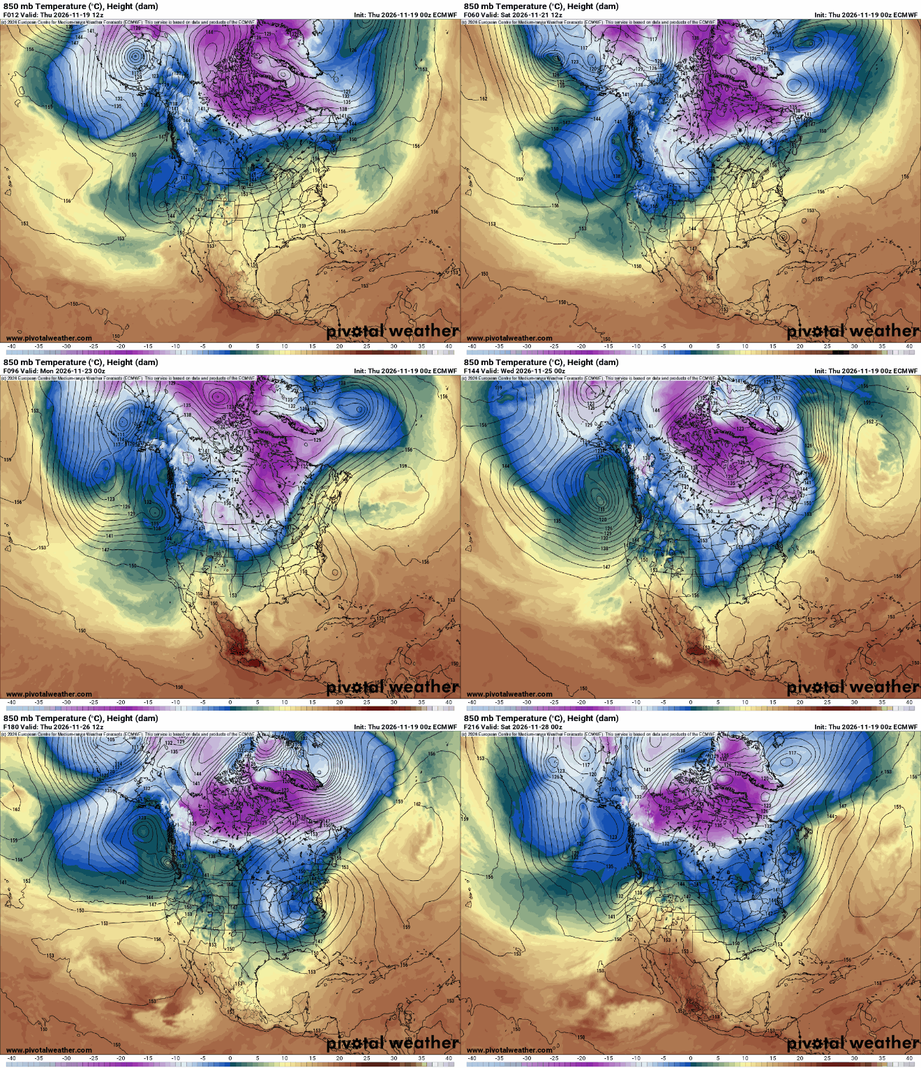
Temperatures dive late Saturday into Sunday. By early next week, afternoon highs will be mostly in the 30s with overnights in the 20s and 10s. Normal highs next week range from the upper 20s north to upper 30s south.

There’s also the chance we see some snowflakes in southern Minnesota perhaps midweek next week too but that system looks murky at this point and doesn’t appear to be a big hassle for folks on the road the day before Thanksgiving.