Rain continues with a sharp drop in temperatures for Sunday
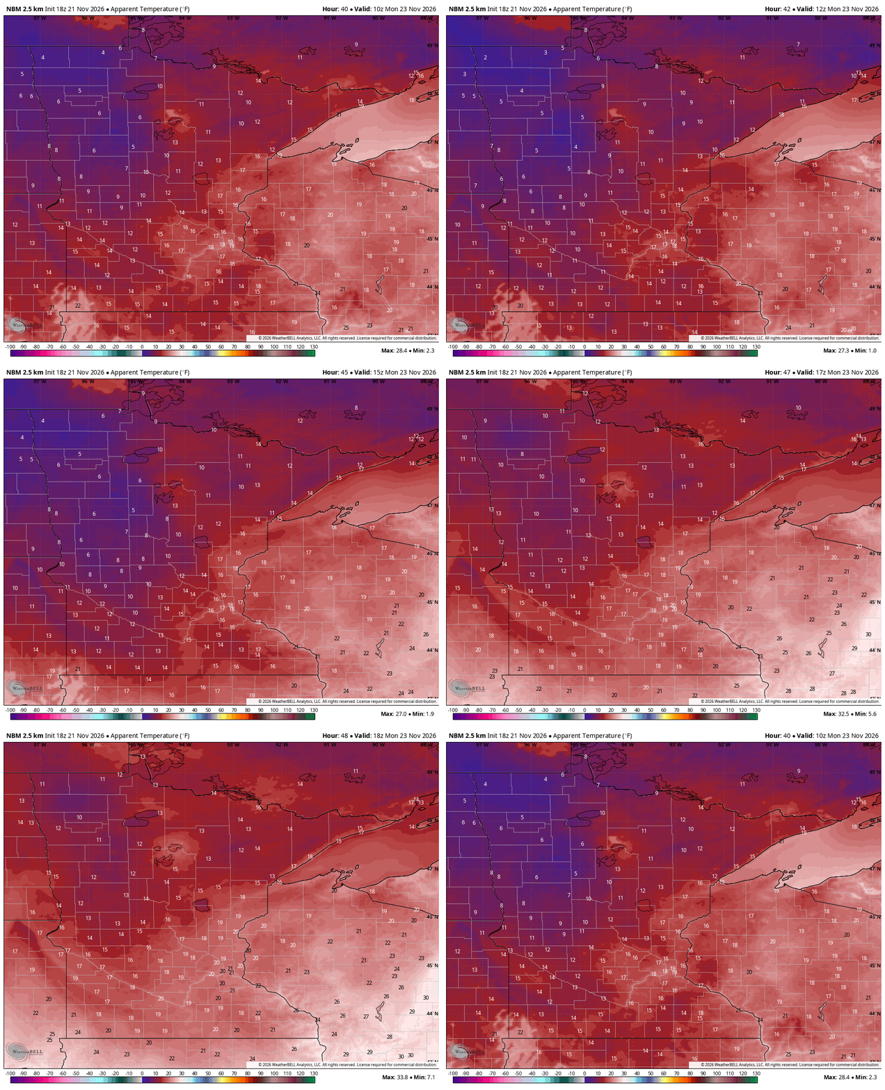
Single digit and teens for wind chills Monday morning

Go Deeper.
Create an account or log in to save stories.
Like this?
Thanks for liking this story! We have added it to a list of your favorite stories.


A second round of rain moves through southeastern Minnesota and western Wisconsin Saturday night as our cold front continues to push across the region, bringing noticeably cooler air behind it.
Rain showers and much cooler temperatures
Our dramatic cold front will continue bringing rain showers to far eastern and southeastern Minnesota Saturday night.
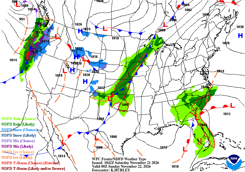
Rainfall totals could range from a half inch to an inch in a few lucky counties. Meanwhile, parts of northern Minnesota, especially areas north of Highway 2, could see some light snow. Snowfall amounts will remain light, generally ranging from less than a half inch to around an inch, wrapping up by Sunday morning.

On Sunday, we'll begin to see a transition toward quieter weather as high pressure builds south from Canada. That high pressure system will settle overhead by Monday night, bringing mostly clear skies, lighter winds, and our coldest air of the season so far.
Monday is shaping up to be a chilly one, with widespread high temperatures at or below freezing and morning wind chill values in the single digits and teens!
Looking ahead to Thanksgiving week, temperatures will gradually moderate, but a couple of weak weather systems could bring some opportunities for light precipitation Wednesday and Thanksgiving Day.
There is still some uncertainty regarding precipitation type and placement, with a few forecast models suggesting the possibility of some snow, especially across western Minnesota Wednesday and parts of Wisconsin on Thanksgiving.
Turn Up Your Support
MPR News helps you turn down the noise and build shared understanding. Turn up your support for this public resource and keep trusted journalism accessible to all.