Severe thunderstorms and tornadoes in northern Minnesota

Severe thunderstorm watch until midnight
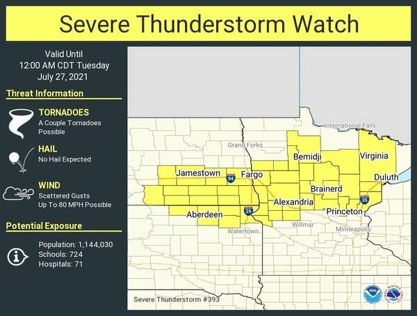
Severe thunderstorm watch
NOAA/Twin Cities National Weather Service

NOAA’s Storm Prediction Center has issued a severe thunderstorms watch for most of northern Minnesota until midnight.

Severe storms will track across parts of northern and central Minnesota Monday night. The best chance for storms in the Twin Cities and southern Minnesota favors the hours between midnight and about 3 a.m.

You can track up-to-the-minute severe weather warnings and reports on the MPR News severe weather live blog.

URGENT - IMMEDIATE BROADCAST REQUESTED

Severe Thunderstorm Watch Number 393 NWS Storm Prediction Center Norman OK

520 PM CDT Mon Jul 26 2021

The NWS Storm Prediction Center has issued a

* Severe Thunderstorm Watch for portions of Northern to central Minnesota Southeast North Dakota Northeast South Dakota

* Effective this Monday afternoon from 520 PM until Midnight CDT.

* Primary threats include... Scattered large hail and isolated very large hail events to 4 inches in diameter likely Scattered damaging winds and isolated significant gusts to 80 mph possible A tornado or two possible

SUMMARY...Intense supercell over northwest Minnesota may become a long-track, cyclic giant hail producing storm across north-central Minnesota. Additional storms are expected along a front in south-central to southeast North Dakota, with further development farther east towards central Minnesota through the evening.

Create a More Connected Minnesota

MPR News is your trusted resource for the news you need. With your support, MPR News brings accessible, courageous journalism and authentic conversation to everyone - free of paywalls and barriers. Your gift makes a difference.