
December snow
Go Deeper.
Create an account or log in to save stories.
Like this?
Thanks for liking this story! We have added it to a list of your favorite stories.


[image]
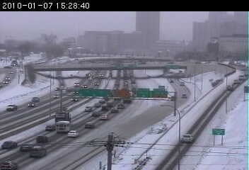
Slick roadways this afternoon on MNDOT traffic cams at Highway 212 and 101 in the southwest metro.
It's December and it snows in Minnesota. No big headlines here, but this may end up being our most significant snowfall of the season so far.
A potent little storm is bringing widespread snow to much of the Dakotas, Minnesota and Wisconsin. It looks like the heaviest snow band will eventually set up in southern Minnesota, northeast Iowa, and yet again in central and southern Wisconsin. 6 to 10 inches could pile up in La Crosse and Rochester before the storm pulls out early Tuesday.
Turn Up Your Support
MPR News helps you turn down the noise and build shared understanding. Turn up your support for this public resource and keep trusted journalism accessible to all.
We may see a wide range with this system in snow totals for the metro. We should see a range of between1 to 3 inches north to 3 to 6 inches south. We will have to see exactly where the heavy radar enhanced snow bands set up after dark tonight to pinpoint the heaviest totals.
Bottom line is you will have to shovel and plow in most of the metro, and roads will be slick tonight.
I love forecasting snow. These systems are about as challenging as it gets for weather forecasters anywhere in the world.
Here are some links to stay ahead of the storm. Let it snow!
PH

