
Now that’s a warm front!
Go Deeper.
Create an account or log in to save stories.
Like this?
Thanks for liking this story! We have added it to a list of your favorite stories.


[image]
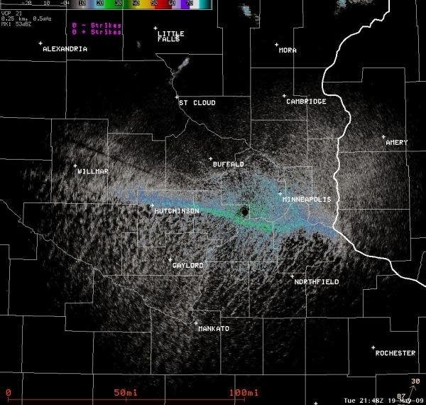
Twin Cities NWS Doppler radar detects the warm front Tuesday.
Weather technology always amazes me.
Everyone knows we can see storms or even rotation on doppler radars these days. But did you know Doppler can see birds, insects or even warm fronts?
Turn Up Your Support
MPR News helps you turn down the noise and build shared understanding. Turn up your support for this public resource and keep trusted journalism accessible to all.
The image above front Tuesday clearly shows the record warm front that surged into the Twin Cities. Radar can see discontinuities in the atmosphere, especially when they are collecting "scatterers" such as dust or bugs. Yesterday's warm front is that east to west oriented line in the southern Twin Cities.
The warm surge brought the warmest temperatures ever recorded so early in the season for the Twin Cities and much of Minnesota.
It's nice to know our "tax dollars at work" can see other things in addition to storms.
PH

