
Evening Forecast: Scattered showers
Go Deeper.
Create an account or log in to save stories.
Like this?
Thanks for liking this story! We have added it to a list of your favorite stories.


[image]
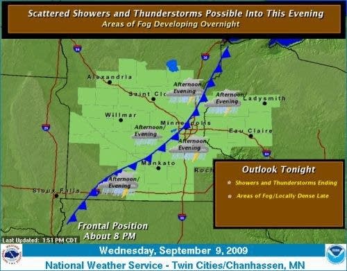
A fading cool front is washing out over southern Minnesota this evening. The front still has enough oomph to serve as the focus for scattered showers and a few thunderstorms through this evening. Local downpours will occur under storms with a humid air mass this evening.
Thursday into Friday still looks dry at this point. Then a quirky cut-off low will approach the area Friday night into Saturday morning. It will be a close call for showers Friday night into Saturday morning, before the system moves backwards into Montana by Sunday. The latest model runs today bring rain right up to the western edge of the metro Friday night, and then pull it back into the Dakotas Saturday. That would leave us with a sunnier drier weekend with temperatures close to 80 by Sunday afternoon.
Stay tuned to this quirky system and the weekend forecast!
PH
Turn Up Your Support
MPR News helps you turn down the noise and build shared understanding. Turn up your support for this public resource and keep trusted journalism accessible to all.

