
Nice Virga photo
Go Deeper.
Create an account or log in to save stories.
Like this?
Thanks for liking this story! We have added it to a list of your favorite stories.


[image]
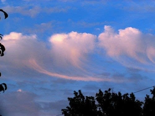
Virga streaks fall from cumulus clouds Sunday. (Photo by Ken Paulman)
Here's something you don't see everyday.
Check out this photo by MPR web editor guru Ken Paulman. He took this from his back deck Sunday around 5pm in West St. Paul looking northeast.
Turn Up Your Support
MPR News helps you turn down the noise and build shared understanding. Turn up your support for this public resource and keep trusted journalism accessible to all.
The wispy streaks falling from the cumulus clouds are called Virga. Virga is rainfall that leaves the cloud base but evaporates before it reaches the ground. The clouds were deep enough to produce a few rain shafts, but too shallow to get much of that rain to the surface. There is also a layer of drier air underneath the cloud base that is causing the rain droplets to evaporate.
Virga is quite common in the desert southwest. Pilots know to steer clear of areas like this. Evaporational cooling in the air column underneath these areas can cause severe downdrafts. Dry microbursts can occur near these types of cloud formations.
It's good to know that what's a potential danger to pilots can be so picturesque on the ground.
PH

