
Warmest two weeks of the year
Go Deeper.
Create an account or log in to save stories.
Like this?
Thanks for liking this story! We have added it to a list of your favorite stories.


This is what many of us we wait for all year in Minnesota. Mid-July. Warm days, stinging sun, bathwater lakes, tropical nights and balmy breezes.
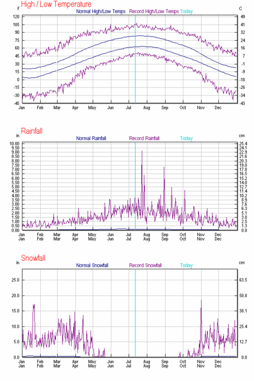
In spite of our the coolest day today so far in July, we are now entering the what is climatologically the warmest two week period of the year in Minnesota. On Tuesday, the average high in the Twin Cities hits 84 degrees, and stays there until July 27th.
That's the warmest average high temperature of the year in the Twin Cities. The average overnight low "tops out" at 64 degrees the next two weeks. It's pretty remarkable to think that we deal with sub-zero readings in winter when a cool breeze the rest of this month seems as far away as possible in Minnesota.
Turn Up Your Support
MPR News helps you turn down the noise and build shared understanding. Turn up your support for this public resource and keep trusted journalism accessible to all.
Even though the average high drops slightly to 83 degrees by month's end, the next 4 weeks are really the warmest on average in Minnesota.
Lag of the seasons:
Many people ask me why the warmest weather comes as much as a month after the summer solstice, when sun intensity is highest. It's called the seasonal lag.
The best analogy I can think of is your stove. If you turn the burner on high, it's doesn't heat a pot of water to boiling right away. It takes time for the heat energy to work into the system, and begin to boil the water. Our atmosphere works the same way. The incoming solar energy we received over the past month takes time to heat the system. So even though the sunlight is decreasing ever so slightly this time of year, temperatures continue to rise.
Enjoy the best that summer has to offer today, and stay tuned for more tomorrow on a potential severe weather outbreak heading in Wednesday.
PH

