
Friday cold front packs a punch
Go Deeper.
Create an account or log in to save stories.
Like this?
Thanks for liking this story! We have added it to a list of your favorite stories.


Get ready for a shot of cool crisp Canadian air.
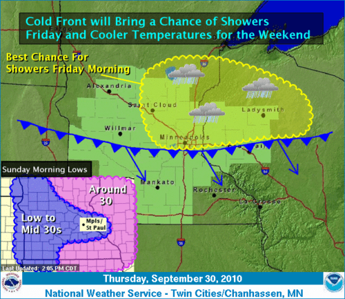
The season's strongest cold front will blow through Minnesota Friday. Behind the front, the coldest air of the season will bring a frost threat to much of Minnesota, including the Twin Cities metro.
It's time to dig out some little used weather adjectives like crisp, bracing, frigid, frosty, and refreshing.
Turn Up Your Support
MPR News helps you turn down the noise and build shared understanding. Turn up your support for this public resource and keep trusted journalism accessible to all.
The invigorating air mass will plunge temps into the 30s for much of southern Minnesota by Sunday morning, with temps in the 20s up north. You will want to cover up any sensitive plants to protect from frost this weekend.
The front may sport a few showers as it moves through Friday.
The cabin closing air mass will keep highs in the 50s on Saturday with temps recovering into the 60s Sunday.
Short lived cold snap:
If you like warm weather, the good news is the cold spell will be brief. Warmer southerly winds will kick in by Monday, and temperatures could push into the 70s again early next week. The milder pattern will return, and Minnesota may see above average temps for the next 10 days.
PH

