Tornado watch until 8 p.m. west of metro
Go Deeper.
Create an account or log in to save stories.
Like this?
Thanks for liking this story! We have added it to a list of your favorite stories.


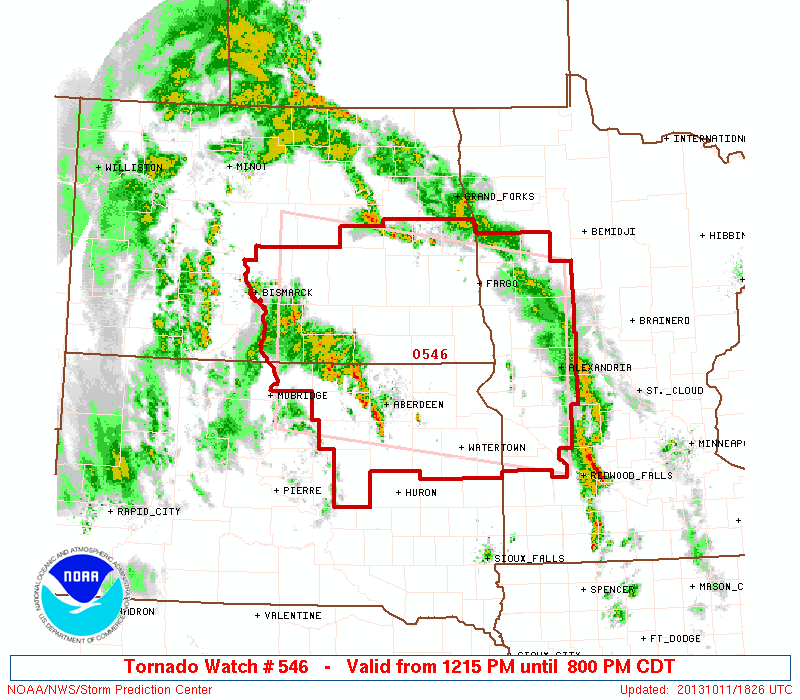
The National Oceanic and Atmospheric Administration's Storm Prediction Center has issued a tornado watch until 8 p.m. for the eastern Dakotas and western Minnesota. The watch does not include the Twin Cities metro area.
URGENT - IMMEDIATE BROADCAST REQUESTED
TORNADO WATCH NUMBER 546
NWS STORM PREDICTION CENTER NORMAN OK
Turn Up Your Support
MPR News helps you turn down the noise and build shared understanding. Turn up your support for this public resource and keep trusted journalism accessible to all.
1215 PM CDT FRI OCT 11 2013
THE NWS STORM PREDICTION CENTER HAS ISSUED A
* TORNADO WATCH FOR PORTIONS OF WESTERN MINNESOTA
SOUTH-CENTRAL AND SOUTHEAST NORTH DAKOTA
NORTH-CENTRAL AND NORTHEAST SOUTH DAKOTA
* EFFECTIVE THIS FRIDAY AFTERNOON AND EVENING FROM 1215 PM UNTIL 800 PM CDT.
* PRIMARY THREATS INCLUDE...SEVERAL TORNADOES POSSIBLE
SEVERAL DAMAGING WIND GUSTS TO 70 MPH POSSIBLE A FEW LARGE HAIL EVENTS TO 1 INCH IN DIAMETER POSSIBLE
THE TORNADO WATCH AREA IS APPROXIMATELY ALONG AND 90 STATUTE MILES NORTH AND SOUTH OF A LINE FROM 85 MILES WEST SOUTHWEST OF JAMESTOWN NORTH DAKOTA TO 5 MILES EAST OF ALEXANDRIA MINNESOTA.
PRECAUTIONARY/PREPAREDNESS ACTIONS...
REMEMBER...A TORNADO WATCH MEANS CONDITIONS ARE FAVORABLE FOR TORNADOES AND SEVERE THUNDERSTORMS IN AND CLOSE TO THE WATCH AREA. PERSONS IN THESE AREAS SHOULD BE ON THE LOOKOUT FOR
THREATENING WEATHER CONDITIONS AND LISTEN FOR LATER STATEMENTS AND POSSIBLE WARNINGS.
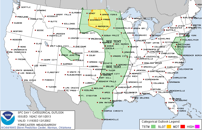
The greatest risk for severe storms is west of the Twin Cities. A band of showers and thunderstorms will move through the Twin Cities late this afternoon and evening, but most of the storms will likely stay below severe limits. The National Weather Service says a severe thunderstorm must contain winds of at least 58 mph and or large hail 1 inch or greater in diameter.
Here's NOAA's risk area for today.