
Cold eases, eyeing significant snow chances next Thursday?
Go Deeper.
Create an account or log in to save stories.
Like this?
Thanks for liking this story! We have added it to a list of your favorite stories.


You know it's been cold when 19 above feels better.
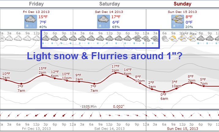
The core of arctic air has finally eased out of Minnesota. We bounce around in the teens through Saturday, before a one day chill down back into the single digits Sunday.
Next week looks milder before another arctic plunge. And I'm eyeing another potentially significant snow event late next week.
The good news about the cold? Outdoor ice rinks open early this year. Snow covered landscape brings excellent skiing and winter recreation and assures a white Christmas. Life can slow down a bit, an opportunity to recharge our batteries in these dark days of December.
Turn Up Your Support
MPR News helps you turn down the noise and build shared understanding. Turn up your support for this public resource and keep trusted journalism accessible to all.
The not so good news? Extreme cold is challenging for many people, cars and pets. Waiting at the bus stop or walking 6 blocks in -25 wind chills? Not fun. And as we found out with a college student in Duluth last weekend, exposure to extreme cold overnight can be life changing, even life threatening.
Most Minnesotans I talk to will gladly take the modest warm up this week.

Modest warming trend
It may be nothing to write home about, but the warmest temperatures in over a week are a blessing to many. Here's a look at temperature trends as we move into the weekend. The next Clipper will bring some light snow Friday night into Saturday.
Milder next week
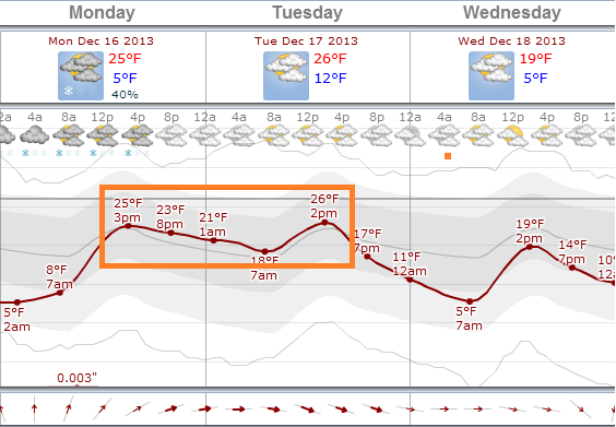
Temperatures in the 20s return next week, and we may even crack 30 degrees. Here's a look at a more sustained warming trend after a chilly Sunday.
Significant snow potential next Thursday and Friday
I'm keeping one eye on the potential for more significant snow late next week. The Global Forecast System has been good lately, and has consistently hinted the past few days at spinning up a low pressure system in advance of the next arctic shot late next week.

When we see this kind of day to day consistency, it lends a little more credibility to possible events a week out. It's still too early to be specific, but there is the potential for significant snow in somewhere in Minnesota next Thursday and Friday.

As we say in the weather biz, stay tuned!

