
Early December warm wave may be unprecedented
Go Deeper.
Create an account or log in to save stories.
Like this?
Thanks for liking this story! We have added it to a list of your favorite stories.


Attention K-Mart weather shoppers. The season formerly know as winter has been postponed until further notice.
Our well advertised December warm wave has arrived.
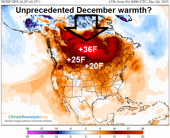
If the forecast temperature anomalies pan out for the next week, this will be one of the warmest starts to December on record across Minnesota. Get ready for a string of days with highs in the 40s, and some thermometers in the metro may hit 50 degrees next week. Temperatures in Minnesota will push 20 degrees above average by late next week, and as much as 36 degrees warmer than average across Hudson Bay in Canada. The sheer geographic coverage and magnitude of next week's warmth across North America may be unprecedented for December.
Turn Up Your Support
MPR News helps you turn down the noise and build shared understanding. Turn up your support for this public resource and keep trusted journalism accessible to all.
Pacific front parade
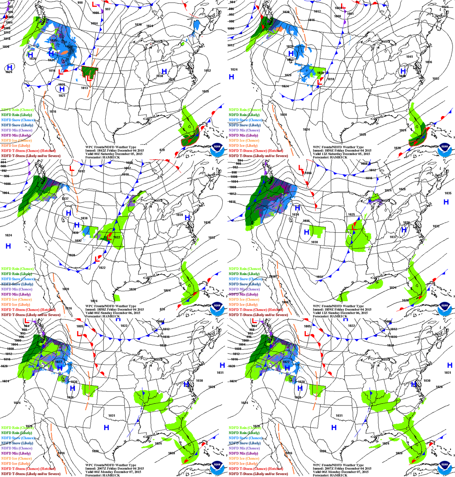
The short term weather maps over the next week feature a parade of Pacific fronts. All blue-barbed lines (cold fronts) on the map are not created equal. This weekend's front comes by way of Seattle instead of Whitehorse in the Yukon. The next warm front arrives early next week. Winter pause? Not exactly. Real Minnesota winter nowhere in sight as of yet.
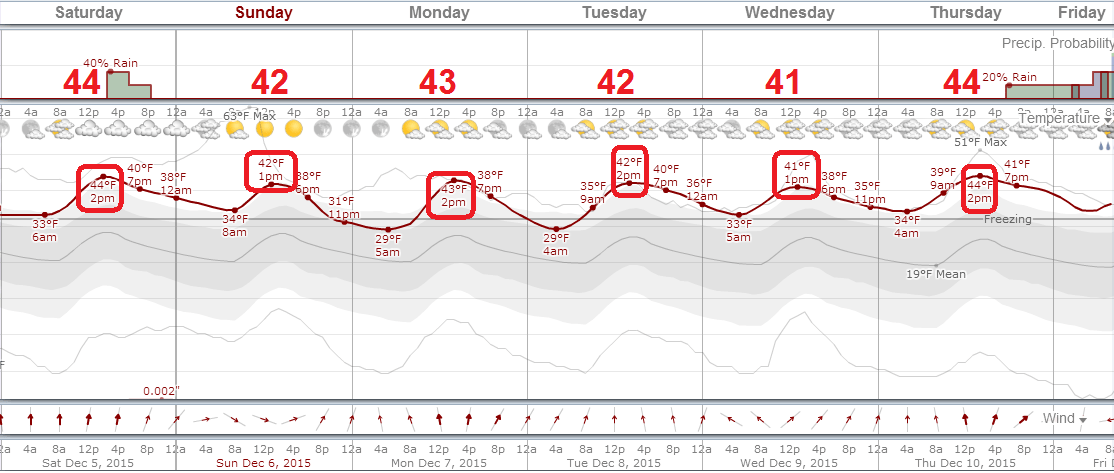
Here is a closer breakdown of the forecast over the next week. Both GFS and Euro are cranking out a string of 40s for the metro and much of Minnesota. My hunch? The forecast numbers for late next week are probably 5 degrees too conservative. Once the snow is gone temperatures will respond even more quickly.
Warm December in the bank?
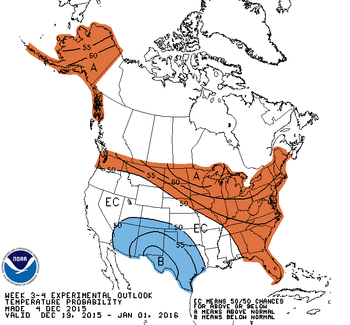
With extreme warmth likely through at least December 12, a much warmer than average first month of meteorological winter seems to be in the bank. I do see a cooling trend possible after mid-month, but probably back to just above average. Here's NOAA's updated three-week experimental outlook; a 70 percent chance of above average temperatures overall through the rest of December.
Still a shot at White Christmas
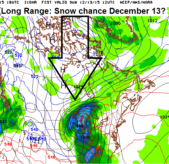
Take heart snow lovers. The weather pattern appears to turn colder in late December. Temperatures may still hover above average, but I see a shot of at least two potential snow systems in the second half of the month. This could be wishful thinking this far out, but the GFS is hinting at a potential snow system around December 13.
Overall I still think winter snowfall will end up below the metro average of 54 inches. Here's one data point to support my previous forecasts.
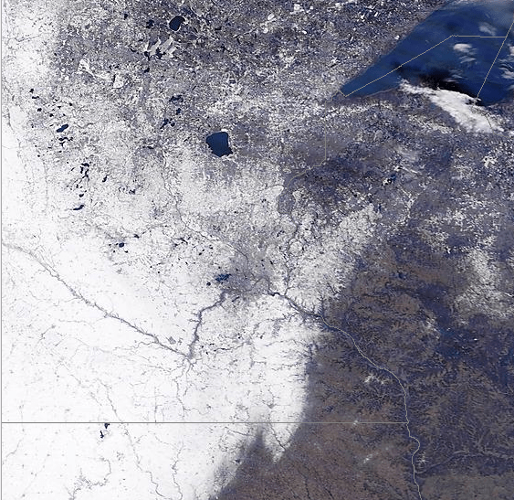
Edge of snow cover
The Twin Cities rides the edge of disappearing snow cover this weekend. You can clearly see the snow edge and black-colored lakes still sporting open water including Mille Lacs.
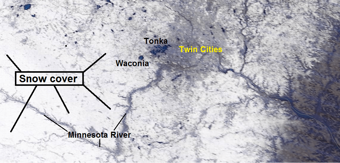
Here's a closer look at the Twin Cities area on the 250-meter resolution shot. Note the open lakes including Minnetonka, Waconia and the Minneapolis lakes.
El Niño: Record November
It's official. The Super El Niño lived up to the hype by eking out the record for November over 1997-8.

