
Messy Monday update: Wind, rain, sleet and snow
Go Deeper.
Create an account or log in to save stories.
Like this?
Thanks for liking this story! We have added it to a list of your favorite stories.


Welcome to Minnesota, Land of 10,000 Weather Extremes.
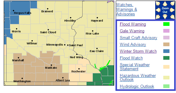
Just select your favorite type of weather warning on the map below. Flood watches, gale warnings and winter storm watches in the same state? Only in Minnesota. Submitted for your approval.
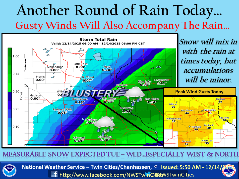
Lashing wind and mixed precipitation continue to rake the Twin Cities and southern Minnesota today. Expect just about anything; wind gusts over 30 mph, rain, sleet and even snow at times.
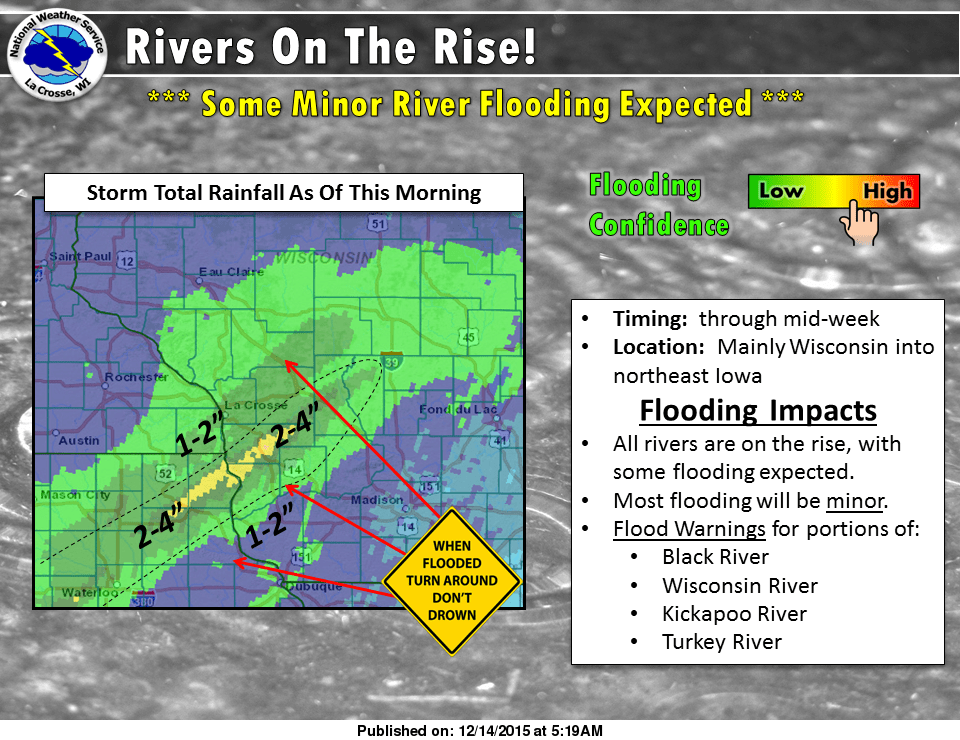
The view from the La Crosse, Wis., National Weather Service, where flood warnings are up today for area rivers. Serious 48 hour rainfall totals from 4" to 7" are piling up.
Turn Up Your Support
MPR News helps you turn down the noise and build shared understanding. Turn up your support for this public resource and keep trusted journalism accessible to all.
1 ESE Viroqua [Vernon Co, WI] COCORAHS reports HEAVY RAIN of 6.27 INCH at 7:00 AM CST -- COCORAHS STATION VIROQUA 0.8 ESE /
1 E Viroqua [Vernon Co, WI] CO-OP OBSERVER reports HEAVY RAIN of 5.96 INCH at 7:00 AM CST -- CO-OP OBSERVER STATION VIROQUA /
3 E Viroqua [Vernon Co, WI] MESONET reports HEAVY RAIN of 5.43 INCH at 7:59 AM CST -- MESONET STATION YTTRI DAM /
1 E Eldorado [Fayette Co, IA] MESONET reports HEAVY RAIN of 4.84 INCH at 7:45 AM CST -- MESONET STATION ELDORADO /EDRI4/
Kendall [Monroe Co, WI] MESONET reports HEAVY RAIN of 4.16 INCH at 8:10 AM CST -- MESONET STATION KENDALL /C1930/
3 ENE Westby [Vernon Co, WI] CO-OP OBSERVER reports HEAVY RAIN of 4.11 INCH at 7:00 AM CST -- CO-OP OBSERVER STATION WESTBY 3ENE /WESW3/
DE Soto [Crawford Co, WI] MESONET reports HEAVY RAIN of 4.08 INCH at 8:11 AM CST -- MESONET STATION DE SOTO /C4731/
4 WSW Viroqua [Vernon Co, WI] MESONET reports HEAVY RAIN of 4.06 INCH at 7:57 AM CST -- MESONET STATION SIDIE HOLLOW DAM /SIDW3/
Serious, even life threatening flooding is likely today.
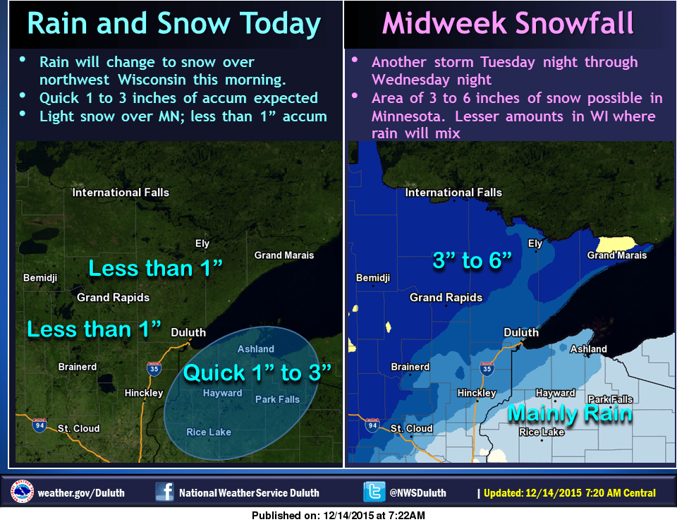
Up north, it's a wintry mix today, with eyes on the next system coming in Tuesday night and Wednesday.
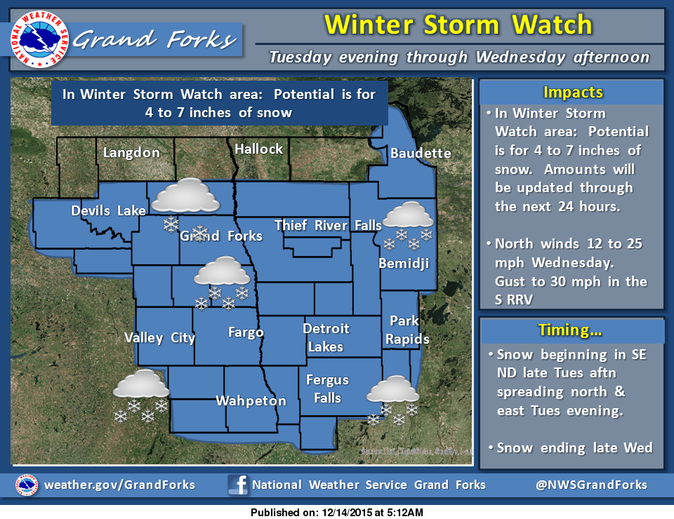
Here's more on the next incoming storm from the Red River Valley National Weather Service office, with winter storm watches for the Red River Valley and northwest Minnesota.
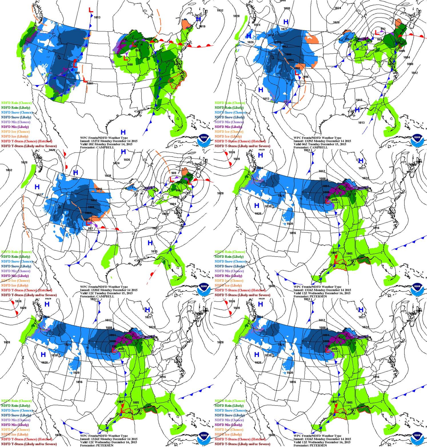
Here's a good look at storm No. 1 pulling out tonight. Storm No. 2 moves in Tuesday night and Wednesday. The snow bull's-eye favors the northwest half of Minnesota.
The Twin Cities rides the edge of the rain snow line once again as the low pressure center makes a beeline right for Minneapolis-St. Paul.
Stay dry today, and stay tuned.

