
Warmest Christmas Eve on record east, colder next week
Go Deeper.
Create an account or log in to save stories.
Like this?
Thanks for liking this story! We have added it to a list of your favorite stories.


Pack the Bermuda shorts if you're traveling to the East Coast for Christmas this year. Santa may be arriving by pontoon boat.
This will be the warmest Christmas Eve ever recorded (by far) for most of the eastern United States.

With high temperatures soaring into the 70s along the East Coast this week, daily record highs will be smashed by 10 degrees or more. Many eastern cities will challenge all-time December maximum temperature records this holiday week.
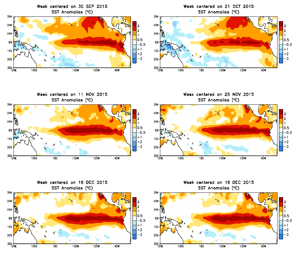
Yes, it's El Niño
Turn Up Your Support
MPR News helps you turn down the noise and build shared understanding. Turn up your support for this public resource and keep trusted journalism accessible to all.
So far El Niño has delivered in spades on the forecast of a milder than average winter across the Midwest and eastern United States. El Niño's impacts are reverberating worldwide. Superimpose likely the strongest El Niño on record over climate change and you get record warm weather weirding. London has had the warmest December on record so far with temperatures more like May than December. December daffodils?
More from the Guardian.

December temperatures in London have been warmer than July’s. Scotland is balmier than Barcelona. Artificial snow covers European ski slopes. Africa faces its worst food crisis in a generation as floods and droughts strike vulnerable countries.
With unusual weather from Britain to Australia, scientists are blaming climate change – but also the natural phenomenon called El Niño, which is raising temperatures and disrupting weather patterns. A double whammy then, but how disturbed should we be as the records tumble?
According to the UK Met Office, the exceptional warmth in Britain and northern continental Europe is linked to the strongest El Niño ever recorded. “What we are experiencing is typical of an early winter El Niño effect,” said Adam Scaife, head of Met Office long- range forecasting.
The other shoe?
The question across Minnesota and the Midwest this winter? It's not how much cold or snow. It's if winter will ever arrive.
We may finally have some answers.
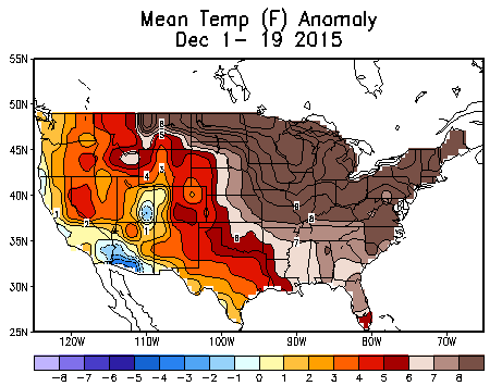
First, another significantly milder than average week. The overall pattern for December so far is off the charts. Minnesota is the epicenter of warmth compared to average in the United States so far this December.
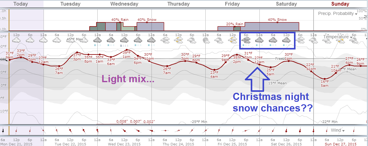
This week presents a few rain or snow showers for the metro. The first one comes tonight with the passing warm front and potential shot of light snow for the metro. The next round comes early Wednesday morning. Right now I don't see any big accumulations until possibly Christmas night.
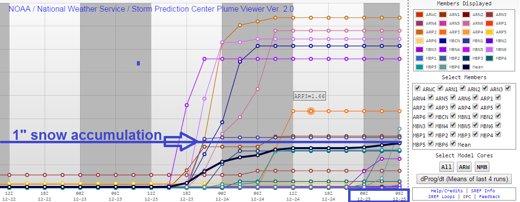
The vast majority of NOAA's Short Range Ensemble Forecast (SREF) member models agree. Only eight of 27 SREF ensemble members forecast 1 inch or greater snowfall totals for the Twin Cities by Christmas. Yes weather fans, these are the kinds of outputs that we weather model geeks look at everyday.
Changes next week?
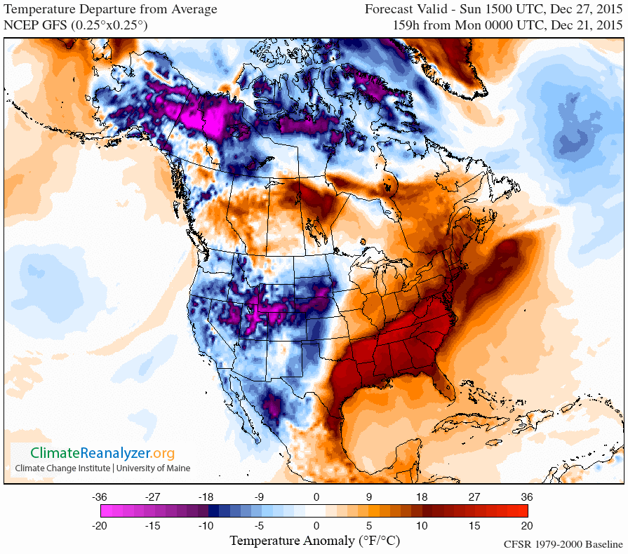
Several atmospheric signs point to a change in the jet stream pattern that should bring colder, more seasonable winter temperatures our way next week. It may not be bitter arctic air by Minnesota winter standards, but you may actually believe it's almost January in Minnesota next week.
Here's NOAA's GFS model temperature departure for Sunday via University of Maine's Climate Reanalyzer. This pattern of near average temperatures is more typical of what Minnesota should see next week.
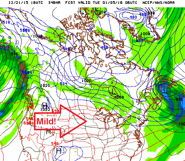
The big question is, will it last? There are already signs of another El Niño-induced gush of unseasonably mild Pacific air the first week of January.
Stay tuned.

