
Models sorting out weekend heat, Colin sets early record
Go Deeper.
Create an account or log in to save stories.
Like this?
Thanks for liking this story! We have added it to a list of your favorite stories.


Perfect weather?
"All weather is local." " There is really no bad weather, just different kinds of good weather." " If you don't like the weather, just wait 15 minutes."
There are plenty of tried and true Minnesota weather sayings. Meteorologists get a constant, often unsolicited stream of feedback about our weather patterns. It's a great way to keep our fingers on the pulse of how the natives are feeling about our weather. The number one comment I'm getting from Minnesota weather consumers this year?
"This has been one of the best springs I can remember."
Turn Up Your Support
MPR News helps you turn down the noise and build shared understanding. Turn up your support for this public resource and keep trusted journalism accessible to all.
Agreed. maybe on of the best weather years so far. An easy winter. An early spring. Just enough rainfall to get by for most of Minnesota? I editorialize, but does it get any better than this?

As we look ahead there is model "divergence" as usual about the magnitude and duration of our upcoming heat spike. Cue the weather forecast jokes. This week's best weather joke might go something like this:
"Two forecast models walk into a bar."
Weather perfection Tuesday and Wednesday
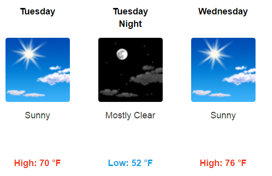
The weather for the next 48 hours meets most Minnesotans definition of weather perfection. High in the 70s. Low humidity. Plenty of sunshine.
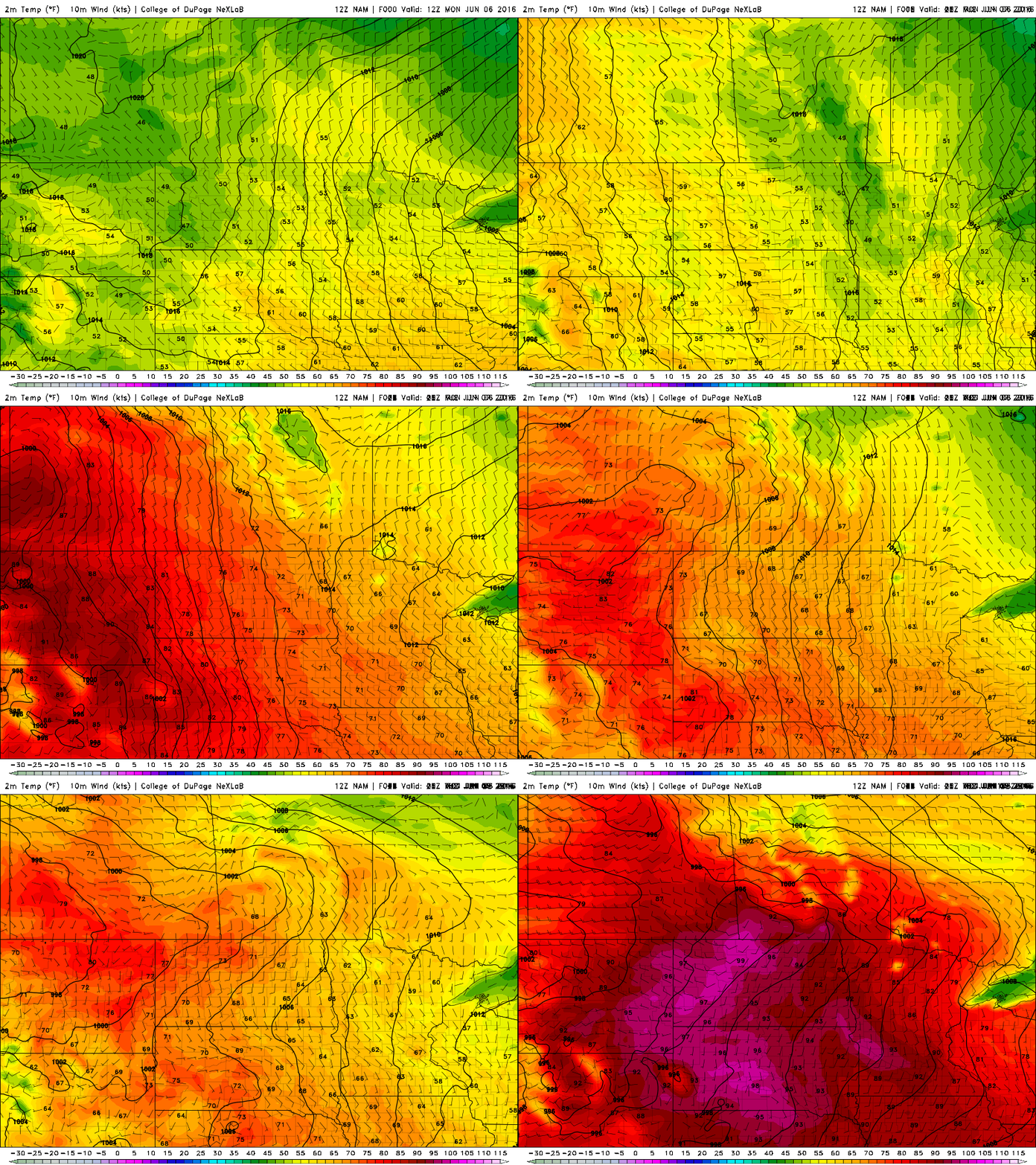
Watch as Canadian high pressure builds south. Thursday's warm front gathers in the Dakotas.

Summer heat spikes build in pulses. NOAA's NAM provides a visual loop of how the thermal ridge of heat builds to the west, then pushes 90-degree heat into Minnesota by Thursday afternoon.
Model differences
Model differences developed Monday on the duration of the upcoming heat spike. What's new right?
NOAA's GFS keeps sustained heat near 90 degrees into the Twin Cities this weekend. The European model drives a cool front south Friday night, dropping temperatures and humidity dramatically after a hot Friday afternoon. Suffice to say Friday looks hot, and then we'll see how far south the front is able to push this weekend.
This NWS product captures the essence of the week nicely.
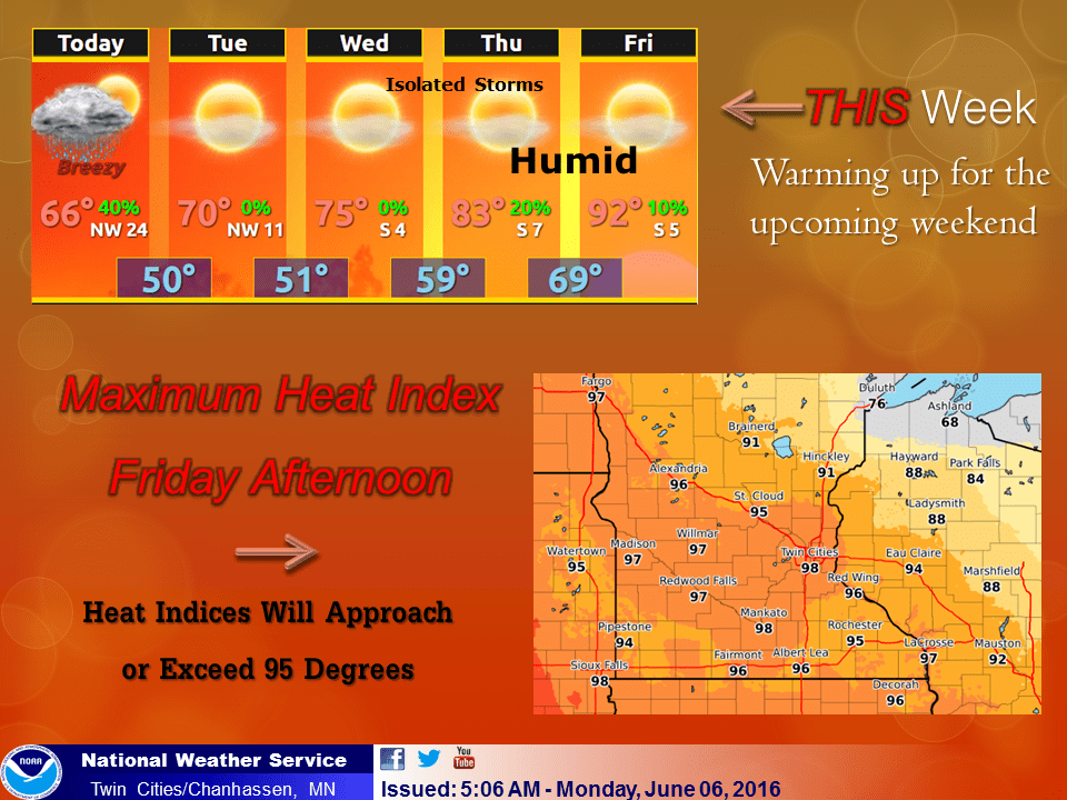
If the front stalls and hangs up near the Twin Cities, big thunder is a threat this across a good chunk of Minnesota weekend.
Colin comes ashore
Tropical Storm Colin is accelerating to the northeast as it crosses northern Florida tonight. The main feature of Colin? Localized heavy rainfall bands that will drop multi-inch totals. NOAA's NAM 4 km model lights up with vibrant colors as Colin crosses Florida.
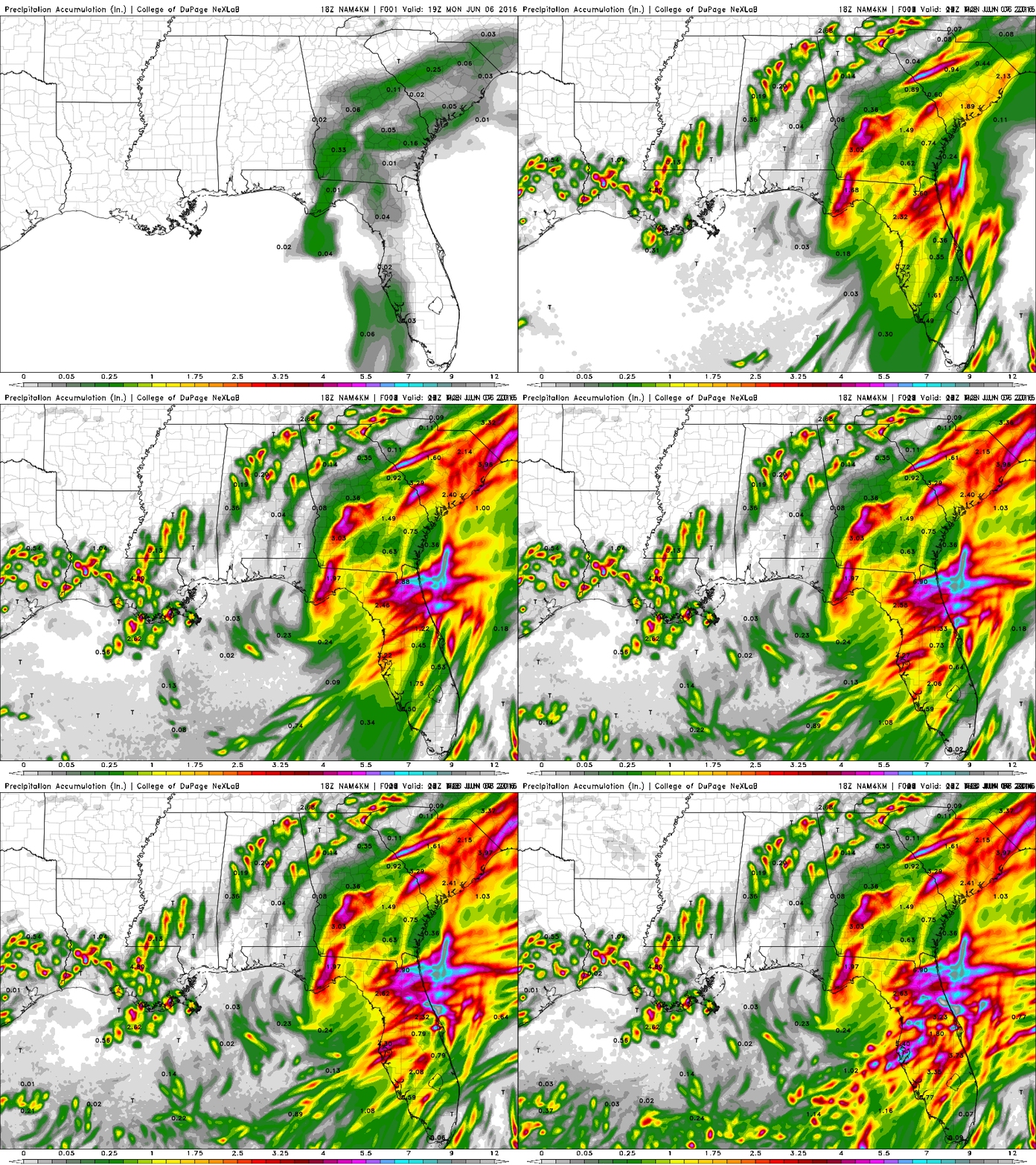
Colin strafes the Carolina coasts before charging out into the open Atlantic. Good news for most of the Atlantic Coast.
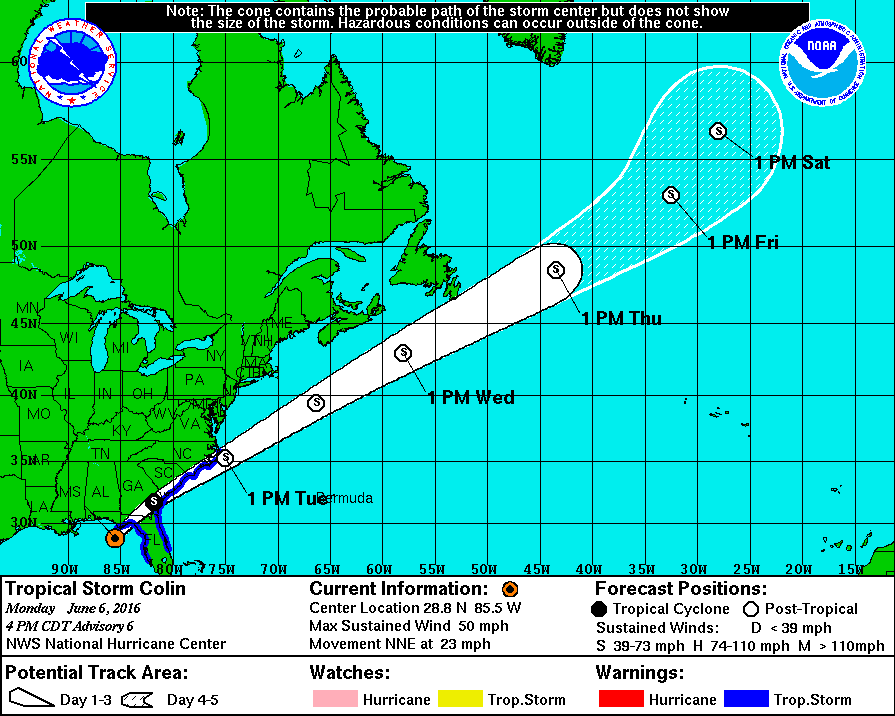
Colin is the earliest 3rd named storm to form in the Atlantic basin this year. The 2016 Atlantic hurricane season is off to a record fast start.
The southeast is getting off luck with Colin so far. But the record early start to hurricane season has some of us worried we're overdue for a more potent U.S. hurricane strike this year.
Stay tuned.

