
Wednesday downpours: Multi-inch rainfall potential
Go Deeper.
Create an account or log in to save stories.
Like this?
Thanks for liking this story! We have added it to a list of your favorite stories.


Here we go again.
The next active warm front bubbles northward into southern Minnesota Wednesday. This one has all the ingredients for locally heavy rainfall totals once again.

Stalled front
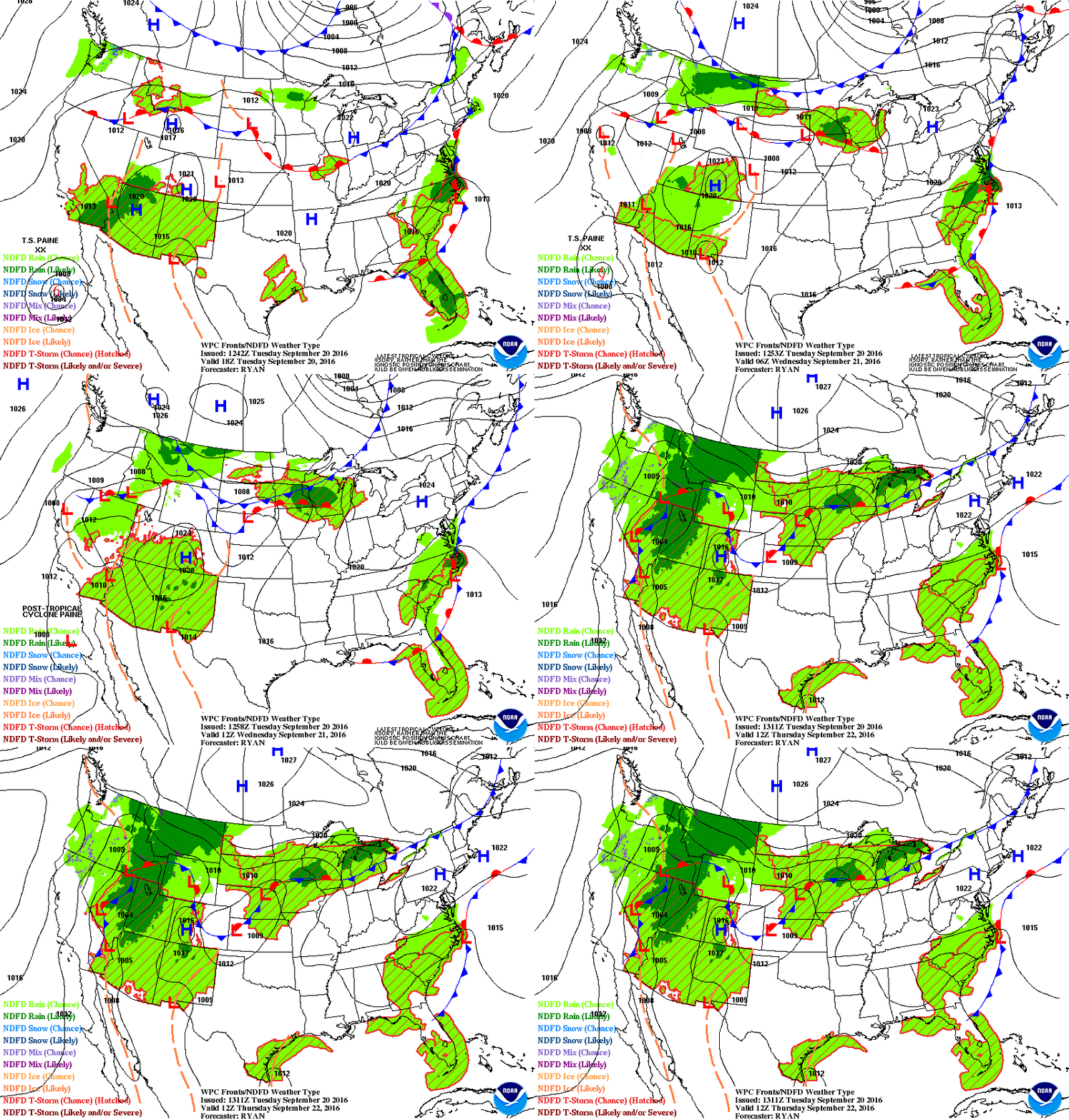
The recipe for this week's deluge? A stalled warm front draped across the Minnesota Iowa border Wednesday. Watch the front generate a green zone of persistent and potentially heavy rainfall on the maps.
Turn Up Your Support
MPR News helps you turn down the noise and build shared understanding. Turn up your support for this public resource and keep trusted journalism accessible to all.
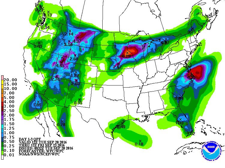
Southeast Minnesota focus again?
Once again it looks like communities along and either side of the I-90 corridor will be the focus for the heaviest rain zone. The National Oceanic and Atmospheric Administration's latest rainfall output is cranking out some eye opening numbers, with the potential for 6 inches-plus totals just southeast of the Twin Cities.
Flood watches possible later today
The Twin Cities National Weather Service is likely to issue flood watches later today for a big chunk of southeast Minnesota. Here's their latest take on the inbound storm, which is still in the developmental phase. Weather news you can use.
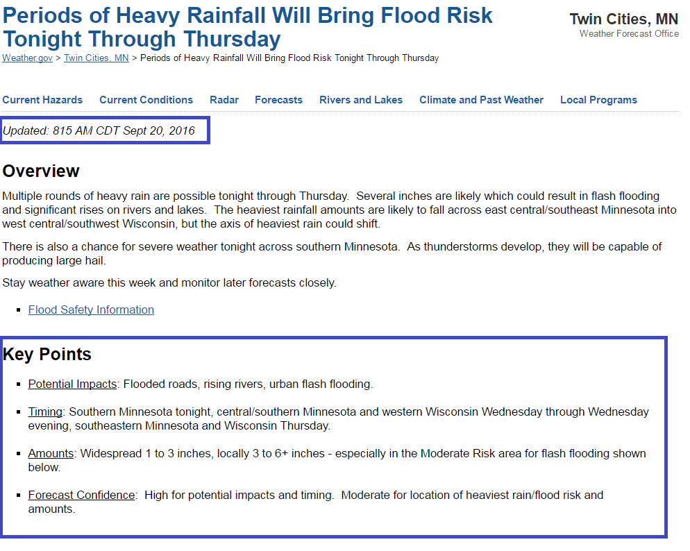
Heavy and potentially flooding rain looks likely. The biggest uncertainty still lies around precisely where the 3- to 6-inch rainfall zone will set up. NOAA's Weather Prediction Center has shifted the threat for heaviest rains north to include the Twin Cities National Weather Service region.

The latest runs of NOAA's NAM 4 km model also bring the heaviest rainfall closer to the Twin Cities area through Wednesday night. Pockets of 3 to 6 inches bracket the Mississippi River from the Twin Cities to La Crosse, Wis., in this scenario.

Bottom Line: Heavy, multi-inch rainfall is still likely Wednesday into Thursday morning. Flash flood potential is there.
Stay tuned for updates.

