
Light snow Friday; Christmas storm on track
Go Deeper.
Create an account or log in to save stories.
Like this?
Thanks for liking this story! We have added it to a list of your favorite stories.


Here we go. Everyone is ready to make the trek over the river and though the woods this holiday season.
The best travel days this Christmas holiday weekend? Christmas Eve and Monday.
Friday snow
We're still on track for a shot of mostly light snow Friday.
Turn Up Your Support
MPR News helps you turn down the noise and build shared understanding. Turn up your support for this public resource and keep trusted journalism accessible to all.

Winter weather advisories are up for southeast Minnesota and most of Wisconsin Friday.

212 PM CST THU DEC 22 2016
...WINTER WEATHER ADVISORY IN EFFECT FROM 6 AM TO 9 PM CST
FRIDAY...
THE NATIONAL WEATHER SERVICE IN LA CROSSE HAS ISSUED A WINTER WEATHER ADVISORY FOR SNOW...WHICH IS IN EFFECT FROM 6 AM TO 9 PM CST FRIDAY.
* EXPECT SNOW TO DEVELOP AROUND 6 AM FRIDAY AND THEN DIMINISH AROUND 9 PM FRIDAY. A LIGHT WINTRY MIX WITH FREEZING DRIZZLE IS ALSO POSSIBLE FRIDAY EVENING.
* THE HEAVIEST SNOWFALL RATES WILL OCCUR BETWEEN NOON AND 6 PM FRIDAY.
* TOTAL SNOW ACCUMULATIONS OF 2 TO 4 INCHES. A LIGHT GLAZE OF ICE IS ALSO POSSIBLE.
* LOOK FOR REDUCED VISIBILITIES AT TIMES.
* PLAN ON SLIPPERY ROAD CONDITIONS...INCLUDING DURING THE MORNING AND EVENING COMMUTES ON FRIDAY.
Christmas storm still on track
No big changes in the Christmas storm tracks or scenario. Expect a mix of snow and ice Christmas morning before precip changes to all rain Christmas Day.
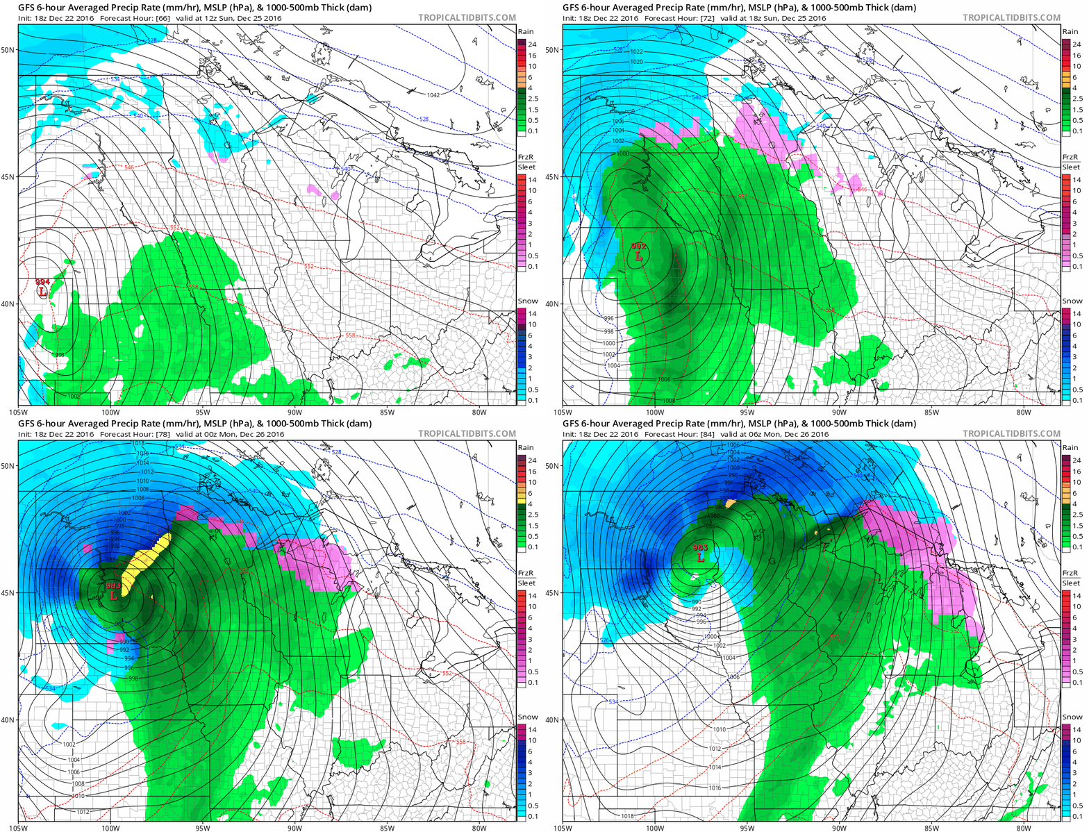
This still looks like a shot of ice Christmas morning, and that could slick up roads a bit. Winter storm watches are up for the Red River Valley.

Stay tuned!

