Free Arctic vacation this week; daylight grows
Go Deeper.
Create an account or log in to save stories.
Like this?
Thanks for liking this story! We have added it to a list of your favorite stories.


The frozen tundra. The nation's icebox. The Land of 10,000 (Frozen) Lakes. Insert your favorite Minnesota cold weather cliche here.
A sustained blob of Arctic air parks over Minnesota this week. The air mass overhead is not as cold as the one that produced minus 20 in the Twin Cities on Dec. 18. But what this air mass lacks in intensity it makes up in duration. Temps slide below zero each night into Sunday morning. Daytime highs stagger into the single digits above zero. Respectably cold.
Watch the maps as temperatures pulse either side of the zero mark for the rest of the week.

High and dry
Turn Up Your Support
MPR News helps you turn down the noise and build shared understanding. Turn up your support for this public resource and keep trusted journalism accessible to all.
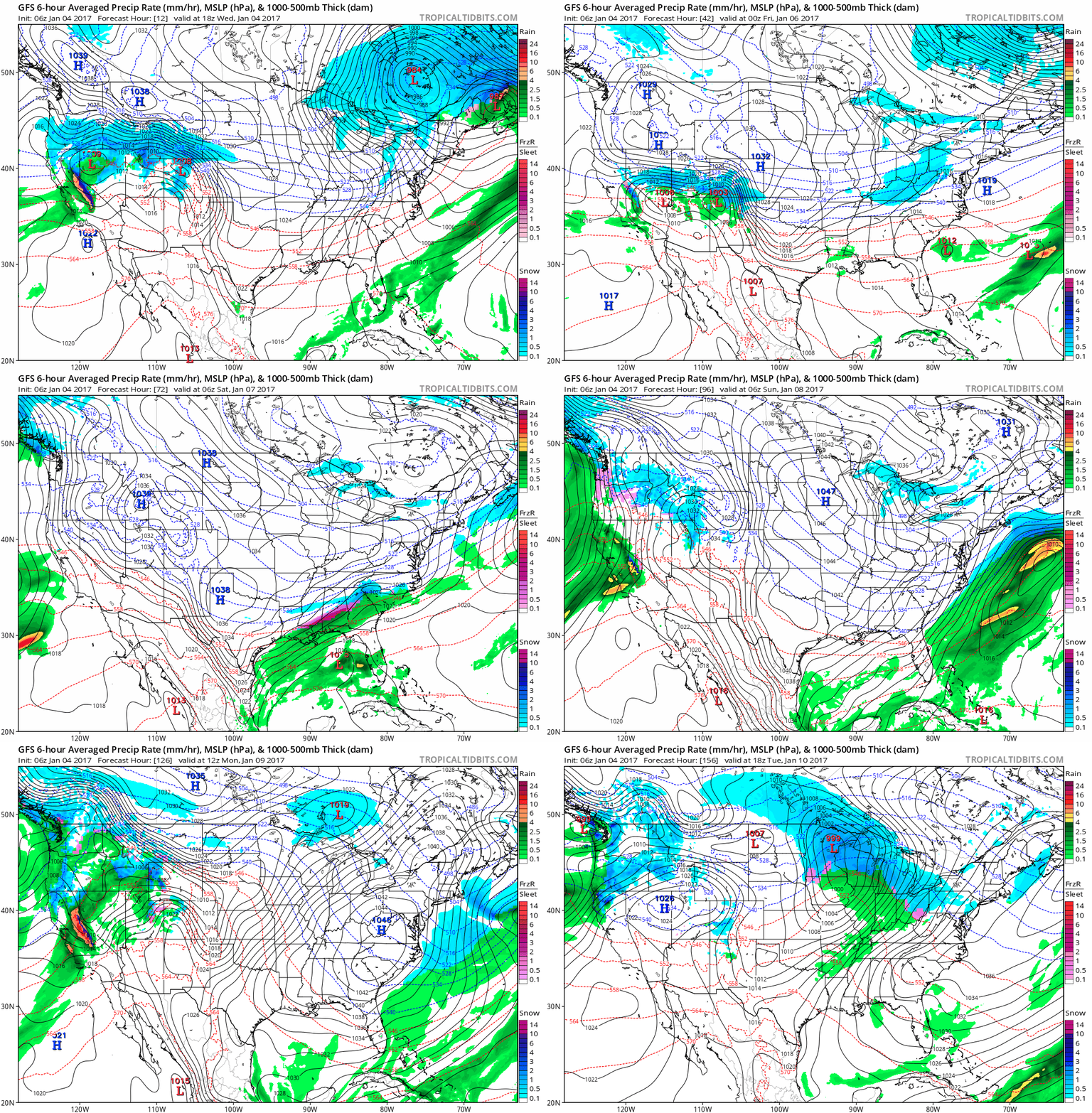
The surface weather maps tell the story across the U.S. Minnesota rides the brittle, but dry side of Arctic high pressure cells shoving storms to our south. Southwest flow returns early next week, with a sloppy system and a messy wintry mix by next Tuesday.
Making ice
At least we're making ice this week on Minnesota lakes. With temperatures below zero at night we're building at least an inch of ice per day on most lakes. Ice thickness varies over short distance on many lakes. I'm getting reports of 5 inches to 8 inches on lakes around the Twin Cities now, with over a foot of ice on northern Minnesota lakes.
Remember the channels and spots near any moving water can be deceptively thin. Be careful out there.

Milder next week
The upper air pattern looks favorable for a significant temperature moderation next week across the U.S.

After a solid five days in the deep freeze, temps in the 30s likely return to the Twin Cities by next Tuesday.

Brighter days
We're gaining daylight more rapidly now as we move away from the winter solstice.

The Twin Cities is adding over a minute of daylight each day, and the pace is accelerating. We'll gain almost an hour by the end of January.

The increasing "civil twilight" means it's bright in the southwest sky until around 5:30 p.m. now. Enjoy the longer days as we inevitably march toward spring. In less than three months we may be looking at greening grass.