Fore! Golf weather ahead, signs of snow late next week?
Go Deeper.
Create an account or log in to save stories.
Like this?
Thanks for liking this story! We have added it to a list of your favorite stories.


The weather map today almost looks like February.
The coldest air in several days drifts across Minnesota today. Highs stagger into just the 30s in the metro for a change, with 20s north. But milder air is already pooling to the west. The next warm front is taking shape in the Dakotas.

Pulses of warmth
The warm wave arrives in pulses the next few days. We start cool Thursday morning, then warm into the 40s by afternoon. Shades of yellow and temps in the 50s to near 60 degrees sweep across snow-free southern Minnesota through the weekend. The average high for the Twin Cities this weekend? 30 degrees.
Turn Up Your Support
MPR News helps you turn down the noise and build shared understanding. Turn up your support for this public resource and keep trusted journalism accessible to all.
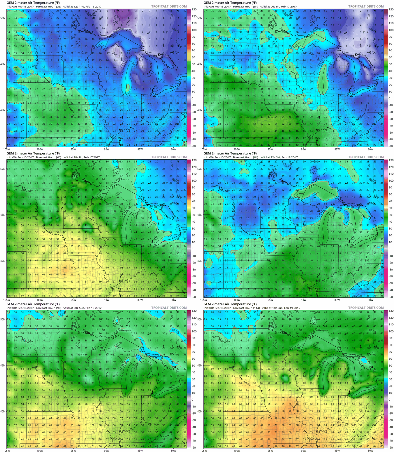
Balmy Friday
Friday and next Monday may be the warmest days of the coming heat wave. Highs in the 60s dominate areas southwest of the Twin Cities. Your local bank thermometer may flash 60 in the metro Friday afternoon. Outdoor lunch on Feb. 17 anyone?
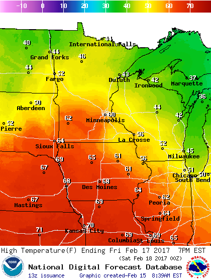
Minneapolis driving ranges open Friday
CBS Minnesota reports that several Minneapolis driving ranges will open Friday. 'Weather weirding' indeed.

Hope for snow lovers?
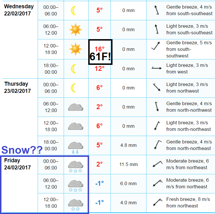
Two of the major models we watch, the National Oceanic and Atmospheric Administration's Global Forecast System and the European Centre for Medium-Range Weather Forecasts, are still hinting at potential snow late next week.

The European model keeps temps near 60 degrees through next Wednesday, then brings snow by Friday.
Stay tuned.