
Weekend warm front brings 60s, again
Go Deeper.
Create an account or log in to save stories.
Like this?
Thanks for liking this story! We have added it to a list of your favorite stories.


Here we go again.
After the 6th warmest February on record, and the 10th warmest meteorological winter (Dec-Feb) in Minnesota, thermometers surge upward again this weekend. It's not you imagination. Winters are trending strongly warmer in Minnesota. Dr. Mark Seeley reports that 15 of the past 20 winters have been warmer than average in the once frozen tundra.
The not so cold climate truth? Anyone under 20 in Minnesota doesn't have a life experience baseline to compare what the pioneer-like Minnesota winters of the 70s and 80s felt like.
Fast forward to April
Turn Up Your Support
MPR News helps you turn down the noise and build shared understanding. Turn up your support for this public resource and keep trusted journalism accessible to all.
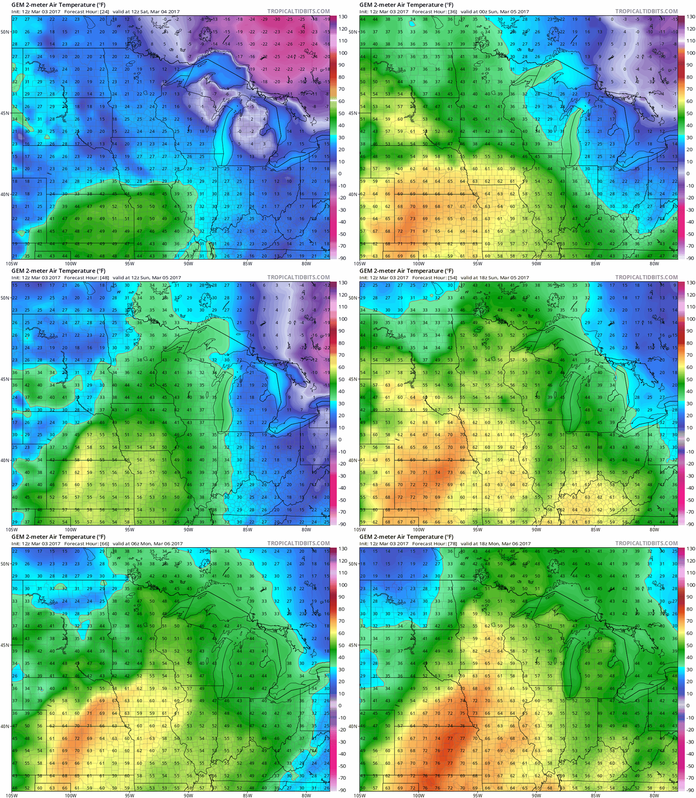
Our late week cool snap fades as the weather maps scream April once again this weekend. A windy warm front nudges thermometers higher Saturday. By Sunday afternoon, a full on "thermal ridge" sends thermometers into overdrive. Bank thermometers in southern Minnesota flash 60+ Sunday and Monday afternoon. Weather maps morph from blue to green, yellow and red.
Monday rain
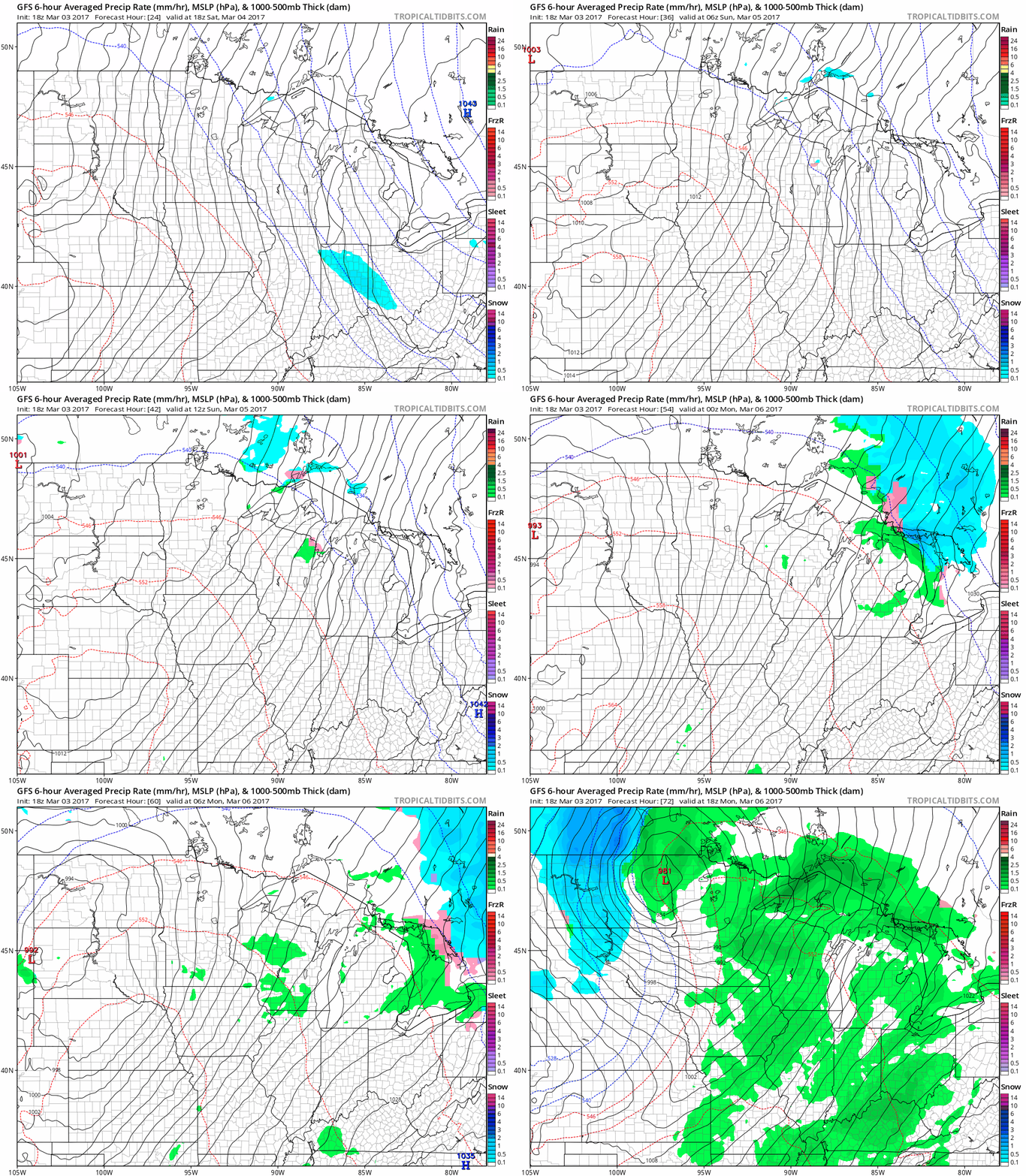
There's a reason March is no longer the snowiest month in Minnesota. Far more frequently, precipitation falls as rain instead of snow in Minnesota's cold season. Monday features another wet, but liquid March low pressure system. Look for rain showers all the way north to the Canadian border and beyond. Welcome to Minnesota's modified climate.
Another warm spike next week
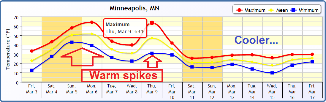
We cool off a bit after Monday's warmth and rain. Another warm spike appears possible by next Thursday. Temps trend colder by the weekend of March 11-12. The European Model (ECMWF) hints at possible snow Sunday March 12th.
19th straight warm month at MSP?
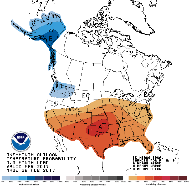
The maps I'm looking at suggest we'll see some reasonably cold weather in March, punctuated by occasional very warm spikes. Will the warm spells be enough to propel the Twin Cities to 19 in a row? Place your bets.
GOES 16 continues to dazzle
The leap in capability with NOAA's new GOES 16 satellite looks like a modern day success story. It's going to be fun for us as daily practitioners of weather to incorporate the expanded, higher resolution data into our forecasts. No need to look directly at the sun, GOES 16 can do that for you.
Earth changes accelerate
Permafrost thawing at an alarming rate
Trend in Arctic Sea ice continues
Antarctica too
The data behind the changes
Scientists in the streets

