
Rare March tornado watch until 10 pm
Go Deeper.
Create an account or log in to save stories.
Like this?
Thanks for liking this story! We have added it to a list of your favorite stories.


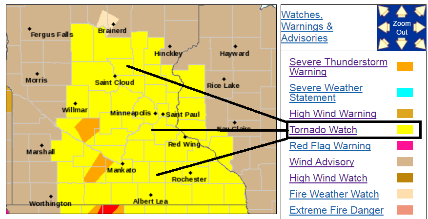
Our fast forward spring continues. A highly erratic weather pattern has yielded the first tornado watch of the season for southern Minnesota and the Twin Cities.
URGENT - IMMEDIATE BROADCAST REQUESTED
Tornado Watch Number 63
NWS Storm Prediction Center Norman OK
245 PM CST Mon Mar 6 2017
The NWS Storm Prediction Center has issued a
* Tornado Watch for portions of Central and southern Minnesota
Far west-central Wisconsin
* Effective this Monday afternoon and evening from 245 PM until 1000 PM CST.
* Primary threats include...A couple tornadoes possible
Scattered damaging wind gusts to 65 mph possible
Isolated large hail events to 1.5 inches in diameter possible
SUMMARY...Widely scattered storms developing over southwest Minnesota will spread northeast this evening with a risk for all severe hazards.
If a tornado does develop today, it will be the earliest in Minnesota on record.
As always, check the MPR severe weather live blog here.
Turn Up Your Support
MPR News helps you turn down the noise and build shared understanding. Turn up your support for this public resource and keep trusted journalism accessible to all.

