
East Coast blizzard bust, Minnesota’s warming trend begins
Go Deeper.
Create an account or log in to save stories.
Like this?
Thanks for liking this story! We have added it to a list of your favorite stories.


They got off easy in NYC and Philly today.
https://twitter.com/wxshift/status/841732694606266368
But prolific snowfall totals pounded areas just a few miles inland.
Snowfall totals of 2 feet to 30" are reported in parts of New York and Pennsylvania. Snowfall rates of 5.5" per hour blasted Albany, NY. That's unreal, I've never seen snow that heavy in Minnesota.
Turn Up Your Support
MPR News helps you turn down the noise and build shared understanding. Turn up your support for this public resource and keep trusted journalism accessible to all.
This is already a top 10 snowfall for some locations near Boston.
Throw in some near and hurricane force wind gusts, and you've got one heck of a blizzard inland.
The storm is brutal at ground level, but beautiful from space. GOES 16 continues to deliver amazingly detailed images.
Minnesota: Warming trend begins
Our weather pattern evolves into a more typical early spring pattern over the next 48 hours. I concur with the Twin Cities NWS that this could be the last sub-zero night of the season for most if not all Minnesota locations.

Temps respond as winds turn southerly Wednesday. A few rain showers sail across Minnesota Wednesday night into Thursday morning.

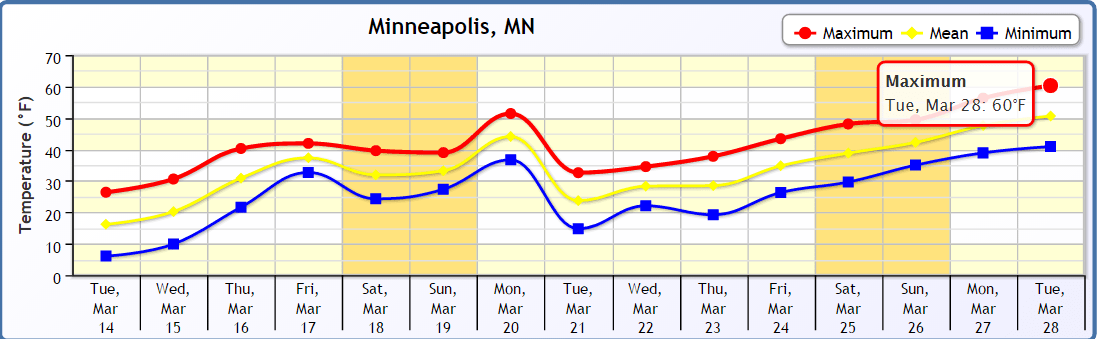
Our overall weather pattern looks blissfully quiet the next week or so. Highs in the 50s look likely Sunday and Monday. The longer term trend is up, with 60 possible again by late month.
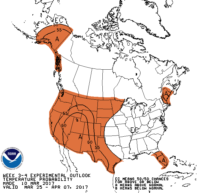
NOAA's experimental 3-4 week temperatures product suggests warmer than average temps as we turn the corner into April.
True spring at last?

