
Rainy pattern arrives, first 70 in sight?
Go Deeper.
Create an account or log in to save stories.
Like this?
Thanks for liking this story! We have added it to a list of your favorite stories.


April showers are here a week early.
A slow moving low pressure storm slides south, dealing waves of showery weather. The bulk of the rain arrives overnight and Friday, but a few showers may linger this weekend.
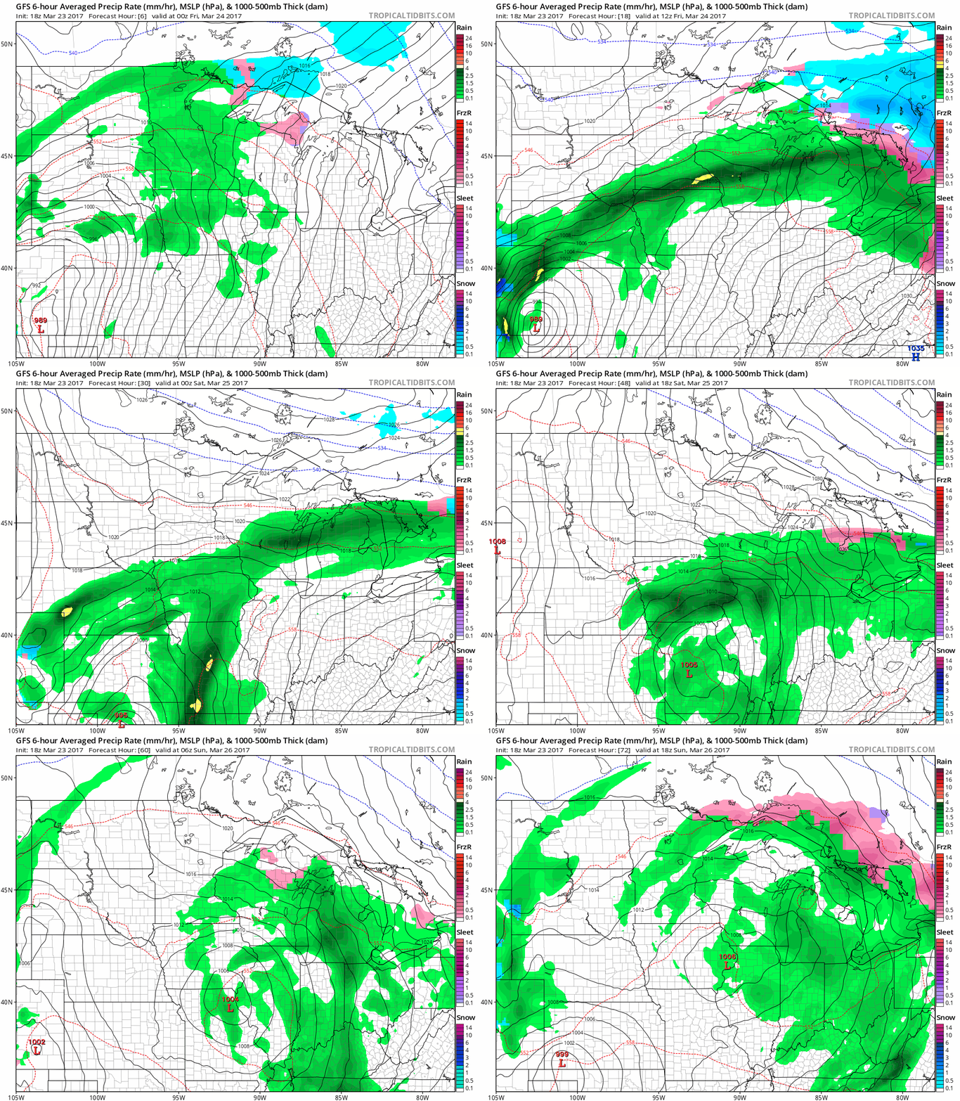
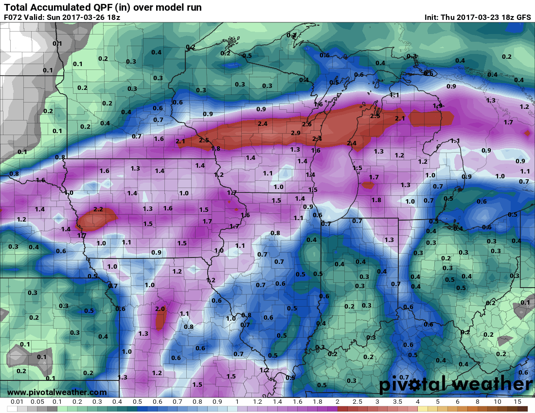
The heaviest rainfall still favors southern Minnesota and Wisconsin. The Twin Cities lies on the northern edge of the soak zone. Rainfall totals of .50" look likely for the metro. 1" to 2"+ totals still center on Rochester and La Crosse.
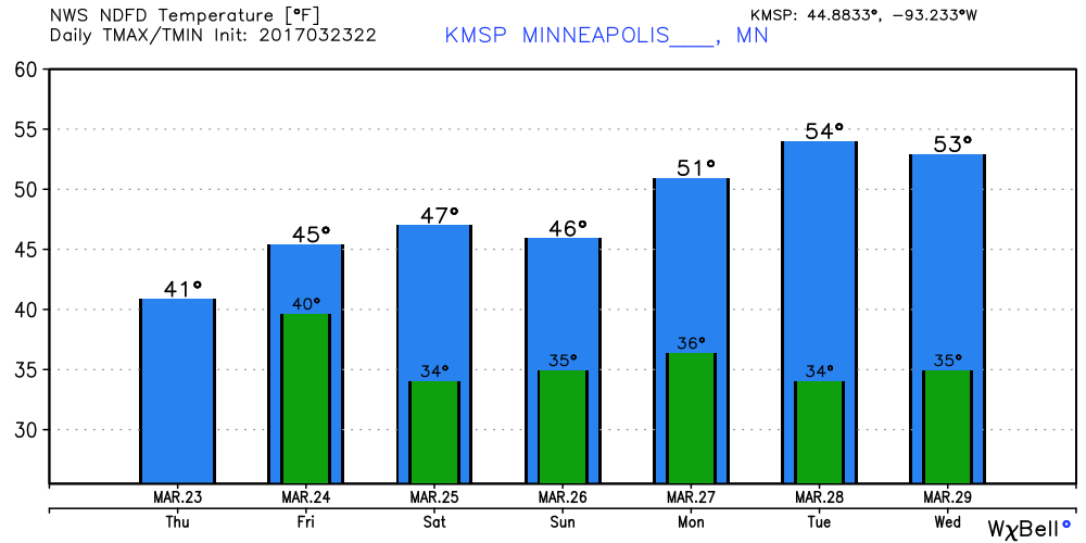
Temperatures gradually warm from the upper 40s to low 50s the next few days in southern Minnesota including the Twin Cities metro.
Turn Up Your Support
MPR News helps you turn down the noise and build shared understanding. Turn up your support for this public resource and keep trusted journalism accessible to all.
Spring in sight?
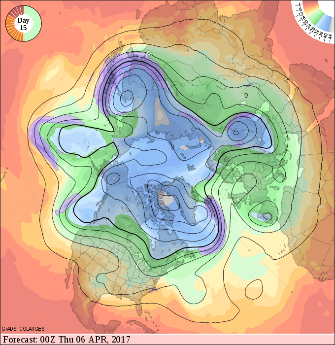
The upper air pattern continues to suggest that By the first week of April, the jet stream lifts north into Canada. If this map verifies, we'll go into full spring fever mode, and the season's first 70-degree temps are likely.
We warm gradually through the 50s next week, and then the lid comes off the first week of April. Models continue to crank out 70 for the Twin Cities the first week of April.

NOAA 16-day GFS suggest a warm and potentially thundery end to the first week of April.

Time to dust off the Doppler, golf clubs, and prep the boat?

