
Foggy start, spotty showers for Twins Opening Day
Go Deeper.
Create an account or log in to save stories.
Like this?
Thanks for liking this story! We have added it to a list of your favorite stories.


Play Ball!
But bring the rain gear just in case.

Hope springs eternal in Minnesota in April. Long lost birds singing again in your backyard. Your grass turning green. The Twins will win 100 games?
Okay, let's not push it.
Turn Up Your Support
MPR News helps you turn down the noise and build shared understanding. Turn up your support for this public resource and keep trusted journalism accessible to all.
Opening Day 2017: clouds and a few light showers
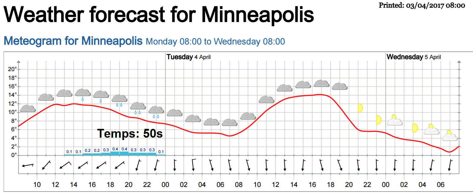
Clouds and a few generally light showers grace Twins Opening Day today. They should get the game in okay. Temps hover in the 50s. Bring a jacket that can double as rain gear for mostly light and spotty showers.
Opening Day Weather history
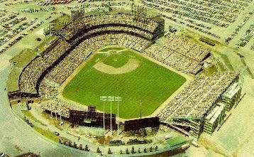
As you might expect, the Minnesota Twins have seen just about every kind of weather on opening day historically. Here's a look from the Minnesota Climatology Working Group.
[image]
April in Minnesota is a transitional month. The weather can fluctuate wildly from some fairly hot days to some very chilly readings and even some snowfall. The Minnesota Twins returned to outdoor baseball in 2010. The Twins also played outdoor baseball from 1961 to 1981 at Metropolitan Stadium in Bloomington and then moved to the Metrodome from 1982 to 2009. For the 21 home openers played at Metropolitan Stadium and the three home openers played so far at Target Field, there's been a variety of weather conditions. The coldest home opener was April 14, 1962 with a high of 34 degrees and a low of 20 that day reported at the Twin Cities International Airport. Winds were quite brisk and gusting to 21mph out of the NW in the afternoon. The Minnesota Twins lost to the California Angels that day 5-12. The warmest opener was April 22, 1980 with a high temperature of 90 degrees. The Twins played the California Angels on this opener too, this time the Twins won 8-1. The average high temperature for the day on the dates for the home openers over the 24 years is 60 degrees.
Low pressure slides south
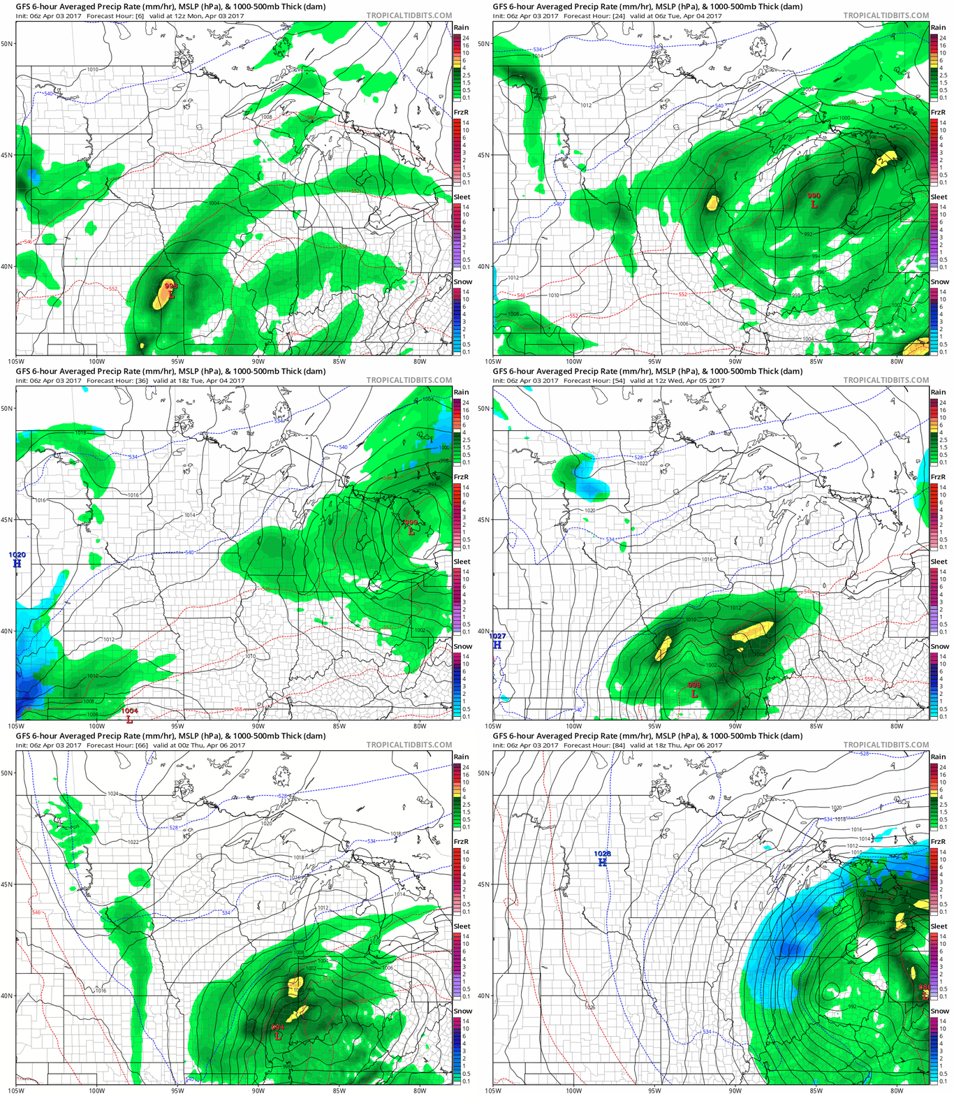
The Twin Cities rides the northern edge of Monday's low-pressure system. High pressure brings sunshine as the week unfolds.
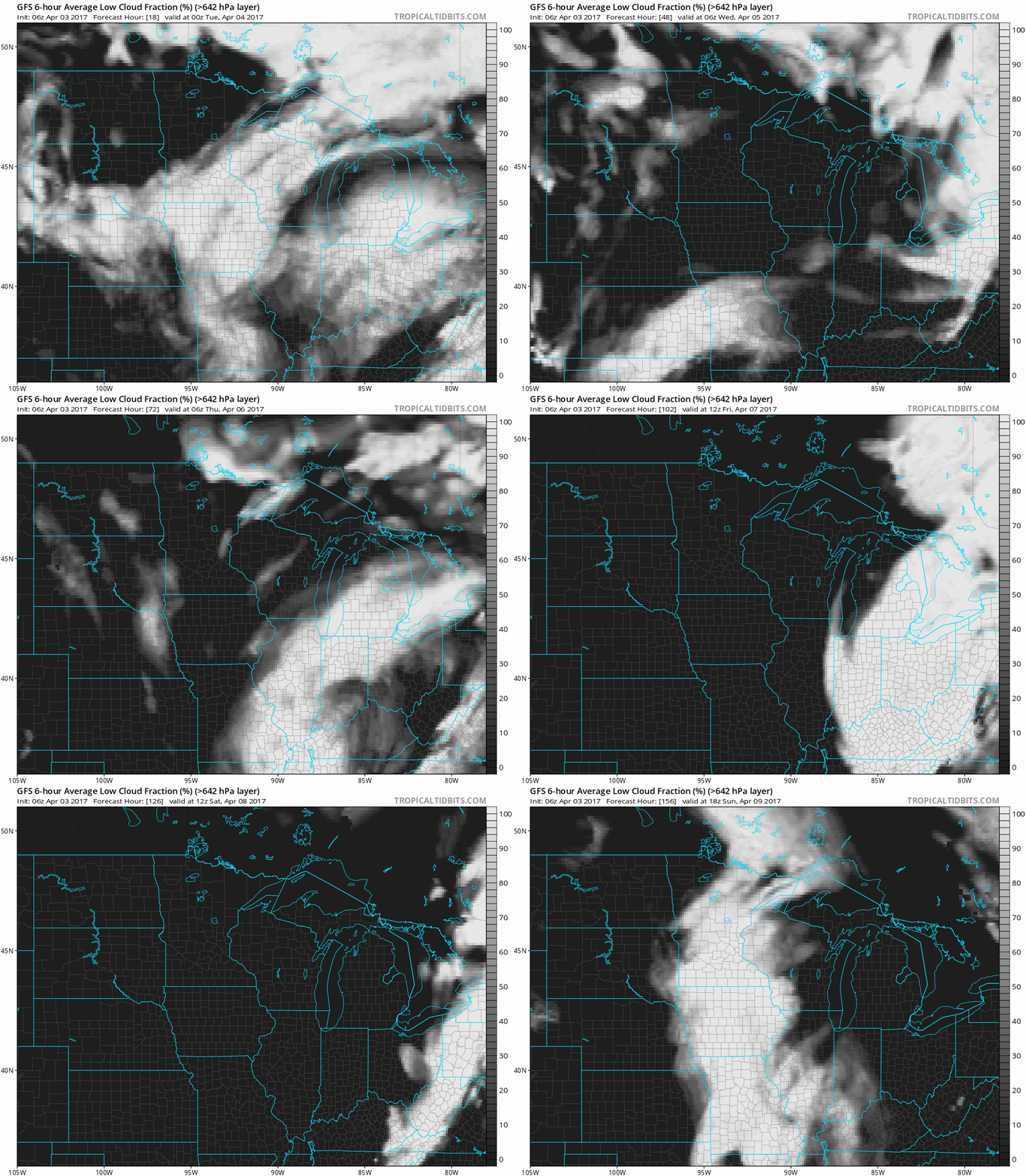
One factor meteorologists watch closely is the total fraction of low level moisture (clouds) we can expect. Watch as the sun returns Tuesday, and stays with probably through Saturday. Clouds (and showers) stream north on Sunday. A five-day mostly sunny stretch ahead this week? Pinch me.
Warmer by the weekend
The upper air pattern still suggests a significant warming trend starting Friday and lasting through next weekend. Note the bubble of high pressure building over the Midwest on Friday's upper air map below.
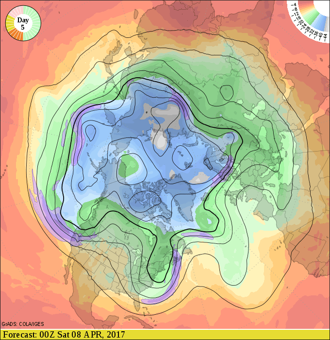
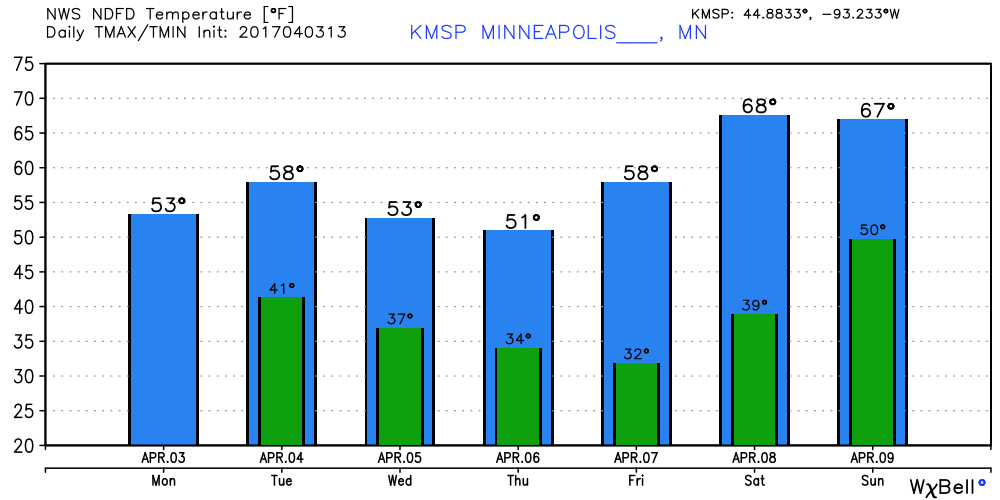
We bounce around through the 50s this week. Temperatures easily make a run into the 60s this weekend. The season's first 70-degree temperatures in the Twin Cities is not out of the question Saturday.
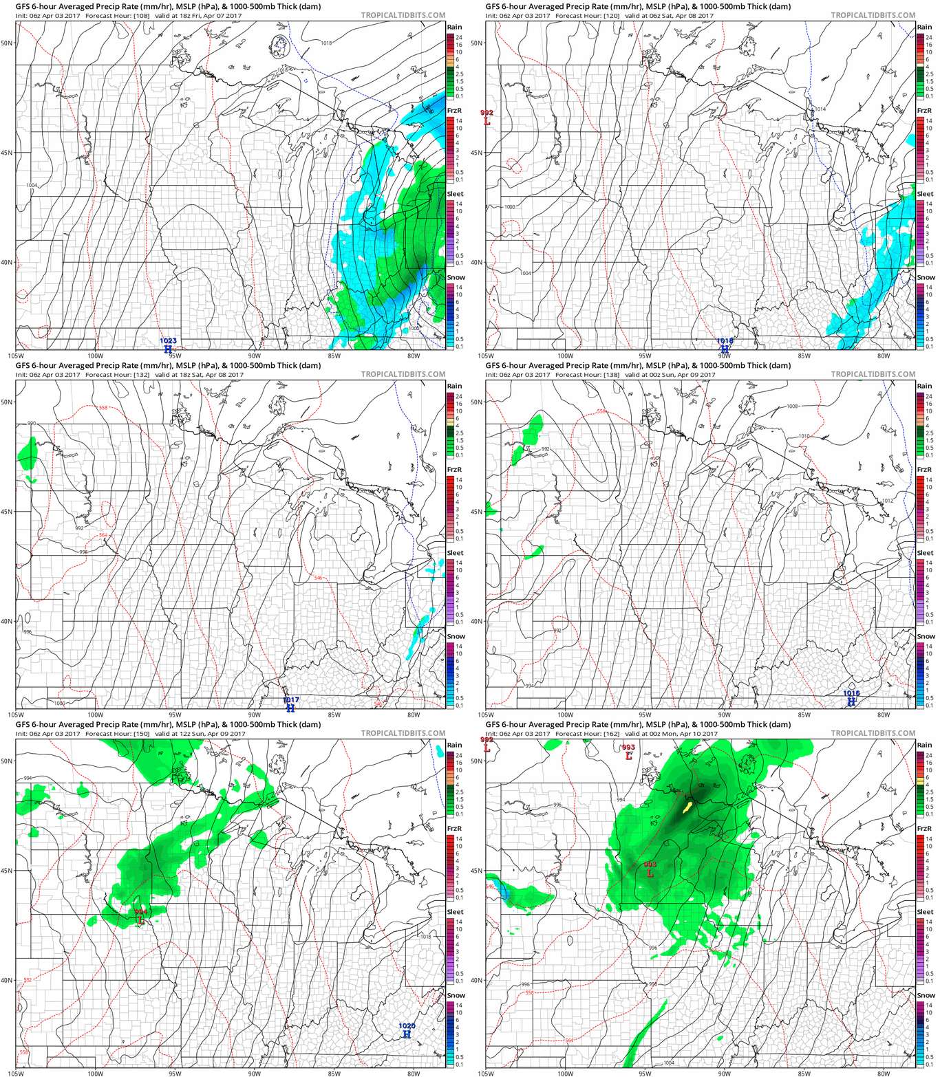
Sunday thundershowers?
The next low pressure wave headed for Minnesota arrives Sunday. April showers look likely, and a clap of thunder is possible. Time to turbocharge the spring green wave with a shot of nitrogen-enhanced rainfall?
The European model is sunny and dry, with 70 degrees on Sunday so stay tuned.

