
April showers: Wetter pattern emerging next 2 weeks?
Go Deeper.
Create an account or log in to save stories.
Like this?
Thanks for liking this story! We have added it to a list of your favorite stories.


Our dry start to 2017 is about to change for the wetter. Precipitation this year in the Twin Cities is running nearly 2" below average so far. Most of Minnesota received less than 50% of average precipitation in March.
It was the 22nd driest March in 123 years of records according to the Midwest Regional Climate Center.
Pattern change ahead
Monday's snow may have been the opening salvo in a much wetter pattern the next two weeks. Meteorologists watch jet stream configurations for clues to developing weather patterns. The jet stream set up the next 1-2 weeks blows in off the North Pacific toward Minnesota. Each wave in that jet pattern brings rainfall chances to Minnesota.
Turn Up Your Support
MPR News helps you turn down the noise and build shared understanding. Turn up your support for this public resource and keep trusted journalism accessible to all.

A series of low pressure waves rides that jet stream in the days ahead. Watch as NOAA's GFS model shows 3 to 4 rainfall systems sweeping across Minnesota in the next 2 weeks.
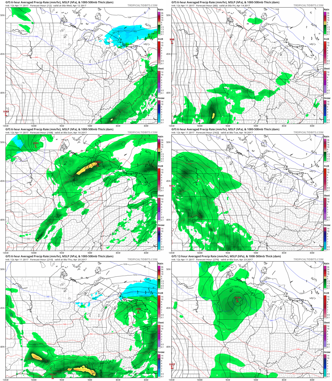
The outlook favors rainfall every 2-4 days for the next 2 weeks. You'll have to pick your sunny days in between. Overall some impressive rainfall totals of 2" to 4"+ appear likely the next 2 weeks. That should send our Minnesota landscape into rapid green-up mode.

Wetter trend of recent springs
If the current model projections of a significantly wetter pattern evolves, it would fit the overall recent trend of wetter springs in Minnesota. You may recall the incredibly wet spring and early summer of 2014 that pushed many lakes into overflow mode.

Rivers and creeks like Minnehaha Creek should be running more swiftly in the next few weeks. I predict increased flows on Lake Minnetonka's Gray's Bay Dam in the coming days to make headroom for the wetter pattern.
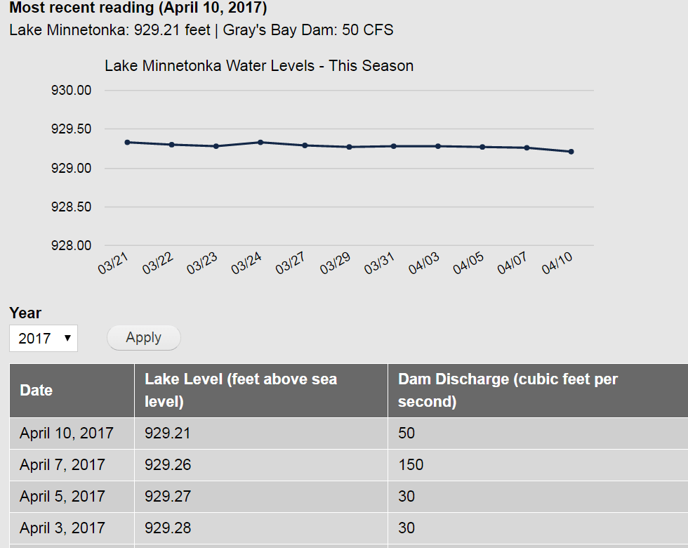
I don't know if we'll go into full spring flood mode again, but the next two weeks definitely look wetter.
Arctic Sea ice still at record lows
Great Barrier Reef: Tragic and massive bleaching event
Climate change fingerprints are all over the massive destruction zones in on the the 7 Natural Wonders of the World.
Permafrost methane: A climate change wildcard
One of the 'unknown unknowns' about future climate change? How quickly will arctic thawed permafrost release massive amounts of climate changing methane into our atmosphere? This is what keeps some climate scientists up at night.

