Soggy into Thursday, sun returns Friday
Go Deeper.
Create an account or log in to save stories.
Like this?
Thanks for liking this story! We have added it to a list of your favorite stories.


The sky is cryin'
Can't you see the tears roll down the street -Elmore James

Our latest wave of seemingly perpetual April showers linger into Thursday morning. The good news? The highest severe risk favors Iowa overnight. A cooler atmosphere over Minnesota likely limits our severe threat.
Showers and a few claps of thunder swirl overhead into Thursday. To the north, it's cold enough for a transition to snow in northeast Minnesota.
Turn Up Your Support
MPR News helps you turn down the noise and build shared understanding. Turn up your support for this public resource and keep trusted journalism accessible to all.

Low lingers Thursday
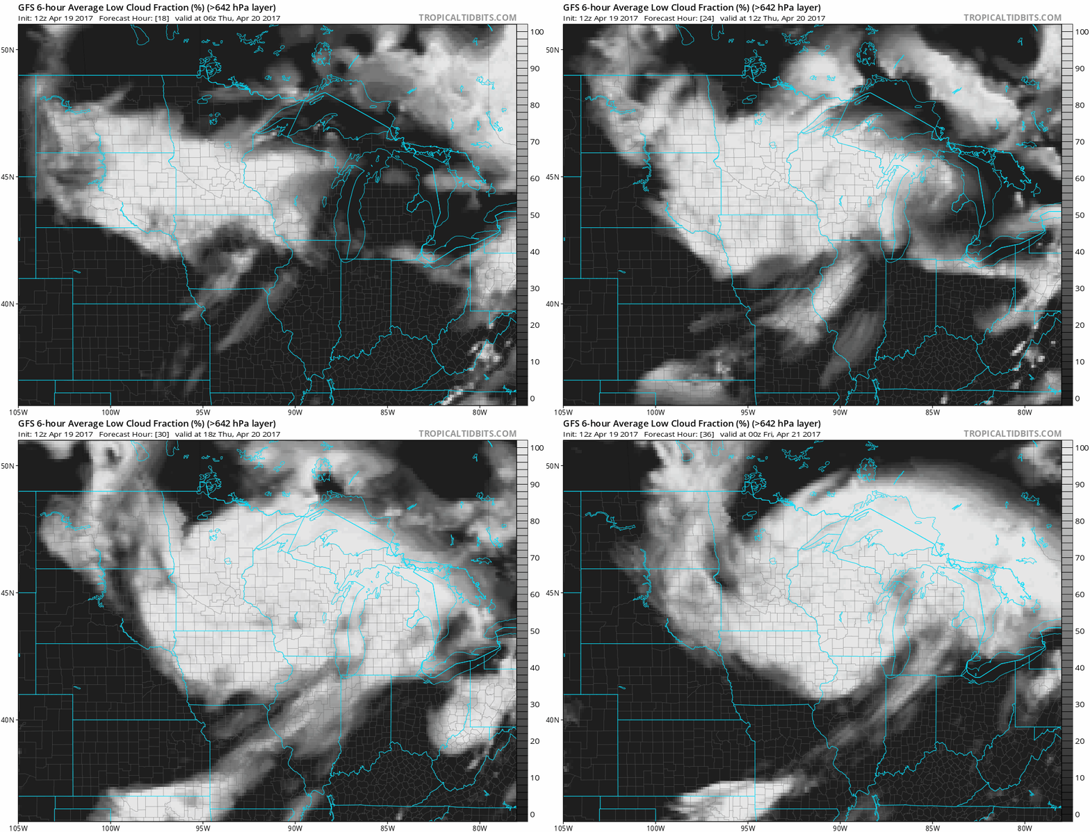
Minnesota lingers in the cool damp exhaust of our latest low pressure system Thursday. Morning showers give way to a drier afternoon. Lingering clouds make sunshine hard to come by. NOAA's GFS low cloud fraction output shows the gray swirl overhead through Thursday.
Sun returns Friday
You may be searching for your long lost sunglasses Friday. Watch high pressure set up shop over Minnesota this weekend. Sunday may bring a few clouds, but Friday and Saturday look to provide bright blue skies and light winds.

GOES 16 continues to amaze
The imagery from now operational GOES 16 is stunning.
Tornado drill Thursday
The sirens will sound twice on Thursday. Is your plan ready?