
Ice, rain, sun and a possible metro slop storm?
Go Deeper.
Create an account or log in to save stories.
Like this?
Thanks for liking this story! We have added it to a list of your favorite stories.


Welcome to Minnesota's weather smorgasbord.
The buffet menu? Ice. Snow. Rain. General weather malaise. As predicted, many areas along the North Shore dealt with ice Wednesday.
https://twitter.com/bryanhansel/status/857287800206401536
Farther up the shore, Thunder Bay, Ontario, is one of the hardest hit areas.
Turn Up Your Support
MPR News helps you turn down the noise and build shared understanding. Turn up your support for this public resource and keep trusted journalism accessible to all.
Icy coating
Up to half an inch of ice is reported in northeast Minnesota. Here are some totals from the Duluth National Weather Service office.
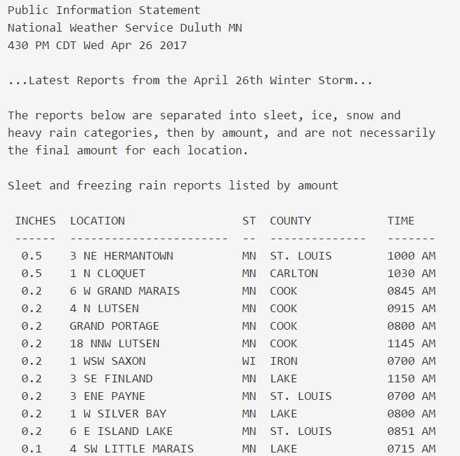
The ice storm warnings have been lifted for the North Shore. Winter weather continues into early Thursday.

Twin Cities rain
Farther south, a cold rain. Rainfall totals of one-half inch to 1 inch are common.
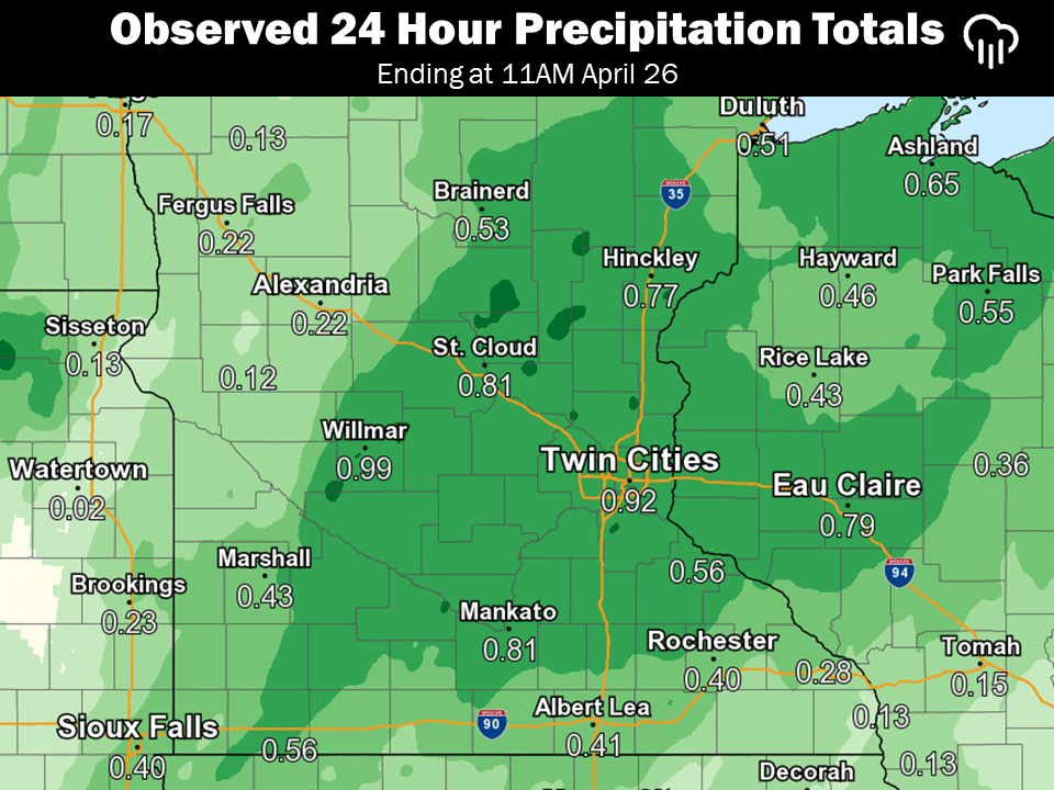
Sun returns Friday and Saturday
This probably should have been my lead, according to cloud-weary Minnesotans. High pressure chases the clouds away Friday and Saturday. Look for bright sun and temps rebounding into the 50s. Saturday actually looks like a cool but very pleasant spring day.

Metro slop storm potential Monday?
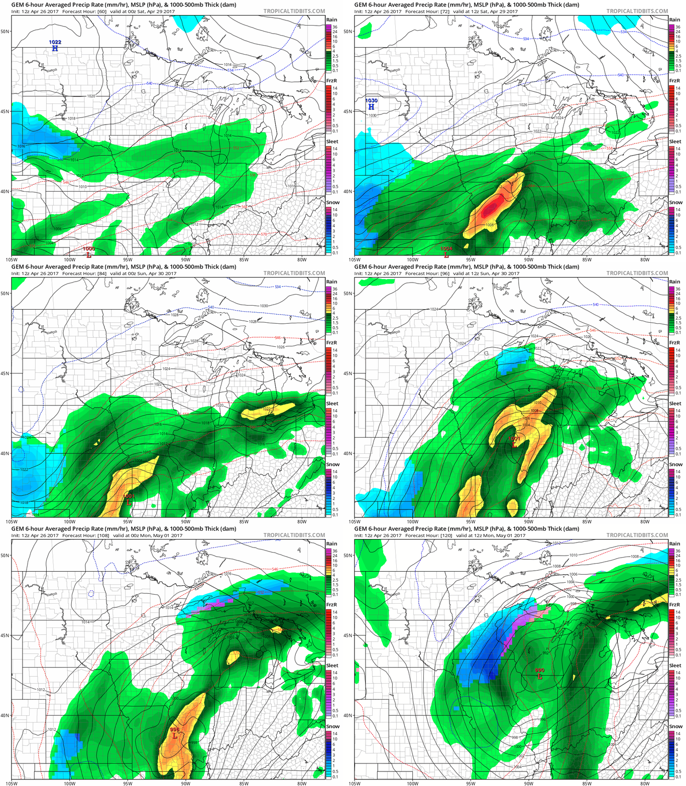
It's still too early to buy the farm on this one. But several models suggest the next inbound low-pressure storm Sunday into Monday may be cold enough for some (potentially heavy) sloppy snow in or close to the Twin Cities.
I know.
Here's Environment Canada's GEM model solution.
Accumulations?
I feel like the next graphic should come with a warning label.
Warning: The following graphic contains images that may be disturbing to some Minnesotans in late April.
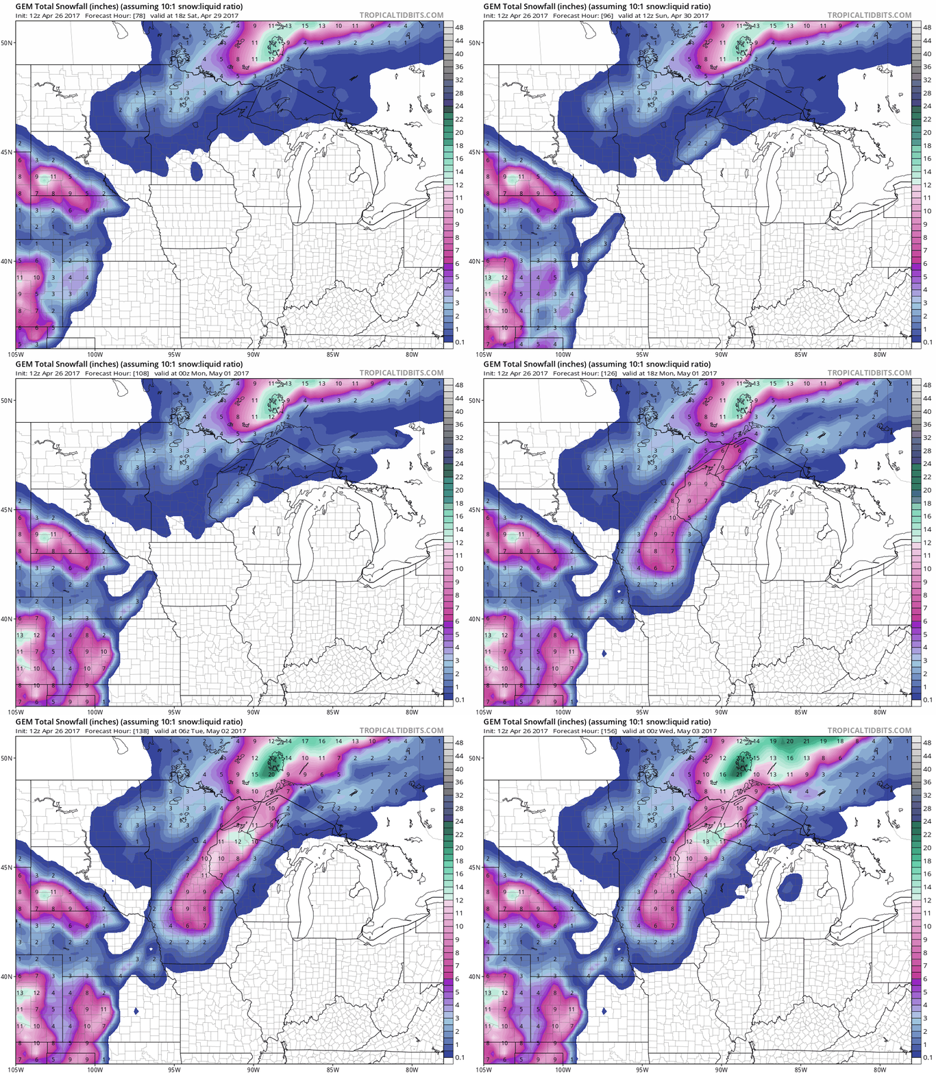
Again, it's too early to express high confidence in a possible Monday metro slop storm. But you heard it here first.
Stay tuned.

